
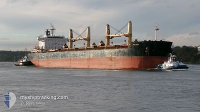
MELINDA
Bulk Carrier
Current Trip
| Time Travelled | 9 days |
|---|---|
| Remaining Time | --- |
| Distance Travelled | 2555.18 nm |
| Remaining Distance | --- |
| AVG Speed | 10.5 Knots |
| MAX Speed | 12.8 Knots |
| AVG Wind | 11.5 knots |
| MAX Wind | 30.9 knots |
| MIN Temp | 16.7°C / 62.06°F |
| MAX Temp | 32.4°C / 90.32°F |
| Draught | 10 m |
| Position Received | 5 d ago |
Current Position
| Longitude | -61.87986° |
|---|---|
| Latitude | 23.66795° |
| Status | Under way using engine |
| Speed | 10.8 Knots |
| Course | 49.4° |
| Area | North Atlantic Ocean |
| Station | T-AIS |
| Position Received | 5 d ago |
Info
Information
The current position of MELINDA is in North Atlantic Ocean with coordinates 23.66795° / -61.87986° as reported on 2024-04-20 03:38 by AIS to our vessel tracker app. The vessel's current speed is 10.8 Knots and is heading at the port of SANTANDER. The estimated time of arrival as calculated by MyShipTracking vessel tracking app is 2024-05-01 17:00 LT
The vessel MELINDA (IMO: 9623881, MMSI: 538005726) is a Bulk Carrier that was built in 2012 ( 12 years old ). It's sailing under the flag of [MH] Marshall Is.
In this page you can find informations about the vessels current position, last detected port calls, and current voyage information. If the vessels is not in coverage by AIS you will find the latest position.
The current position of MELINDA is detected by our AIS receivers and we are not responsible for the reliability of the data. The last position was recorded while the vessel was in Coverage by the Ais receivers of our vessel tracking app.
The current draught of MELINDA as reported by AIS is 10 meters
Weather
| Temperature | 17.1°C / 62.78°F |
|---|---|
| Wind Speed | 9 knots |
| Direction | 90° E |
| Pressure | 1029.9 hPa |
| Humidity | 67.9 % |
| Cloud Coverage | 88 % |
Featured Company
Last Port Calls
| Port | Arrival | Departure | Time In Port |
|---|---|---|---|
| 2024-04-03 19:29 | 2024-04-15 15:40 | 11 d | |
| 2024-03-22 22:33 | 2024-03-24 16:25 | 1 d | |
| 2024-03-18 05:08 | 2024-03-22 05:29 | 4 d | |
| 2024-02-22 15:19 | 2024-02-24 22:01 | 2 d | |
| 2024-02-07 06:43 | 2024-02-14 21:43 | 7 d |
Most Visited Ports (Last year)
| Port | Arrivals | |
|---|---|---|
| 2 | ||
| 2 | ||
| 1 | ||
| 1 | ||
| 1 | ||
| 1 |
Last Trips
| Origin | Departure | Destination | Arrival | Distance | |
|---|---|---|---|---|---|
| 2024-03-24 12:25 | 2024-04-03 14:29 | 1620.24 nm | |||
| 2024-03-22 01:29 | 2024-03-22 18:33 | 79.61 nm | |||
| 2024-02-24 23:01 | 2024-03-18 01:08 | 4783.34 nm | |||
| 2024-02-14 22:43 | 2024-02-22 16:19 | 2225.48 nm | |||
| 2023-12-26 16:05 | 2024-02-07 07:43 | 5107.00 nm |
Events
| Time | Event | Details | Position / Dest | Info |
|---|---|---|---|---|
| 2024-04-20 03:43 | Status Changed | Default Under way using engine |
23.68167 / -61.86167
SANTANDER,SPAIN
|
Speed: 10.8 kn Course: 49.4° |
| 2024-04-20 03:38 | Change Sea Area | High seas of the North Atlantic Ocean Domican Republic part of the Caribbean Sea |
23.66795 / -61.87986
North Atlantic Ocean
SANTANDER,SPAIN
|
Speed: 10.8 kn Course: 49.4° |
| 2024-04-20 03:38 | Status Changed | Under way using engine Default |
23.66795 / -61.87986
SANTANDER,SPAIN
|
Speed: 10.8 kn Course: 48° |
| 2024-04-20 03:38 | OUT of Coverage |
23.66795 / -61.87986
North Atlantic Ocean
SANTANDER,SPAIN
|
Speed: 10.8 kn Course: 49.4° |
|
| 2024-04-20 03:25 | IN Coverage |
23.66795 / -61.87986
North Atlantic Ocean
SANTANDER,SPAIN
|
Speed: 10.8 kn Course: 49.4° |
|
| 2024-04-18 08:07 | Status Changed | Default Under way using engine |
18.45667 / -68.06500
SANTANDER,SPAIN
|
Speed: 10.5 kn Course: 35.5° |
| 2024-04-18 08:06 | OUT of Coverage |
18.45428 / -68.06864
Caribbean Sea
SANTANDER,SPAIN
|
Speed: 10.5 kn Course: 35.5° |
|
| 2024-04-18 08:06 | Change Sea Area | Domican Republic part of the Caribbean Sea Colombian part of the Caribbean Sea |
18.45428 / -68.06864
Caribbean Sea
SANTANDER,SPAIN
|
Speed: 10.5 kn Course: 35.5° |
| 2024-04-18 08:06 | Status Changed | Under way using engine Default |
18.45388 / -68.06894
SANTANDER,SPAIN
|
Speed: 10.6 kn Course: 37° |
| 2024-04-18 08:06 | IN Coverage |
18.45428 / -68.06864
Caribbean Sea
SANTANDER,SPAIN
|
Speed: 10.5 kn Course: 35.5° |