
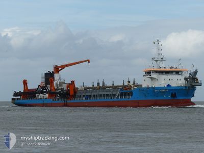
MEDWAY
Trailing Suction Hopper Dredger
Current Trip
BREMERHAVEN
| Time Travelled | 23 h, 30 mins |
|---|---|
| Remaining Time | --- |
| Distance Travelled | 85.13 nm |
| Remaining Distance | --- |
| AVG Speed | 8.3 Knots |
| MAX Speed | 16.9 Knots |
| AVG Wind | 13.9 knots |
| MAX Wind | 18 knots |
| MIN Temp | 5.4°C / 41.72°F |
| MAX Temp | 8.5°C / 47.3°F |
| Draught | 5.5 m |
| Position Received | 1 h, 11 m ago |
Current Position
| Longitude | --- |
|---|---|
| Latitude | --- |
| Status | Restricted manoeuverability |
| Speed | 11.9 Knots |
| Course | 306.9° |
| Area | North Sea |
| Station | T-AIS |
| Position Received | 1 h, 11 m ago |
Info
Information
The current position of MEDWAY is in North Sea with coordinates 53.73640° / 8.23846° as reported on 2025-12-07 14:32 by AIS to our vessel tracker app. The vessel's current speed is 11.9 Knots
The vessel MEDWAY (IMO: 9524152, MMSI: 209416000) is a Trailing Suction Hopper Dredger that was built in 2012 ( 13 years old ). It's sailing under the flag of [CY] Cyprus.
In this page you can find informations about the vessels current position, last detected port calls, and current voyage information. If the vessels is not in coverage by AIS you will find the latest position.
The current position of MEDWAY is detected by our AIS receivers and we are not responsible for the reliability of the data. The last position was recorded while the vessel was in Coverage by the Ais receivers of our vessel tracking app.
The current draught of MEDWAY as reported by AIS is 5.5 meters
Weather
| Temperature | 8.1°C / 46.58°F |
|---|---|
| Wind Speed | 12 knots |
| Direction | 187° S |
| Pressure | 1006.6 hPa |
| Humidity | 93.7 % |
| Cloud Coverage | 100 % |
Featured Company
Last Port Calls
| Port | Arrival | Departure | Time In Port |
|---|---|---|---|
| 2025-12-06 15:10 | 2025-12-06 17:13 | 2 h | |
| 2025-12-06 12:17 | 2025-12-06 14:18 | 2 h | |
| 2025-12-06 09:56 | 2025-12-06 10:32 | 35 m | |
| 2025-12-06 07:18 | 2025-12-06 07:49 | 30 m | |
| 2025-12-06 06:10 | 2025-12-06 06:35 | 25 m | |
| 2025-12-06 05:32 | |||
| 2025-12-06 04:00 | 2025-12-06 05:00 | 59 m | |
| 2025-12-06 03:25 | 2025-12-06 03:55 | 30 m | |
| 2025-12-06 02:10 | 2025-12-06 02:37 | 26 m | |
| 2025-12-05 23:55 | 2025-12-06 00:22 | 27 m |
Most Visited Ports (Last year)
| Port | Arrivals | |
|---|---|---|
| 669 | ||
| 140 | ||
| 17 | ||
| 4 | ||
| 4 | ||
| 2 |
Last Trips
| Origin | Departure | Destination | Arrival | Distance | |
|---|---|---|---|---|---|
| 2025-12-06 14:18 | 2025-12-06 15:10 | 6.60 nm | |||
| 2025-12-06 10:32 | 2025-12-06 12:17 | 18.01 nm | |||
| 2025-12-06 07:49 | 2025-12-06 09:56 | 9.26 nm | |||
| 2025-12-06 06:35 | 2025-12-06 07:18 | 6.55 nm | |||
| 2025-12-06 05:00 | 2025-12-06 06:10 | 5.22 nm | |||
| 2025-12-06 05:00 | 2025-12-06 05:32 | 0.93 nm | |||
| 2025-12-06 03:55 | 2025-12-06 04:00 | 0.82 nm | |||
| 2025-12-06 02:37 | 2025-12-06 03:25 | 6.95 nm | |||
| 2025-12-06 00:22 | 2025-12-06 02:10 | 9.79 nm | |||
| 2025-12-05 22:11 | 2025-12-05 23:55 | 18.16 nm |
Events
| Time | Event | Details | Position / Dest | Info |
|---|---|---|---|---|
| 2025-12-07 15:01 | START Moving | 7.68 nm, North East of WANGERSIEL |
53.74839 / 8.20760
BREMERHAVEN
|
Speed: 10.5 kn Course: 117° |
| 2025-12-07 14:45 | STOP Moving | 7.5 nm, North East of WANGERSIEL |
53.75203 / 8.19791
BREMERHAVEN
|
Speed: 0.2 kn Course: 126° |
| 2025-12-07 14:37 | Status Changed | Default Restricted manoeuverability |
53.74898 / 8.21290
BREMERHAVEN
|
Speed: 11.9 kn Course: 306.9° |
| 2025-12-07 14:32 | OUT of Coverage |
53.73640 / 8.23846
North Sea
|
Speed: 11.9 kn Course: 306.9° |
|
| 2025-12-07 14:25 | Status Changed | Restricted manoeuverability Default |
53.73122 / 8.25368
BREMERHAVEN
|
Speed: 1.5 kn Course: 122° |
| 2025-12-07 14:05 | Status Changed | Default Restricted manoeuverability |
53.73482 / 8.24481
BREMERHAVEN
|
Speed: 0.8 kn Course: 98° |
| 2025-12-07 12:58 | Status Changed | Restricted manoeuverability Default |
53.72527 / 8.25921
BREMERHAVEN
|
Speed: 8.6 kn Course: 123° |
| 2025-12-07 12:53 | Status Changed | Default Restricted manoeuverability |
53.73397 / 8.23649
BREMERHAVEN
|
Speed: 3.4 kn Course: 70° |
| 2025-12-07 12:53 | START Moving | 8.23 nm, East of WANGERSIEL |
53.73397 / 8.23649
BREMERHAVEN
|
Speed: 14.6 kn Course: 123° |
| 2025-12-07 12:29 | STOP Moving | 7.51 nm, North East of WANGERSIEL |
53.75028 / 8.20011
BREMERHAVEN
|
Speed: 0.3 kn Course: 314° |