
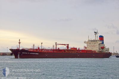
MEDALTA ADVENTURER
Tanker B
Current Trip
| Time Travelled | 6 days |
|---|---|
| Remaining Time | 21 h, 11 mins |
| Distance Travelled | 1169.97 nm |
| Remaining Distance | 415.77 nm |
| AVG Speed | 11.8 Knots |
| MAX Speed | 15.1 Knots |
| AVG Wind | 13.2 knots |
| MAX Wind | 32.8 knots |
| MIN Temp | 8.1°C / 46.58°F |
| MAX Temp | 25.1°C / 77.18°F |
| Draught | 9 m |
| Position Received | 21 h, 39 m ago |
Current Position
| Longitude | 11.38312° |
|---|---|
| Latitude | 37.94071° |
| Status | Under way using engine |
| Speed | 10.9 Knots |
| Course | 297.7° |
| Area | Mediterranean Sea - Western Basin |
| Station | T-AIS |
| Position Received | 21 h, 39 m ago |
Info
Information
The current position of MEDALTA ADVENTURER is in Mediterranean Sea - Western Basin with coordinates 37.94071° / 11.38312° as reported on 2024-04-23 10:13 by AIS to our vessel tracker app. The vessel's current speed is 10.9 Knots and is heading at the port of FOS. The estimated time of arrival as calculated by MyShipTracking vessel tracking app is 2024-04-25 05:04 LT
The vessel MEDALTA ADVENTURER (IMO: 9761451, MMSI: 319084600) is a Tanker B It's sailing under the flag of [KY] Cayman Is.
In this page you can find informations about the vessels current position, last detected port calls, and current voyage information. If the vessels is not in coverage by AIS you will find the latest position.
The current position of MEDALTA ADVENTURER is detected by our AIS receivers and we are not responsible for the reliability of the data. The last position was recorded while the vessel was in Coverage by the Ais receivers of our vessel tracking app.
The current draught of MEDALTA ADVENTURER as reported by AIS is 9 meters
Weather
| Temperature | 13.1°C / 55.58°F |
|---|---|
| Wind Speed | 25 knots |
| Direction | 310° NW |
| Pressure | 1012 hPa |
| Humidity | 56.4 % |
| Cloud Coverage | 43 % |
Featured Company
Last Port Calls
| Port | Arrival | Departure | Time In Port |
|---|---|---|---|
| 2024-04-16 12:44 | 2024-04-17 09:21 | 20 h | |
| 2024-04-11 04:43 | 2024-04-12 06:39 | 1 d | |
| 2024-04-08 03:02 | 2024-04-09 06:17 | 1 d | |
| 2024-03-30 11:06 | 2024-03-31 08:21 | 21 h | |
| 2024-03-28 14:10 | 2024-03-29 14:10 | 23 h | |
| 2024-03-24 15:31 | 2024-03-26 00:09 | 1 d | |
| 2024-03-23 17:20 | 2024-03-24 14:36 | 21 h | |
| 2024-03-14 06:55 | 2024-03-15 09:52 | 1 d | |
| 2024-03-08 12:40 | 2024-03-09 08:24 | 19 h | |
| 2024-03-03 15:48 | 2024-03-04 18:21 | 1 d |
Last Trips
| Origin | Departure | Destination | Arrival | Distance | |
|---|---|---|---|---|---|
| 2024-04-12 08:39 | 2024-04-16 15:44 | 816.89 nm | |||
| 2024-04-09 09:17 | 2024-04-11 06:43 | 607.47 nm | |||
| 2024-03-31 10:21 | 2024-04-08 06:02 | 2319.61 nm | |||
| 2024-03-29 15:10 | 2024-03-30 12:06 | 265.58 nm | |||
| 2024-03-26 01:09 | 2024-03-28 15:10 | 279.39 nm | |||
| 2024-03-24 15:36 | 2024-03-24 16:31 | 2.72 nm | |||
| 2024-03-15 12:52 | 2024-03-23 18:20 | 1863.12 nm | |||
| 2024-03-09 09:24 | 2024-03-14 09:55 | 1584.86 nm | |||
| 2024-03-04 20:21 | 2024-03-08 13:40 | 1069.74 nm | |||
| 2024-03-01 09:45 | 2024-03-03 17:48 | 425.73 nm |
Events
| Time | Event | Details | Position / Dest | Info |
|---|---|---|---|---|
| 2024-04-23 10:33 | Status Changed | Default Under way using engine |
37.96731 / 11.31747
FR FOS
|
Speed: 10.9 kn Course: 297.7° |
| 2024-04-23 10:13 | OUT of Coverage |
37.94071 / 11.38312
Mediterranean Sea - Western Basin
FR FOS
|
Speed: 10.9 kn Course: 297.7° |
|
| 2024-04-23 10:13 | Status Changed | Under way using engine Default |
37.93998 / 11.38486
FR FOS
|
Speed: 10.9 kn Course: 297° |
| 2024-04-23 09:45 | Status Changed | Default Under way using engine |
37.90003 / 11.47741
FR FOS
|
Speed: 11.1 kn Course: 297.4° |
| 2024-04-23 09:14 | Status Changed | Under way using engine Default |
37.85675 / 11.58305
FR FOS
|
Speed: 10.8 kn Course: 294° |
| 2024-04-23 08:49 | Status Changed | Default Under way using engine |
37.82406 / 11.67048
FR FOS
|
Speed: 10.7 kn Course: 294.8° |
| 2024-04-23 08:40 | Status Changed | Under way using engine Default |
37.81298 / 11.70170
FR FOS
|
Speed: 10.4 kn Course: 294° |
| 2024-04-23 08:18 | Status Changed | Default Under way using engine |
37.78646 / 11.77369
FR FOS
|
Speed: 10.6 kn Course: 293.8° |
| 2024-04-23 06:35 | Detected in Sea | Italian part of the Mediterranean Sea - Western Basin |
37.64765 / 12.12500
Mediterranean Sea - Western Basin
FR FOS
|
Speed: 10.5 kn Course: 301.6° |
| 2024-04-23 04:20 | Status Changed | Under way using engine Default |
37.45593 / 12.57811
FR FOS
|
Speed: 11.7 kn Course: 301° |