
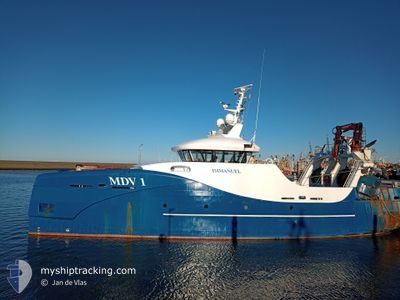
MDV1 IMMANUEL
Fishing
Current Trip
EEMSHAVEN
| Time Travelled | 3 days |
|---|---|
| Remaining Time | --- |
| Distance Travelled | 2.41 nm |
| Remaining Distance | --- |
| AVG Speed | 12.3 Knots |
| MAX Speed | 12.3 Knots |
| AVG Wind | 10.6 knots |
| MAX Wind | 10.8 knots |
| MIN Temp | 7.2°C / 44.96°F |
| MAX Temp | 7.3°C / 45.14°F |
| Draught | 4.5 m |
| Position Received | 3 d ago |
Current Position
| Longitude | 6.81088° |
|---|---|
| Latitude | 53.49854° |
| Status | Under way using engine |
| Speed | 11.8 Knots |
| Course | 325.7° |
| Area | North Sea |
| Station | T-AIS |
| Position Received | 3 d ago |
Info
Information
The current position of MDV1 IMMANUEL is in North Sea with coordinates 53.49854° / 6.81088° as reported on 2024-04-22 00:02 by AIS to our vessel tracker app. The vessel's current speed is 11.8 Knots
The vessel MDV1 IMMANUEL (IMO: 9771573, MMSI: 244860048) is a Fishing It's sailing under the flag of [NL] Netherlands.
In this page you can find informations about the vessels current position, last detected port calls, and current voyage information. If the vessels is not in coverage by AIS you will find the latest position.
The current position of MDV1 IMMANUEL is detected by our AIS receivers and we are not responsible for the reliability of the data. The last position was recorded while the vessel was in Coverage by the Ais receivers of our vessel tracking app.
The current draught of MDV1 IMMANUEL as reported by AIS is 4.5 meters
Weather
| Temperature | 7.2°C / 44.96°F |
|---|---|
| Wind Speed | 10 knots |
| Direction | 40° NE |
| Pressure | 1026.2 hPa |
| Humidity | 65.6 % |
| Cloud Coverage | 83 % |
Featured Company
Last Port Calls
| Port | Arrival | Departure | Time In Port |
|---|---|---|---|
| 2024-04-19 02:32 | 2024-04-21 23:50 | 2 d | |
| 2024-04-11 19:31 | 2024-04-15 00:07 | 3 d | |
| 2024-04-05 22:54 | 2024-04-08 00:01 | 2 d | |
| 2024-03-27 16:56 | 2024-04-01 19:25 | 5 d | |
| 2024-03-22 17:14 | 2024-03-27 08:31 | 4 d | |
| 2024-03-15 22:38 | 2024-03-18 01:01 | 2 d | |
| 2024-03-11 17:18 | 2024-03-11 18:02 | 43 m | |
| 2024-03-08 23:15 | 2024-03-11 01:03 | 2 d | |
| 2024-03-01 09:14 | 2024-03-04 00:56 | 2 d | |
| 2024-02-21 21:01 | 2024-02-26 00:35 | 4 d |
Most Visited Ports (Last year)
| Port | Arrivals | |
|---|---|---|
| 20 | ||
| 10 | ||
| 10 | ||
| 6 | ||
| 1 |
Last Trips
| Origin | Departure | Destination | Arrival | Distance | |
|---|---|---|---|---|---|
| 2024-04-15 02:07 | 2024-04-19 04:32 | 135.06 nm | |||
| 2024-04-08 02:01 | 2024-04-11 21:31 | 169.19 nm | |||
| 2024-04-01 21:25 | 2024-04-06 00:54 | 221.61 nm | |||
| 2024-03-27 09:31 | 2024-03-27 17:56 | 73.62 nm | |||
| 2024-03-18 02:01 | 2024-03-22 18:14 | 323.75 nm | |||
| 2024-03-11 19:02 | 2024-03-15 23:38 | 279.83 nm | |||
| 2024-03-11 02:03 | 2024-03-11 18:18 | 12.08 nm | |||
| 2024-03-04 01:56 | 2024-03-09 00:15 | 378.93 nm | |||
| 2024-02-26 01:35 | 2024-03-01 10:14 | 253.50 nm | |||
| 2024-02-21 14:12 | 2024-02-21 22:01 | 80.74 nm |
Events
| Time | Event | Details | Position / Dest | Info |
|---|---|---|---|---|
| 2024-04-22 00:02 | OUT of Coverage |
53.49854 / 6.81088
North Sea
|
Speed: 11.8 kn Course: 325.7° |
|
| 2024-04-21 23:50 | PORT DEPARTURE |
|
53.46303 / 6.83854
EEMSHAVEN
|
Speed: 8.7 kn Course: 354° |
| 2024-04-21 23:44 | START Moving |
53.45579 / 6.83142
[NL] EEMSHAVEN
|
Speed: 4.5 kn Course: 103° |
|
| 2024-04-19 02:43 | STOP Moving |
53.45562 / 6.82839
[NL] EEMSHAVEN
|
Speed: Course: 108° |
|
| 2024-04-19 02:32 | PORT ARRIVAL |
|
53.46119 / 6.83902
[NL] EEMSHAVEN
|
Speed: 9.9 kn Course: 172.7° |
| 2024-04-19 02:11 | Change Sea Area | Dutch part of the North Sea German part of the North Sea |
53.51171 / 6.78209
North Sea
EEMSHAVEN
|
Speed: 11.2 kn Course: 127.6° |
| 2024-04-19 01:38 | Detected in Sea | German part of the North Sea |
53.56926 / 6.64881
North Sea
EEMSHAVEN
|
Speed: 9.8 kn Course: 126.8° |
| 2024-04-19 00:54 | Change Sea Area | Dutch part of the North Sea German part of the North Sea |
53.62920 / 6.48589
North Sea
EEMSHAVEN
|
Speed: 8.4 kn Course: 134° |
| 2024-04-18 21:49 | ETA Changed | 2024/04/19 04:30 2024/04/11 22:00 |
54.05039 / 6.34047
EEMSHAVEN
|
Speed: 8.7 kn Course: 174.3° |
| 2024-04-18 19:57 | IN Coverage |
54.31822 / 6.28574
North Sea
|
Speed: 9.2 kn Course: 168.7° |