
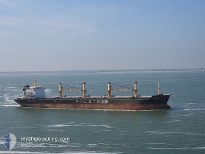
MAZURY
Bulk Carrier
Current Trip
| Time Travelled | 8 days |
|---|---|
| Remaining Time | --- |
| Distance Travelled | 2231.22 nm |
| Remaining Distance | --- |
| AVG Speed | 10.5 Knots |
| MAX Speed | 12.4 Knots |
| AVG Wind | 14.1 knots |
| MAX Wind | 23.5 knots |
| MIN Temp | 24.9°C / 76.82°F |
| MAX Temp | 28.7°C / 83.66°F |
| Draught | 6 m |
| Position Received | 10 d ago |
Current Position
| Longitude | -74.23068° |
|---|---|
| Latitude | 11.07201° |
| Status | Moored |
| Speed | |
| Course | 313° |
| Area | Caribbean Sea |
| Station | T-AIS |
| Position Received | 10 d ago |
Info
Information
The current position of MAZURY is in Caribbean Sea with coordinates 11.07201° / -74.23068° as reported on 2024-04-15 00:54 by AIS to our vessel tracker app. The vessel's current speed is 0 Knots and is heading at the port of SAO LUIS. The estimated time of arrival as calculated by MyShipTracking vessel tracking app is 2024-04-24 10:00 LT
The vessel MAZURY (IMO: 9285122, MMSI: 311829000) is a Bulk Carrier that was built in 2005 ( 19 years old ). It's sailing under the flag of [BS] Bahamas.
In this page you can find informations about the vessels current position, last detected port calls, and current voyage information. If the vessels is not in coverage by AIS you will find the latest position.
The current position of MAZURY is detected by our AIS receivers and we are not responsible for the reliability of the data. The last position was recorded while the vessel was in Coverage by the Ais receivers of our vessel tracking app.
The current draught of MAZURY as reported by AIS is 6 meters
Weather
| Temperature | 28.7°C / 83.66°F |
|---|---|
| Wind Speed | 10 knots |
| Direction | 67° ENE |
| Pressure | 1011.5 hPa |
| Humidity | 75.4 % |
| Cloud Coverage | 100 % |
Featured Company
Last Port Calls
| Port | Arrival | Departure | Time In Port |
|---|---|---|---|
| 2024-04-14 16:03 | 2024-04-16 06:04 | 1 d | |
| 2024-03-06 16:47 | 2024-03-09 04:05 | 2 d | |
| 2024-03-01 13:29 | 2024-03-04 10:04 | 2 d | |
| 2024-02-01 07:51 | 2024-02-08 16:55 | 7 d |
Most Visited Ports (Last year)
| Port | Arrivals | |
|---|---|---|
| 2 | ||
| 2 | ||
| 2 | ||
| 2 | ||
| 1 | ||
| 1 |
Last Trips
| Origin | Departure | Destination | Arrival | Distance | |
|---|---|---|---|---|---|
| 2024-03-08 23:05 | 2024-04-14 11:03 | 2809.41 nm | |||
| 2024-03-04 06:04 | 2024-03-06 11:47 | 575.21 nm | |||
| 2024-01-03 09:59 | 2024-02-01 04:51 | 4453.40 nm |
Events
| Time | Event | Details | Position / Dest | Info |
|---|---|---|---|---|
| 2024-04-16 12:13 | START Moving | 4.14 nm, North West of PUERTO DRUMMOND |
11.12000 / -74.27333
BR ALU
|
Speed: 5 kn Course: 333° |
| 2024-04-16 06:40 | STOP Moving | 3.9 nm, North West of PUERTO DRUMMOND |
11.11833 / -74.26833
BR ALU
|
Speed: Course: -1° |
| 2024-04-16 06:04 | START Moving | 1.18 nm, North West of PUERTO DRUMMOND |
11.07667 / -74.24834
BR ALU
|
Speed: 6 kn Course: -1° |
| 2024-04-16 06:04 | PORT DEPARTURE |
|
11.07667 / -74.24834
BR ALU
|
Speed: 3 kn Course: -1° |
| 2024-04-16 00:47 | Destination Changed | BR ALU CO PUD |
11.07201 / -74.23071
[CO] PUERTO DRUMMOND
|
Speed: Course: 313° |
| 2024-04-16 00:47 | ETA Changed | 2024/04/24 10:00 2024/04/12 17:00 |
11.07201 / -74.23071
[CO] PUERTO DRUMMOND
|
Speed: Course: 313° |