
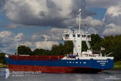
COE MINA
General Cargo
Current Trip
| Time Travelled | 10 h, 43 mins |
|---|---|
| Remaining Time | 5 h, 10 mins |
| Distance Travelled | 93.85 nm |
| Remaining Distance | 51.13 nm |
| AVG Speed | 8.1 Knots |
| MAX Speed | 10 Knots |
| AVG Wind | 11.1 knots |
| MAX Wind | 15.9 knots |
| MIN Temp | 2.5°C / 36.5°F |
| MAX Temp | 5.9°C / 42.62°F |
| Draught | 4.9 m |
| Position Received | Now |
Current Position
| Longitude | 14.45623° |
|---|---|
| Latitude | 55.27709° |
| Status | Under way using engine |
| Speed | 9.8 Knots |
| Course | 23° |
| Area | Kattegat |
| Station | T-AIS |
| Position Received | Now |
Info
Information
The current position of COE MINA is in Kattegat with coordinates 55.27709° / 14.45623° as reported on 2024-04-24 06:39 by AIS to our vessel tracker app. The vessel's current speed is 9.8 Knots and is heading at the port of AHUS. The estimated time of arrival as calculated by MyShipTracking vessel tracking app is 2024-04-24 11:49 LT
The vessel COE MINA (IMO: 8509820, MMSI: 212746000) is a General Cargo that was built in 1985 ( 39 years old ). It's sailing under the flag of [CY] Cyprus.
In this page you can find informations about the vessels current position, last detected port calls, and current voyage information. If the vessels is not in coverage by AIS you will find the latest position.
The current position of COE MINA is detected by our AIS receivers and we are not responsible for the reliability of the data. The last position was recorded while the vessel was in Coverage by the Ais receivers of our vessel tracking app.
The current draught of COE MINA as reported by AIS is 4.9 meters
Weather
| Temperature | 4.6°C / 40.28°F |
|---|---|
| Wind Speed | 13 knots |
| Direction | 138° SE |
| Pressure | 1009.8 hPa |
| Humidity | 71.5 % |
| Cloud Coverage | 94 % |
Featured Company
Last Port Calls
| Port | Arrival | Departure | Time In Port |
|---|---|---|---|
| 2024-04-23 05:51 | 2024-04-23 19:56 | 14 h | |
| 2024-04-20 07:06 | 2024-04-21 09:41 | 1 d | |
| 2024-04-17 14:34 | 2024-04-19 14:44 | 2 d | |
| 2024-04-13 12:51 | 2024-04-15 20:28 | 2 d | |
| 2024-04-10 13:24 | 2024-04-12 15:03 | 2 d | |
| 2024-04-04 13:18 | 2024-04-08 19:45 | 4 d | |
| 2024-03-27 11:21 | 2024-04-02 17:54 | 6 d | |
| 2024-03-24 12:19 | 2024-03-25 12:13 | 23 h | |
| 2024-03-20 02:41 | 2024-03-20 23:27 | 20 h | |
| 2024-03-18 14:10 | 2024-03-19 05:10 | 15 h |
Last Trips
| Origin | Departure | Destination | Arrival | Distance | |
|---|---|---|---|---|---|
| 2024-04-21 11:41 | 2024-04-23 07:51 | 368.02 nm | |||
| 2024-04-19 16:44 | 2024-04-20 09:06 | 163.46 nm | |||
| 2024-04-15 22:28 | 2024-04-17 16:34 | 366.02 nm | |||
| 2024-04-12 17:03 | 2024-04-13 14:51 | 231.23 nm | |||
| 2024-04-08 21:45 | 2024-04-10 15:24 | 398.20 nm | |||
| 2024-04-02 19:54 | 2024-04-04 15:18 | 389.61 nm | |||
| 2024-03-25 14:13 | 2024-03-27 12:21 | 428.78 nm | |||
| 2024-03-21 00:27 | 2024-03-24 14:19 | 788.82 nm | |||
| 2024-03-19 06:10 | 2024-03-20 03:41 | 116.83 nm | |||
| 2024-03-15 18:08 | 2024-03-18 15:10 | 548.37 nm |
Events
| Time | Event | Details | Position / Dest | Info |
|---|---|---|---|---|
| 2024-04-24 03:58 | Change Sea Area | Danish part of the Kattegat German part of the Baltic Sea |
54.95273 / 14.01624
Kattegat
SEAHU
|
Speed: 9.1 kn Course: 24° |
| 2024-04-24 00:28 | Status Changed | Under way using engine Default |
54.41936 / 13.85964
SEAHU
|
Speed: 9.3 kn Course: 7° |
| 2024-04-24 00:28 | IN Coverage |
54.41936 / 13.85964
Baltic Sea
SEAHU
|
Speed: 9.4 kn Course: 7° |
|
| 2024-04-23 22:33 | Status Changed | Default Under way using engine |
54.20326 / 13.59116
SEAHU
|
Speed: 9.2 kn Course: 93.2° |
| 2024-04-23 22:27 | OUT of Coverage |
54.20429 / 13.56642
Baltic Sea
SEAHU
|
Speed: 9.2 kn Course: 93.2° |
|
| 2024-04-23 22:21 | Status Changed | Under way using engine Default |
54.20470 / 13.54028
SEAHU
|
Speed: 9.1 kn Course: 91° |
| 2024-04-23 22:12 | IN Coverage |
54.20470 / 13.54028
Baltic Sea
SEAHU
|
Speed: 9.1 kn Course: 90.5° |
|
| 2024-04-23 20:51 | Status Changed | Default Under way using engine |
54.25167 / 13.24833
SEAHU
|
Speed: 9 kn Course: 136.6° |
| 2024-04-23 20:36 | OUT of Coverage |
54.26805 / 13.19778
Baltic Sea
SEAHU
|
Speed: 9 kn Course: 136.6° |
|
| 2024-04-23 19:56 | START Moving | 0.84 nm, East of STRALSUND |
54.30405 / 13.11309
SEAHU
|
Speed: 3.5 kn Course: 138° |