
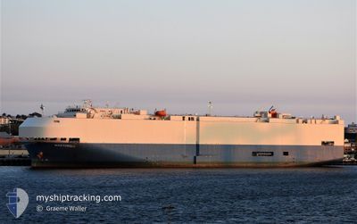
MARTORELL
Vehicles Carrier
Current Trip
| Time Travelled | 11 days |
|---|---|
| Remaining Time | 1 day |
| Distance Travelled | 4709.75 nm |
| Remaining Distance | 643.02 nm |
| AVG Speed | 16.8 Knots |
| MAX Speed | 19.1 Knots |
| AVG Wind | 15.3 knots |
| MAX Wind | 27.8 knots |
| MIN Temp | 2.4°C / 36.32°F |
| MAX Temp | 13.2°C / 55.76°F |
| Draught | 7.5 m |
| Position Received | 1 m ago |
Current Position
| Longitude | 140.44393° |
|---|---|
| Latitude | 41.39760° |
| Status | Under way using engine |
| Speed | 15.7 Knots |
| Course | 243° |
| Area | Japan Sea |
| Station | T-AIS |
| Position Received | 1 m ago |
Info
Information
The current position of MARTORELL is in Japan Sea with coordinates 41.39760° / 140.44393° as reported on 2024-04-25 15:58 by AIS to our vessel tracker app. The vessel's current speed is 15.7 Knots and is heading at the port of ONSAN. The estimated time of arrival as calculated by MyShipTracking vessel tracking app is 2024-04-27 08:49 LT
The vessel MARTORELL (IMO: 9267675, MMSI: 351780000) is a Vehicles Carrier that was built in 2003 ( 21 years old ). It's sailing under the flag of [PA] Panama.
In this page you can find informations about the vessels current position, last detected port calls, and current voyage information. If the vessels is not in coverage by AIS you will find the latest position.
The current position of MARTORELL is detected by our AIS receivers and we are not responsible for the reliability of the data. The last position was recorded while the vessel was in Coverage by the Ais receivers of our vessel tracking app.
The current draught of MARTORELL as reported by AIS is 7.5 meters
Weather
| Temperature | 9.8°C / 49.64°F |
|---|---|
| Wind Speed | 13 knots |
| Direction | 242° WSW |
| Pressure | 1008.5 hPa |
| Humidity | 87.3 % |
| Cloud Coverage | 71 % |
Featured Company
Last Port Calls
| Port | Arrival | Departure | Time In Port |
|---|---|---|---|
| 2024-04-13 14:12 | 2024-04-14 01:00 | 10 h | |
| 2024-04-09 18:51 | 2024-04-10 10:56 | 16 h | |
| 2024-04-08 16:16 | 2024-04-09 06:32 | 14 h | |
| 2024-03-25 22:12 | 2024-03-26 06:47 | 8 h | |
| 2024-03-23 21:45 | 2024-03-24 07:57 | 10 h | |
| 2024-03-21 21:11 | 2024-03-23 14:21 | 1 d | |
| 2024-02-14 11:06 | 2024-02-15 19:49 | 1 d | |
| 2024-02-10 04:26 | 2024-02-10 21:34 | 17 h | |
| 2024-02-05 13:41 | 2024-02-05 22:34 | 8 h | |
| 2024-02-04 10:41 | 2024-02-04 18:09 | 7 h |
Last Trips
| Origin | Departure | Destination | Arrival | Distance | |
|---|---|---|---|---|---|
| 2024-04-10 03:56 | 2024-04-13 07:12 | 1221.22 nm | |||
| 2024-04-08 23:32 | 2024-04-09 11:51 | 179.18 nm | |||
| 2024-03-26 15:47 | 2024-04-08 09:16 | 4358.37 nm | |||
| 2024-03-24 16:57 | 2024-03-26 07:12 | 536.27 nm | |||
| 2024-03-23 23:21 | 2024-03-24 06:45 | 94.50 nm | |||
| 2024-02-15 14:49 | 2024-03-22 06:11 | 10661.72 nm | |||
| 2024-02-10 16:34 | 2024-02-14 06:06 | 870.44 nm | |||
| 2024-02-05 18:34 | 2024-02-09 23:26 | 1217.73 nm | |||
| 2024-02-04 14:09 | 2024-02-05 09:41 | 230.80 nm | |||
| 2024-02-02 17:44 | 2024-02-04 06:41 | 429.71 nm |
Events
| Time | Event | Details | Position / Dest | Info |
|---|---|---|---|---|
| 2024-04-25 14:23 | Status Changed | Under way using engine Default |
41.62798 / 140.89808
KR USN
|
Speed: 15.4 kn Course: 273° |
| 2024-04-25 14:20 | Status Changed | Default Under way using engine |
41.62734 / 140.91244
KR USN
|
Speed: 15.4 kn Course: 270° |
| 2024-04-25 13:57 | Status Changed | Under way using engine Default |
41.62812 / 141.04627
KR USN
|
Speed: 16.9 kn Course: 264° |
| 2024-04-25 13:50 | Status Changed | Default Under way using engine |
41.63260 / 141.08629
KR USN
|
Speed: 17.2 kn Course: 265° |
| 2024-04-25 13:20 | Change Sea Area | Japanese part of the Japan Sea Japanese part of the North Pacific Ocean |
41.63932 / 141.28407
Japan Sea
KR USN
|
Speed: 17.1 kn Course: 270° |
| 2024-04-25 12:17 | Destination Changed | KR USN JP HTC |
41.63373 / 141.65882
KR USN
|
Speed: 16 kn Course: 263° |
| 2024-04-25 12:17 | ETA Changed | 2024/04/27 06:30 2024/04/25 21:00 |
41.63373 / 141.65882
KR USN
|
Speed: 16 kn Course: 263° |
| 2024-04-25 12:02 | Change Sea Area | Japanese part of the North Pacific Ocean United States part of the North Pacific Ocean |
41.63935 / 141.74992
North Pacific Ocean
JP HTC
|
Speed: 16.2 kn Course: 268° |
| 2024-04-25 12:00 | Status Changed | Under way using engine Default |
41.63950 / 141.75790
JP HTC
|
Speed: 16.1 kn Course: 272° |
| 2024-04-25 11:44 | IN Coverage |
41.63935 / 141.74992
North Pacific Ocean
JP HTC
|
Speed: 16.2 kn Course: 268° |