
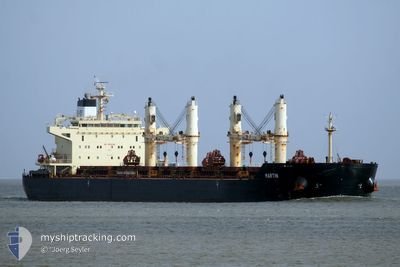
MARTIN
Bulk Carrier
Current Trip
| Time Travelled | 28 days |
|---|---|
| Remaining Time | --- |
| Distance Travelled | 5549.84 nm |
| Remaining Distance | --- |
| AVG Speed | 9.6 Knots |
| MAX Speed | 12.5 Knots |
| AVG Wind | 11.4 knots |
| MAX Wind | 24 knots |
| MIN Temp | 19.3°C / 66.74°F |
| MAX Temp | 31.4°C / 88.52°F |
| Draught | 13.1 m |
| Position Received | 7 d ago |
Current Position
| Longitude | 105.08814° |
|---|---|
| Latitude | 2.30005° |
| Status | Under way using engine |
| Speed | 10.9 Knots |
| Course | 4.9° |
| Area | South China Sea |
| Station | T-AIS |
| Position Received | 7 d ago |
Info
Information
The current position of MARTIN is in South China Sea with coordinates 2.30005° / 105.08814° as reported on 2024-04-16 17:30 by AIS to our vessel tracker app. The vessel's current speed is 10.9 Knots and is heading at the port of KRONG PREAH SIHANOUK. The estimated time of arrival as calculated by MyShipTracking vessel tracking app is 2024-04-18 16:30 LT
The vessel MARTIN (IMO: 9441350, MMSI: 538003973) is a Bulk Carrier that was built in 2010 ( 14 years old ). It's sailing under the flag of [MH] Marshall Is.
In this page you can find informations about the vessels current position, last detected port calls, and current voyage information. If the vessels is not in coverage by AIS you will find the latest position.
The current position of MARTIN is detected by our AIS receivers and we are not responsible for the reliability of the data. The last position was recorded while the vessel was in Coverage by the Ais receivers of our vessel tracking app.
The current draught of MARTIN as reported by AIS is 13.1 meters
Weather
| Temperature | 27.7°C / 81.86°F |
|---|---|
| Wind Speed | 3 knots |
| Direction | 128° SE |
| Pressure | 1006.7 hPa |
| Humidity | 74.2 % |
| Cloud Coverage | 100 % |
Featured Company
Last Port Calls
| Port | Arrival | Departure | Time In Port |
|---|---|---|---|
| 2024-03-21 07:37 | 2024-03-26 02:04 | 4 d | |
| 2024-03-01 16:38 | 2024-03-09 04:54 | 7 d | |
| 2024-02-20 07:48 | 2024-02-23 23:01 | 3 d | |
| 2024-02-03 21:46 |
Most Visited Ports (Last year)
| Port | Arrivals | |
|---|---|---|
| 2 | ||
| 2 | ||
| 2 | ||
| 1 | ||
| 1 | ||
| 1 |
Last Trips
| Origin | Departure | Destination | Arrival | Distance | |
|---|---|---|---|---|---|
| 2024-03-09 07:54 | 2024-03-21 09:37 | 1735.04 nm | |||
| 2024-02-24 01:01 | 2024-03-01 19:38 | 1699.71 nm | |||
| 2024-02-04 03:16 | 2024-02-20 09:48 | 4252.64 nm |
Events
| Time | Event | Details | Position / Dest | Info |
|---|---|---|---|---|
| 2024-04-21 05:12 | STOP Moving |
10.51167 / 103.99333
KH KOS
|
Speed: Course: -1° |
|
| 2024-04-21 03:12 | START Moving |
10.37167 / 103.78500
KH KOS
|
Speed: 10 kn Course: 60° |
|
| 2024-04-16 17:35 | Status Changed | Default Under way using engine |
2.31358 / 105.08923
KH KOS
|
Speed: 10.9 kn Course: 4.9° |
| 2024-04-16 17:30 | Status Changed | Under way using engine Default |
2.30005 / 105.08814
KH KOS
|
Speed: 10 kn Course: 4° |
| 2024-04-16 17:30 | OUT of Coverage |
2.30005 / 105.08814
South China Sea
KH KOS
|
Speed: 10.9 kn Course: 4.9° |
|
| 2024-04-16 16:56 | Status Changed | Default Under way using engine |
2.19667 / 105.07833
KH KOS
|
Speed: 10.7 kn Course: 4.7° |
| 2024-04-16 16:54 | Status Changed | Under way using engine Default |
2.19011 / 105.07932
KH KOS
|
Speed: 10 kn Course: 5° |
| 2024-04-16 16:41 | Status Changed | Default Under way using engine |
2.15167 / 105.07500
KH KOS
|
Speed: 10.7 kn Course: 4.3° |
| 2024-04-16 16:38 | Status Changed | Under way using engine Default |
2.14096 / 105.07524
KH KOS
|
Speed: 10 kn Course: 4° |
| 2024-04-16 16:25 | Status Changed | Default Under way using engine |
2.10255 / 105.07209
KH KOS
|
Speed: 10.7 kn Course: 5.3° |