
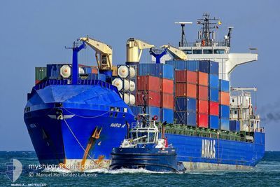
MARIO A
Container Ship
Current Trip
SNDKR !
| Time Travelled | 1 day |
|---|---|
| Remaining Time | --- |
| Distance Travelled | 456.62 nm |
| Remaining Distance | --- |
| AVG Speed | 12.7 Knots |
| MAX Speed | 13.8 Knots |
| AVG Wind | 11.2 knots |
| MAX Wind | 15.9 knots |
| MIN Temp | 19.3°C / 66.74°F |
| MAX Temp | 21.9°C / 71.42°F |
| Draught | 7 m |
| Position Received | 9 m ago |
Current Position
| Longitude | -17.60907° |
|---|---|
| Latitude | 21.91840° |
| Status | Under way using engine |
| Speed | 12.8 Knots |
| Course | 16.4° |
| Area | North Atlantic Ocean |
| Station | T-AIS |
| Position Received | 9 m ago |
Info
Information
The current position of MARIO A is in North Atlantic Ocean with coordinates 21.91840° / -17.60907° as reported on 2024-04-25 02:20 by AIS to our vessel tracker app. The vessel's current speed is 12.8 Knots
The vessel MARIO A (IMO: 9337377, MMSI: 215177000) is a Container Ship that was built in 2007 ( 17 years old ). It's sailing under the flag of [MT] Malta.
In this page you can find informations about the vessels current position, last detected port calls, and current voyage information. If the vessels is not in coverage by AIS you will find the latest position.
The current position of MARIO A is detected by our AIS receivers and we are not responsible for the reliability of the data. The last position was recorded while the vessel was in Coverage by the Ais receivers of our vessel tracking app.
The current draught of MARIO A as reported by AIS is 7 meters
Weather
| Temperature | 19.3°C / 66.74°F |
|---|---|
| Wind Speed | 14 knots |
| Direction | 14° NNE |
| Pressure | 1012.3 hPa |
| Humidity | 87.6 % |
| Cloud Coverage | 99 % |
Featured Company
Last Port Calls
| Port | Arrival | Departure | Time In Port |
|---|---|---|---|
| 2024-04-22 23:50 | 2024-04-23 14:58 | 15 h | |
| 2024-04-14 07:28 | 2024-04-14 22:58 | 15 h | |
| 2024-04-14 06:58 | 2024-04-14 07:03 | 5 m | |
| 2024-04-12 21:59 | 2024-04-13 05:20 | 7 h | |
| 2024-03-31 11:29 | 2024-04-01 06:46 | 19 h | |
| 2024-03-26 17:47 | 2024-03-29 10:05 | 2 d | |
| 2024-03-25 06:30 | 2024-03-26 04:16 | 21 h | |
| 2024-03-23 13:02 | 2024-03-23 23:59 | 10 h | |
| 2024-03-11 19:57 | 2024-03-15 16:33 | 3 d | |
| 2024-02-28 18:54 | 2024-02-29 22:06 | 1 d |
Last Trips
| Origin | Departure | Destination | Arrival | Distance | |
|---|---|---|---|---|---|
| 2024-04-14 23:58 | 2024-04-22 23:50 | 1588.36 nm | |||
| 2024-04-14 08:03 | 2024-04-14 08:28 | 0.66 nm | |||
| 2024-04-13 07:20 | 2024-04-14 07:58 | 330.66 nm | |||
| 2024-04-01 07:46 | 2024-04-12 23:59 | 2759.98 nm | |||
| 2024-03-29 10:05 | 2024-03-31 12:29 | 742.64 nm | |||
| 2024-03-26 04:16 | 2024-03-26 17:47 | 220.11 nm | |||
| 2024-03-24 00:59 | 2024-03-25 06:30 | 479.49 nm | |||
| 2024-03-15 16:33 | 2024-03-23 14:02 | 1858.00 nm | |||
| 2024-02-29 22:06 | 2024-03-11 19:57 | 2592.71 nm | |||
| 2024-02-27 19:06 | 2024-02-28 18:54 | 217.55 nm |
Events
| Time | Event | Details | Position / Dest | Info |
|---|---|---|---|---|
| 2024-04-25 02:23 | Status Changed | Default Under way using engine |
21.92833 / -17.60500
SNDKR !
|
Speed: 12.8 kn Course: 16.4° |
| 2024-04-25 02:10 | Status Changed | Under way using engine Default |
21.88218 / -17.62076
SNDKR !
|
Speed: 13 kn Course: 18° |
| 2024-04-25 02:02 | IN Coverage |
21.88218 / -17.62076
North Atlantic Ocean
|
Speed: 12.9 kn Course: 17.4° |
|
| 2024-04-25 00:05 | Status Changed | Default Under way using engine |
21.44167 / -17.77333
SNDKR !
|
Speed: 13.2 kn Course: 19.3° |
| 2024-04-24 23:59 | OUT of Coverage |
21.41932 / -17.78247
North Atlantic Ocean
|
Speed: 13.2 kn Course: 19.3° |
|
| 2024-04-24 23:43 | Status Changed | Under way using engine Default |
21.36308 / -17.80236
SNDKR !
|
Speed: 13 kn Course: 19° |
| 2024-04-24 23:43 | IN Coverage |
21.36308 / -17.80236
North Atlantic Ocean
|
Speed: 13.2 kn Course: 18.5° |
|
| 2024-04-24 21:32 | Status Changed | Default Under way using engine |
20.90333 / -17.96333
SNDKR !
|
Speed: 13.1 kn Course: 17.6° |
| 2024-04-24 21:26 | OUT of Coverage |
20.88161 / -17.97245
North Atlantic Ocean
|
Speed: 13.1 kn Course: 17.6° |
|
| 2024-04-24 21:25 | Status Changed | Under way using engine Default |
20.87813 / -17.97361
SNDKR !
|
Speed: 13 kn Course: 19° |