
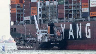
MARINE ANGEL
Tanker
Current Trip
| Time Travelled | 1 day |
|---|---|
| Remaining Time | --- |
| Distance Travelled | 35.75 nm |
| Remaining Distance | --- |
| AVG Speed | 6.6 Knots |
| MAX Speed | 8.3 Knots |
| AVG Wind | 5 knots |
| MAX Wind | 8 knots |
| MIN Temp | 28.4°C / 83.12°F |
| MAX Temp | 30.9°C / 87.62°F |
| Draught | 5.8 m |
| Position Received | 1 m ago |
Current Position
| Longitude | 103.95509° |
|---|---|
| Latitude | 1.30018° |
| Status | At anchor |
| Speed | |
| Course | 117° |
| Area | Singapore Strait |
| Station | T-AIS |
| Position Received | 1 m ago |
Info
Information
The current position of MARINE ANGEL is in Singapore Strait with coordinates 1.30018° / 103.95509° as reported on 2024-04-23 09:31 by AIS to our vessel tracker app. The vessel's current speed is 0 Knots
The vessel MARINE ANGEL (IMO: 9647899, MMSI: 563034200) is a Tanker It's sailing under the flag of [SG] Singapore.
In this page you can find informations about the vessels current position, last detected port calls, and current voyage information. If the vessels is not in coverage by AIS you will find the latest position.
The current position of MARINE ANGEL is detected by our AIS receivers and we are not responsible for the reliability of the data. The last position was recorded while the vessel was in Coverage by the Ais receivers of our vessel tracking app.
The current draught of MARINE ANGEL as reported by AIS is 5.8 meters
Weather
| Temperature | 31°C / 87.8°F |
|---|---|
| Wind Speed | 6 knots |
| Direction | 87° E |
| Pressure | 1004.9 hPa |
| Humidity | 66.4 % |
| Cloud Coverage | 24 % |
Featured Company
Last Port Calls
| Port | Arrival | Departure | Time In Port |
|---|---|---|---|
| 2024-04-21 08:11 | 2024-04-21 14:54 | 6 h | |
| 2024-04-18 08:36 | 2024-04-19 03:20 | 18 h | |
| 2024-04-18 08:02 | 2024-04-18 08:07 | 5 m | |
| 2024-04-13 16:49 | 2024-04-14 03:23 | 10 h | |
| 2024-04-12 11:59 | 2024-04-12 18:49 | 6 h | |
| 2024-04-12 07:33 | 2024-04-12 10:46 | 3 h | |
| 2024-04-05 08:43 | 2024-04-05 13:47 | 5 h | |
| 2024-04-01 14:09 | 2024-04-02 02:50 | 12 h | |
| 2024-03-26 08:29 | 2024-03-26 13:21 | 4 h | |
| 2024-03-13 08:52 | 2024-03-13 14:22 | 5 h |
Most Visited Ports (Last year)
| Port | Arrivals | |
|---|---|---|
| 76 | ||
| 50 | ||
| 13 |
Last Trips
| Origin | Departure | Destination | Arrival | Distance | |
|---|---|---|---|---|---|
| 2024-04-19 11:20 | 2024-04-21 16:11 | 21.95 nm | |||
| 2024-04-18 16:07 | 2024-04-18 16:36 | 2.42 nm | |||
| 2024-04-14 11:23 | 2024-04-18 16:02 | 74.56 nm | |||
| 2024-04-13 02:49 | 2024-04-14 00:49 | 8.46 nm | |||
| 2024-04-12 18:46 | 2024-04-12 19:59 | 9.99 nm | |||
| 2024-04-05 21:47 | 2024-04-12 15:33 | 66.71 nm | |||
| 2024-04-02 10:50 | 2024-04-05 16:43 | 61.90 nm | |||
| 2024-03-26 21:21 | 2024-04-01 22:09 | 156.13 nm | |||
| 2024-03-13 22:22 | 2024-03-26 16:29 | 139.32 nm | |||
| 2024-03-10 01:54 | 2024-03-13 16:52 | 46.90 nm |
Events
| Time | Event | Details | Position / Dest | Info |
|---|---|---|---|---|
| 2024-04-23 08:40 | Status Changed | At anchor Default |
1.30041 / 103.95526
AEPB
|
Speed: 0.1 kn Course: 138° |
| 2024-04-23 08:31 | Status Changed | Default At anchor |
1.30036 / 103.95515
AEPB
|
Speed: 0.3 kn Course: 117° |
| 2024-04-23 00:34 | STOP Moving | 3.85 nm, West of TANAH MERAH |
1.29996 / 103.95495
AEPB
|
Speed: Course: 93° |
| 2024-04-23 00:31 | Status Changed | At anchor Moored |
1.29986 / 103.95516
AEPB
|
Speed: 1 kn Course: 81° |
| 2024-04-23 00:20 | START Moving | 3.07 nm, South West of TANAH MERAH |
1.29211 / 103.97086
AEPB
|
Speed: 3.3 kn Course: 313° |
| 2024-04-22 17:29 | Status Changed | Moored Under way using engine |
1.29262 / 103.97390
AEPB
|
Speed: 0.1 kn Course: 275° |
| 2024-04-22 17:12 | STOP Moving | 2.91 nm, South West of TANAH MERAH |
1.29281 / 103.97337
AEPB
|
Speed: 0.3 kn Course: 217° |
| 2024-04-22 16:12 | START Moving | 2.52 nm, South East of TANAH MERAH |
1.29455 / 104.05590
AEPB
|
Speed: 3.3 kn Course: 111° |
| 2024-04-22 15:54 | Destination Changed | AEPB AEBA |
1.29502 / 104.05464
AEPB
|
Speed: 0.2 kn Course: 83° |
| 2024-04-22 15:54 | ETA Changed | 2024/04/23 01:00 2024/04/22 15:00 |
1.29502 / 104.05464
AEPB
|
Speed: 0.2 kn Course: 83° |