
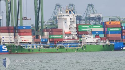
MARIA COSULICH
Oil Products Tanker
Current Trip
AEBA
| Time Travelled | 1 day |
|---|---|
| Remaining Time | --- |
| Distance Travelled | 28.15 nm |
| Remaining Distance | --- |
| AVG Speed | 7.7 Knots |
| MAX Speed | 8.8 Knots |
| AVG Wind | 5 knots |
| MAX Wind | 9.9 knots |
| MIN Temp | 28.4°C / 83.12°F |
| MAX Temp | 31°C / 87.8°F |
| Draught | 7 m |
| Position Received | 7 h, 15 m ago |
Current Position
| Longitude | 104.05839° |
|---|---|
| Latitude | 1.30411° |
| Status | Under way using engine |
| Speed | 0.5 Knots |
| Course | 95° |
| Area | Singapore Strait |
| Station | T-AIS |
| Position Received | 7 h, 15 m ago |
Info
Information
The current position of MARIA COSULICH is in Singapore Strait with coordinates 1.30411° / 104.05839° as reported on 2024-04-23 13:35 by AIS to our vessel tracker app. The vessel's current speed is 0.5 Knots
The vessel MARIA COSULICH (IMO: 9355654, MMSI: 565006000) is a Oil Products Tanker that was built in 2005 ( 19 years old ). It's sailing under the flag of [SG] Singapore.
In this page you can find informations about the vessels current position, last detected port calls, and current voyage information. If the vessels is not in coverage by AIS you will find the latest position.
The current position of MARIA COSULICH is detected by our AIS receivers and we are not responsible for the reliability of the data. The last position was recorded while the vessel was in Coverage by the Ais receivers of our vessel tracking app.
The current draught of MARIA COSULICH as reported by AIS is 7 meters
Weather
| Temperature | 29.1°C / 84.38°F |
|---|---|
| Wind Speed | 7 knots |
| Direction | 77° ENE |
| Pressure | 1006 hPa |
| Humidity | 75.4 % |
| Cloud Coverage | 89 % |
Featured Company
Last Port Calls
| Port | Arrival | Departure | Time In Port |
|---|---|---|---|
| 2024-04-21 21:38 | 2024-04-22 15:20 | 17 h | |
| 2024-04-18 12:55 | 2024-04-19 04:55 | 16 h | |
| 2024-04-17 18:31 | 2024-04-18 01:03 | 6 h | |
| 2024-04-15 01:48 | 2024-04-15 14:40 | 12 h | |
| 2024-04-12 04:07 | 2024-04-13 08:00 | 1 d | |
| 2024-04-07 07:54 | 2024-04-07 22:48 | 14 h | |
| 2024-04-05 09:36 | 2024-04-06 03:25 | 17 h | |
| 2024-04-03 01:29 | 2024-04-03 19:28 | 17 h | |
| 2024-04-01 22:00 | 2024-04-02 09:32 | 11 h | |
| 2024-04-01 01:06 | 2024-04-01 20:55 | 19 h |
Most Visited Ports (Last year)
| Port | Arrivals | |
|---|---|---|
| 89 | ||
| 79 | ||
| 4 | ||
| 4 |
Last Trips
| Origin | Departure | Destination | Arrival | Distance | |
|---|---|---|---|---|---|
| 2024-04-19 12:55 | 2024-04-22 05:38 | 56.28 nm | |||
| 2024-04-18 09:03 | 2024-04-18 20:55 | 21.93 nm | |||
| 2024-04-15 22:40 | 2024-04-18 02:31 | 50.03 nm | |||
| 2024-04-13 16:00 | 2024-04-15 09:48 | 26.14 nm | |||
| 2024-04-08 06:48 | 2024-04-12 12:07 | 120.52 nm | |||
| 2024-04-06 11:25 | 2024-04-07 15:54 | 36.95 nm | |||
| 2024-04-04 03:28 | 2024-04-05 17:36 | 38.09 nm | |||
| 2024-04-02 17:32 | 2024-04-03 09:29 | 25.62 nm | |||
| 2024-04-02 04:55 | 2024-04-02 06:00 | 5.48 nm | |||
| 2024-03-30 20:12 | 2024-04-01 09:06 | 68.59 nm |
Events
| Time | Event | Details | Position / Dest | Info |
|---|---|---|---|---|
| 2024-04-23 13:40 | Status Changed | Default Under way using engine |
1.30394 / 104.05829
AEBA
|
Speed: 0.5 kn Course: 95° |
| 2024-04-23 13:35 | OUT of Coverage |
1.30411 / 104.05839
Singapore Strait
|
Speed: 0.5 kn Course: 273.5° |
|
| 2024-04-23 13:22 | Status Changed | Under way using engine Default |
1.30280 / 104.05534
AEBA
|
Speed: 2.3 kn Course: 106° |
| 2024-04-23 13:20 | Status Changed | Default Under way using engine |
1.30343 / 104.05376
AEBA
|
Speed: Course: 79° |
| 2024-04-23 13:12 | STOP Moving | 2.16 nm, East of TANAH MERAH |
1.30391 / 104.05289
AEBA
|
Speed: 0.2 kn Course: 71° |
| 2024-04-23 12:36 | Status Changed | Under way using engine Default |
1.29215 / 104.01579
AEBA
|
Speed: 6.6 kn Course: 82° |
| 2024-04-23 12:21 | Status Changed | Default Under way using engine |
1.28910 / 103.98620
AEBA
|
Speed: 6.6 kn Course: 108.5° |
| 2024-04-23 12:06 | START Moving | 3.56 nm, West of TANAH MERAH |
1.29306 / 103.96169
AEBA
|
Speed: 3.4 kn Course: 117° |
| 2024-04-23 11:52 | Destination Changed | AEBA AEPB |
1.29413 / 103.96001
AEBA
|
Speed: 0.1 kn Course: 90° |
| 2024-04-23 11:46 | Status Changed | Under way using engine Default |
1.29422 / 103.95999
AEPB
|
Speed: Course: 81° |