
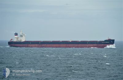
MARGRET OLDENDORFF
Cargo
Current Trip
| Time Travelled | 45 days |
|---|---|
| Remaining Time | 2 days |
| Distance Travelled | 10834.21 nm |
| Remaining Distance | 711.07 nm |
| AVG Speed | 9.8 Knots |
| MAX Speed | 12.9 Knots |
| AVG Wind | 12 knots |
| MAX Wind | 26 knots |
| MIN Temp | 17.3°C / 63.14°F |
| MAX Temp | 31.5°C / 88.7°F |
| Draught | 18 m |
| Position Received | 1 d ago |
Current Position
| Longitude | 119.90431° |
|---|---|
| Latitude | 22.79022° |
| Status | Under way using engine |
| Speed | 11.3 Knots |
| Course | 8.9° |
| Area | South China Sea |
| Station | T-AIS |
| Position Received | 1 d ago |
Info
Information
The current position of MARGRET OLDENDORFF is in South China Sea with coordinates 22.79022° / 119.90431° as reported on 2024-04-15 04:31 by AIS to our vessel tracker app. The vessel's current speed is 11.3 Knots and is heading at the port of QINGDAO. The estimated time of arrival as calculated by MyShipTracking vessel tracking app is 2024-04-18 16:57 LT
The vessel MARGRET OLDENDORFF (IMO: 9648908, MMSI: 636016352) is a Cargo It's sailing under the flag of [LR] Liberia.
In this page you can find informations about the vessels current position, last detected port calls, and current voyage information. If the vessels is not in coverage by AIS you will find the latest position.
The current position of MARGRET OLDENDORFF is detected by our AIS receivers and we are not responsible for the reliability of the data. The last position was recorded while the vessel was in Coverage by the Ais receivers of our vessel tracking app.
The current draught of MARGRET OLDENDORFF as reported by AIS is 18 meters
Weather
| Temperature | 19.6°C / 67.28°F |
|---|---|
| Wind Speed | 9 knots |
| Direction | 146° SE |
| Pressure | 1012.2 hPa |
| Humidity | 96.6 % |
| Cloud Coverage | 100 % |
Featured Company
Most Visited Ports (Last year)
| Port | Arrivals | |
|---|---|---|
| 3 | ||
| 2 | ||
| 1 | ||
| 1 |
Last Trips
| Origin | Departure | Destination | Arrival | Distance | |
|---|---|---|---|---|---|
| 2024-01-04 06:45 | 2024-02-28 22:23 | 12361.71 nm |
Events
| Time | Event | Details | Position / Dest | Info |
|---|---|---|---|---|
| 2024-04-15 04:41 | Status Changed | Default Under way using engine |
22.82167 / 119.90667
CN QINGDAO
|
Speed: 11.3 kn Course: 8.9° |
| 2024-04-15 04:31 | OUT of Coverage |
22.79022 / 119.90431
South China Sea
CN QINGDAO
|
Speed: 11.3 kn Course: 8.9° |
|
| 2024-04-15 04:29 | Status Changed | Under way using engine Default |
22.78190 / 119.90282
CN QINGDAO
|
Speed: 11.5 kn Course: 27° |
| 2024-04-15 04:20 | Status Changed | Default Under way using engine |
22.75618 / 119.89583
CN QINGDAO
|
Speed: 12 kn Course: 38.6° |
| 2024-04-15 04:19 | Status Changed | Under way using engine Default |
22.75202 / 119.89293
CN QINGDAO
|
Speed: 12 kn Course: 34° |
| 2024-04-15 04:09 | Status Changed | Default Under way using engine |
22.72437 / 119.87210
CN QINGDAO
|
Speed: 12 kn Course: 31.9° |
| 2024-04-15 04:04 | Change Sea Area | Taiwanese part of the South China Sea Malaysian part of the Singapore Strait |
22.71095 / 119.86305
South China Sea
CN QINGDAO
|
Speed: 12 kn Course: 32.3° |
| 2024-04-15 04:04 | Status Changed | Under way using engine Default |
22.71095 / 119.86305
CN QINGDAO
|
Speed: 12.2 kn Course: 33° |
| 2024-04-15 03:56 | IN Coverage |
22.71095 / 119.86305
South China Sea
CN QINGDAO
|
Speed: 12 kn Course: 32.3° |
|
| 2024-04-08 17:04 | OUT of Coverage |
1.25967 / 104.21403
Singapore Strait
CN QINGDAO
|
Speed: 10.5 kn Course: 81.2° |