
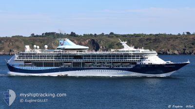
MARELLA DISCOVERY
Passengers Ship
Current Trip
LCCAS
| Time Travelled | 4 h, 8 mins |
|---|---|
| Remaining Time | --- |
| Distance Travelled | 59.89 nm |
| Remaining Distance | --- |
| AVG Speed | 15.7 Knots |
| MAX Speed | 16.4 Knots |
| AVG Wind | 9.9 knots |
| MAX Wind | 12.9 knots |
| MIN Temp | 27.3°C / 81.14°F |
| MAX Temp | 27.8°C / 82.04°F |
| Draught | 8 m |
| Position Received | 2 h, 53 m ago |
Current Position
| Longitude | -61.20708° |
|---|---|
| Latitude | 14.26525° |
| Status | Under way using engine |
| Speed | 15.7 Knots |
| Course | 322.1° |
| Area | Caribbean Sea |
| Station | T-AIS |
| Position Received | 2 h, 53 m ago |
Info
Information
The current position of MARELLA DISCOVERY is in Caribbean Sea with coordinates 14.26525° / -61.20708° as reported on 2024-04-19 23:16 by AIS to our vessel tracker app. The vessel's current speed is 15.7 Knots
The vessel MARELLA DISCOVERY (IMO: 9070632, MMSI: 249639000) is a Passengers Ship that was built in 1996 ( 28 years old ). It's sailing under the flag of [MT] Malta.
In this page you can find informations about the vessels current position, last detected port calls, and current voyage information. If the vessels is not in coverage by AIS you will find the latest position.
The current position of MARELLA DISCOVERY is detected by our AIS receivers and we are not responsible for the reliability of the data. The last position was recorded while the vessel was in Coverage by the Ais receivers of our vessel tracking app.
The current draught of MARELLA DISCOVERY as reported by AIS is 8 meters
Weather
| Temperature | 27.5°C / 81.5°F |
|---|---|
| Wind Speed | 12 knots |
| Direction | 80° E |
| Pressure | 1014.1 hPa |
| Humidity | 78.2 % |
| Cloud Coverage | 100 % |
Featured Company
Last Port Calls
| Port | Arrival | Departure | Time In Port |
|---|---|---|---|
| 2024-04-19 11:19 | 2024-04-19 22:02 | 10 h | |
| 2024-04-18 11:26 | 2024-04-19 00:22 | 12 h | |
| 2024-04-17 11:45 | 2024-04-17 20:02 | 8 h | |
| 2024-04-16 11:25 | 2024-04-16 22:05 | 10 h | |
| 2024-04-15 11:48 | 2024-04-15 21:59 | 10 h | |
| 2024-04-14 11:32 | 2024-04-14 21:48 | 10 h | |
| 2024-04-13 06:20 | 2024-04-13 22:12 | 15 h | |
| 2024-04-11 11:14 | 2024-04-12 00:21 | 13 h | |
| 2024-04-09 12:51 | 2024-04-09 21:54 | 9 h | |
| 2024-04-08 10:55 | 2024-04-08 19:56 | 9 h |
Most Visited Ports (Last year)
| Port | Arrivals | |
|---|---|---|
| 25 | ||
| 24 | ||
| 12 | ||
| 11 | ||
| 11 | ||
| 11 |
Last Trips
| Origin | Departure | Destination | Arrival | Distance | |
|---|---|---|---|---|---|
| 2024-04-18 20:22 | 2024-04-19 07:19 | 121.62 nm | |||
| 2024-04-17 16:02 | 2024-04-18 07:26 | 221.07 nm | |||
| 2024-04-16 18:05 | 2024-04-17 07:45 | 157.41 nm | |||
| 2024-04-15 17:59 | 2024-04-16 07:25 | 154.66 nm | |||
| 2024-04-14 17:48 | 2024-04-15 07:48 | 123.60 nm | |||
| 2024-04-13 18:12 | 2024-04-14 07:32 | 139.50 nm | |||
| 2024-04-11 20:21 | 2024-04-13 02:20 | 379.94 nm | |||
| 2024-04-09 17:54 | 2024-04-11 07:14 | 278.94 nm | |||
| 2024-04-08 15:56 | 2024-04-09 08:51 | 254.15 nm | |||
| 2024-04-07 20:07 | 2024-04-08 06:55 | 100.12 nm |
Events
| Time | Event | Details | Position / Dest | Info |
|---|---|---|---|---|
| 2024-04-19 23:21 | Status Changed | Default Under way using engine |
14.27976 / -61.21859
LCCAS
|
Speed: 15.7 kn Course: 322.1° |
| 2024-04-19 23:16 | OUT of Coverage |
14.26525 / -61.20708
Caribbean Sea
|
Speed: 15.7 kn Course: 322.1° |
|
| 2024-04-19 23:07 | Detected in Sea | Guadeloupe and Martinique part of the Caribbean Sea |
14.23392 / -61.18200
Caribbean Sea
|
Speed: 15.4 kn Course: 323.4° |
| 2024-04-19 22:50 | Status Changed | Under way using engine Default |
14.17364 / -61.13377
LCCAS
|
Speed: 15.5 kn Course: 322° |
| 2024-04-19 22:26 | Status Changed | Default Under way using engine |
14.09319 / -61.07064
LCCAS
|
Speed: 15.4 kn Course: 321.3° |
| 2024-04-19 22:18 | Status Changed | Under way using engine Default |
14.06586 / -61.04943
LCCAS
|
Speed: 15.3 kn Course: 320° |
| 2024-04-19 22:02 | IN Coverage |
14.06586 / -61.04943
Caribbean Sea
|
Speed: 15.4 kn Course: 321.3° |
|
| 2024-04-19 22:02 | PORT DEPARTURE |
|
14.01983 / -61.00877
LCCAS
|
Speed: 5.5 kn Course: 301° |
| 2024-04-19 21:58 | START Moving |
14.01641 / -61.00292
[LC] CASTRIES
|
Speed: 5.5 kn Course: 301° |
|
| 2024-04-19 11:36 | OUT of Coverage |
14.01374 / -60.99678
Caribbean Sea
[LC] CASTRIES
|
Speed: 0.2 kn Course: 280° |