
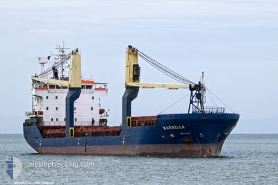
MARBELLA
General Cargo
Current Trip
| Time Travelled | 3 days |
|---|---|
| Remaining Time | --- |
| Distance Travelled | 798.25 nm |
| Remaining Distance | 9.14 nm |
| AVG Speed | 10.8 Knots |
| MAX Speed | 12.9 Knots |
| AVG Wind | 12.9 knots |
| MAX Wind | 23.8 knots |
| MIN Temp | 12.3°C / 54.14°F |
| MAX Temp | 19.9°C / 67.82°F |
| Draught | 6.8 m |
| Position Received | 3 m ago |
Current Position
| Longitude | 12.40232° |
|---|---|
| Latitude | 45.36753° |
| Status | At anchor |
| Speed | |
| Course | 70° |
| Area | Adriatic Sea |
| Station | T-AIS |
| Position Received | 3 m ago |
Info
Information
The current position of MARBELLA is in Adriatic Sea with coordinates 45.36753° / 12.40232° as reported on 2024-04-19 08:19 by AIS to our vessel tracker app. The vessel's current speed is 0 Knots and is heading at the port of VENEZIA. The estimated time of arrival as calculated by MyShipTracking vessel tracking app is 2024-04-18 20:30 LT
The vessel MARBELLA (IMO: 9406958, MMSI: 247386700) is a General Cargo that was built in 2008 ( 16 years old ). It's sailing under the flag of [IT] Italy.
In this page you can find informations about the vessels current position, last detected port calls, and current voyage information. If the vessels is not in coverage by AIS you will find the latest position.
The current position of MARBELLA is detected by our AIS receivers and we are not responsible for the reliability of the data. The last position was recorded while the vessel was in Coverage by the Ais receivers of our vessel tracking app.
The current draught of MARBELLA as reported by AIS is 6.8 meters
Weather
| Temperature | 10.7°C / 51.26°F |
|---|---|
| Wind Speed | 5 knots |
| Direction | 30° NNE |
| Pressure | 1017.3 hPa |
| Humidity | 65 % |
| Cloud Coverage | 39 % |
Featured Company
Last Port Calls
| Port | Arrival | Departure | Time In Port |
|---|---|---|---|
| 2024-04-11 05:51 | 2024-04-15 17:16 | 4 d | |
| 2024-04-07 14:38 | |||
| 2024-03-29 11:25 | 2024-04-02 23:29 | 4 d | |
| 2024-03-22 05:32 | 2024-03-23 13:51 | 1 d | |
| 2024-03-10 06:10 | 2024-03-15 13:22 | 5 d | |
| 2024-02-26 09:03 | 2024-02-28 17:44 | 2 d | |
| 2024-02-15 14:39 | 2024-02-19 17:58 | 4 d | |
| 2024-02-08 02:52 | 2024-02-14 13:06 | 6 d |
Last Trips
| Origin | Departure | Destination | Arrival | Distance | |
|---|---|---|---|---|---|
| 2024-04-03 02:29 | 2024-04-07 16:38 | 1145.40 nm | |||
| 2024-03-23 16:51 | 2024-03-29 14:25 | 313.65 nm | |||
| 2024-03-15 14:22 | 2024-03-22 08:32 | 940.42 nm | |||
| 2024-02-28 18:44 | 2024-03-10 07:10 | 1163.34 nm | |||
| 2024-02-19 18:58 | 2024-02-26 10:03 | 994.90 nm | |||
| 2024-02-14 14:06 | 2024-02-15 15:39 | 290.02 nm | |||
| 2024-01-30 17:59 | 2024-02-08 03:52 | 1514.08 nm |
Events
| Time | Event | Details | Position / Dest | Info |
|---|---|---|---|---|
| 2024-04-18 20:52 | Status Changed | At anchor Under way using engine |
45.36792 / 12.40243
IT PMA
|
Speed: 0.8 kn Course: 92° |
| 2024-04-18 20:46 | STOP Moving | 6.08 nm, South East of VENEZIA |
45.36813 / 12.40385
IT PMA
|
Speed: 0.3 kn Course: 45° |
| 2024-04-18 18:23 | IN Coverage |
45.15168 / 12.77448
Adriatic Sea
IT PMA
|
Speed: 11.2 kn Course: 304° |
|
| 2024-04-18 17:33 | ETA Changed | 2024/04/18 20:30 2024/04/19 02:00 |
43.91398 / 13.89470
IT PMA
|
Speed: 11.4 kn Course: 323.7° |
| 2024-04-18 10:04 | OUT of Coverage |
43.91398 / 13.89470
Adriatic Sea
IT PMA
|
Speed: 11.4 kn Course: 323.7° |
|
| 2024-04-18 10:04 | Detected in Sea | Italian part of the Adriatic Sea |
43.91398 / 13.89470
Adriatic Sea
IT PMA
|
Speed: 11.4 kn Course: 323.7° |
| 2024-04-18 10:04 | IN Coverage |
43.91398 / 13.89470
Adriatic Sea
IT PMA
|
Speed: 11.4 kn Course: 323.7° |
|
| 2024-04-18 02:29 | Status Changed | Default Under way using engine |
42.86263 / 15.08480
IT PMA
|
Speed: 10.5 kn Course: 316.4° |
| 2024-04-18 02:02 | OUT of Coverage |
42.80650 / 15.15868
Adriatic Sea
IT PMA
|
Speed: 10.5 kn Course: 316.4° |
|
| 2024-04-18 00:29 | Change Sea Area | Croatian part of the Adriatic Sea Italian part of the Adriatic Sea |
42.59918 / 15.41670
Adriatic Sea
IT PMA
|
Speed: 11 kn Course: 317.9° |