
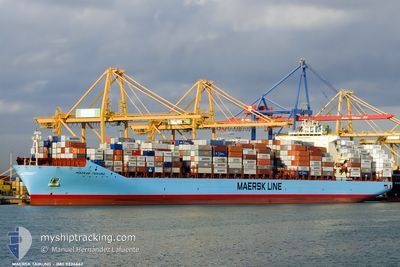
MAERSK TAIKUNG
Container Ship
Current Trip
| Trip Time | 3 days |
|---|---|
| Trip Distance | 629.59 nm |
| AVG Speed | 6.5 Knots |
| MAX Speed | 6.5 Knots |
| Draught | 11.6 m |
| AVG Wind | 10.4 knots |
| MAX Wind | 16.9 knots |
| MIN Temp | 16.4°C / 61.52°F |
| MAX Temp | 24.7°C / 76.46°F |
| Position Received | 1 m ago |
Current Position
| Longitude | -80.15492° |
|---|---|
| Latitude | 25.76617° |
| Status | Moored |
| Speed | |
| Course | 272° |
| Area | North Atlantic Ocean |
| Station | T-AIS |
| Position Received | 1 m ago |
Info
Information
The current position of MAERSK TAIKUNG is in North Atlantic Ocean with coordinates 25.76617° / -80.15492° as reported on 2024-04-20 00:25 by AIS to our vessel tracker app. The vessel's current speed is 0 Knots and is currently inside the port of MIAMI.
The vessel MAERSK TAIKUNG (IMO: 9334662, MMSI: 477178200) is a Container Ship that was built in 2007 ( 17 years old ). It's sailing under the flag of [HK] Hong Kong.
In this page you can find informations about the vessels current position, last detected port calls, and current voyage information. If the vessels is not in coverage by AIS you will find the latest position.
The current position of MAERSK TAIKUNG is detected by our AIS receivers and we are not responsible for the reliability of the data. The last position was recorded while the vessel was in Coverage by the Ais receivers of our vessel tracking app.
The current draught of MAERSK TAIKUNG as reported by AIS is 11 meters
Weather
| Temperature | 25.4°C / 77.72°F |
|---|---|
| Wind Speed | 9 knots |
| Direction | 130° SE |
| Pressure | 1017.4 hPa |
| Humidity | 59.3 % |
| Cloud Coverage | --- |
Featured Company
Last Port Calls
| Port | Arrival | Departure | Time In Port |
|---|---|---|---|
| 2024-04-19 00:21 | |||
| 2024-04-14 08:08 | 2024-04-15 08:40 | 1 d | |
| 2024-04-12 05:35 | 2024-04-13 12:41 | 1 d | |
| 2024-04-07 11:12 | 2024-04-08 06:10 | 18 h | |
| 2024-03-07 21:35 | 2024-03-09 06:21 | 1 d | |
| 2024-02-29 17:56 | 2024-03-01 14:38 | 20 h | |
| 2024-02-28 11:01 | 2024-02-29 07:42 | 20 h | |
| 2024-02-27 04:38 | 2024-02-27 23:24 | 18 h | |
| 2024-02-22 16:40 | 2024-02-23 22:29 | 1 d |
Most Visited Ports (Last year)
| Port | Arrivals | |
|---|---|---|
| 6 | ||
| 5 | ||
| 5 | ||
| 4 | ||
| 3 | ||
| 3 |
Last Trips
| Origin | Departure | Destination | Arrival | Distance | |
|---|---|---|---|---|---|
| 2024-04-15 04:40 | 2024-04-18 20:21 | 629.59 nm | |||
| 2024-04-13 08:41 | 2024-04-14 04:08 | 138.39 nm | |||
| 2024-04-08 02:10 | 2024-04-12 01:35 | 712.59 nm | |||
| 2024-03-09 14:21 | 2024-04-07 07:12 | 12419.88 nm | |||
| 2024-03-01 22:38 | 2024-03-08 05:35 | 1480.43 nm | |||
| 2024-02-29 15:42 | 2024-03-01 01:56 | 137.61 nm | |||
| 2024-02-28 07:24 | 2024-02-28 19:01 | 127.70 nm | |||
| 2024-02-24 06:29 | 2024-02-27 12:38 | 1500.34 nm | |||
| 2024-01-27 19:54 | 2024-02-23 00:40 | 12281.02 nm |
Events
| Time | Event | Details | Position / Dest | Info |
|---|---|---|---|---|
| 2024-04-19 04:21 | Draught Changed | 11 11.6 |
25.76616 / -80.15492
[US] MIAMI
|
Speed: Course: 272° |
| 2024-04-19 04:21 | Destination Changed | MYTPP USMIA |
25.76616 / -80.15492
[US] MIAMI
|
Speed: Course: 272° |
| 2024-04-19 04:21 | ETA Changed | 2024/05/21 08:00 2024/04/18 23:00 |
25.76616 / -80.15492
[US] MIAMI
|
Speed: Course: 272° |
| 2024-04-19 00:55 | Status Changed | Moored Under way using engine |
25.76622 / -80.15495
[US] MIAMI
|
Speed: Course: 272° |
| 2024-04-19 00:47 | STOP Moving |
25.76599 / -80.15484
[US] MIAMI
|
Speed: 0.3 kn Course: 273° |
|
| 2024-04-19 00:21 | PORT ARRIVAL |
|
25.76270 / -80.12995
[US] MIAMI
|
Speed: 8.1 kn Course: 294.5° |
| 2024-04-18 19:22 | START Moving | 19.82 nm, East of MIAMI |
25.71683 / -79.80554
USMIA
|
Speed: 3.1 kn Course: 173° |
| 2024-04-18 17:26 | STOP Moving | 21.57 nm, East of MIAMI |
25.64298 / -79.79319
USMIA
|
Speed: 0.3 kn Course: 185° |
| 2024-04-18 14:23 | START Moving |
25.50231 / -79.76881
USMIA
|
Speed: 3.1 kn Course: 176° |
|
| 2024-04-18 14:13 | ETA Changed | 2024/04/18 23:00 2024/04/19 10:00 |
25.49405 / -79.76536
USMIA
|
Speed: 3 kn Course: 177° |