
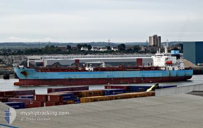
MAERSK TACOMA
Tanker
Current Trip
| Time Travelled | 10 days |
|---|---|
| Remaining Time | 7 days |
| Distance Travelled | 2919.59 nm |
| Remaining Distance | 2126.89 nm |
| AVG Speed | 11.8 Knots |
| MAX Speed | 13.9 Knots |
| AVG Wind | 16 knots |
| MAX Wind | 22.8 knots |
| MIN Temp | 21.5°C / 70.7°F |
| MAX Temp | 28.7°C / 83.66°F |
| Draught | 9 m |
| Position Received | 4 d ago |
Current Position
| Longitude | 57.46765° |
|---|---|
| Latitude | -20.11570° |
| Status | Under way using engine |
| Speed | 10.4 Knots |
| Course | 321.9° |
| Area | Indian Ocean |
| Station | T-AIS |
| Position Received | 4 d ago |
Info
Information
The current position of MAERSK TACOMA is in Indian Ocean with coordinates -20.11570° / 57.46765° as reported on 2024-04-19 14:53 by AIS to our vessel tracker app. The vessel's current speed is 10.4 Knots and is heading at the port of SINGAPORE. The estimated time of arrival as calculated by MyShipTracking vessel tracking app is 2024-05-01 17:57 LT
The vessel MAERSK TACOMA (IMO: 9708617, MMSI: 219179000) is a Tanker It's sailing under the flag of [DK] Denmark.
In this page you can find informations about the vessels current position, last detected port calls, and current voyage information. If the vessels is not in coverage by AIS you will find the latest position.
The current position of MAERSK TACOMA is detected by our AIS receivers and we are not responsible for the reliability of the data. The last position was recorded while the vessel was in Coverage by the Ais receivers of our vessel tracking app.
The current draught of MAERSK TACOMA as reported by AIS is 9 meters
Weather
| Temperature | 27.6°C / 81.68°F |
|---|---|
| Wind Speed | 18 knots |
| Direction | 130° SE |
| Pressure | 1011.4 hPa |
| Humidity | 75.2 % |
| Cloud Coverage | 100 % |
Featured Company
Last Port Calls
| Port | Arrival | Departure | Time In Port |
|---|---|---|---|
| 2024-04-08 09:32 | 2024-04-13 13:21 | 5 d | |
| 2024-03-19 09:52 | 2024-03-20 04:52 | 19 h | |
| 2024-03-17 18:10 | 2024-03-18 16:21 | 22 h | |
| 2024-03-07 19:11 | 2024-03-09 03:07 | 1 d | |
| 2024-02-13 11:50 | 2024-02-18 09:07 | 4 d |
Last Trips
| Origin | Departure | Destination | Arrival | Distance | |
|---|---|---|---|---|---|
| 2024-03-20 12:52 | 2024-04-08 11:32 | 4951.84 nm | |||
| 2024-03-19 00:21 | 2024-03-19 17:52 | 27.01 nm | |||
| 2024-03-09 11:07 | 2024-03-18 02:10 | 70.17 nm | |||
| 2024-02-18 14:37 | 2024-03-08 03:11 | 2894.58 nm | |||
| 2024-01-21 17:17 | 2024-02-13 17:20 | 2133.32 nm |
Events
| Time | Event | Details | Position / Dest | Info |
|---|---|---|---|---|
| 2024-04-19 14:57 | Status Changed | Default Under way using engine |
-20.10607 / 57.46229
SG SIN
|
Speed: 10.4 kn Course: 321.9° |
| 2024-04-19 14:53 | OUT of Coverage |
-20.11570 / 57.46765
Indian Ocean
SG SIN
|
Speed: 10.4 kn Course: 321.9° |
|
| 2024-04-19 14:47 | START Moving | 1.02 nm, North of PORT LOUIS |
-20.12456 / 57.47660
SG SIN
|
Speed: 3.7 kn Course: 316° |
| 2024-04-19 14:36 | Status Changed | Under way using engine Default |
-20.12743 / 57.47529
SG SIN
|
Speed: 0.2 kn Course: 73° |
| 2024-04-19 14:02 | Status Changed | Default At anchor |
-20.12749 / 57.47380
SG SIN
|
Speed: Course: 77° |
| 2024-04-19 13:45 | Destination Changed | SG SIN MU PLU |
-20.12765 / 57.47388
SG SIN
|
Speed: Course: 77° |
| 2024-04-19 13:45 | ETA Changed | 2024/05/01 16:00 2024/04/19 06:30 |
-20.12765 / 57.47388
SG SIN
|
Speed: Course: 77° |
| 2024-04-19 13:35 | IN Coverage |
-20.12750 / 57.47393
Indian Ocean
|
Speed: Course: 157.4° |
|
| 2024-04-19 06:10 | STOP Moving | 0.95 nm, North West of PORT LOUIS |
-20.12715 / 57.47371
MU PLU
|
Speed: 0.3 kn Course: 101° |
| 2024-04-18 21:07 | OUT of Coverage |
-20.37688 / 55.73545
Indian Ocean
MU PLU
|
Speed: 12.2 kn Course: 78.4° |