
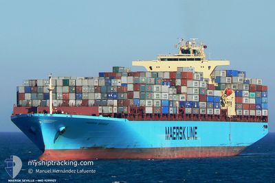
MAERSK SEVILLE
Container Ship
Current Trip
| Time Travelled | 2 days |
|---|---|
| Remaining Time | --- |
| Distance Travelled | 763.30 nm |
| Remaining Distance | --- |
| AVG Speed | 16.2 Knots |
| MAX Speed | 19.2 Knots |
| AVG Wind | 10.8 knots |
| MAX Wind | 18 knots |
| MIN Temp | 24.4°C / 75.92°F |
| MAX Temp | 28.9°C / 84.02°F |
| Draught | 13.3 m |
| Position Received | 2 d ago |
Current Position
| Longitude | --- |
|---|---|
| Latitude | --- |
| Status | Under way using engine |
| Speed | 15.7 Knots |
| Course | 312.8° |
| Area | Malacca Strait |
| Station | T-AIS |
| Position Received | 2 d ago |
Info
Information
The current position of MAERSK SEVILLE is in Malacca Strait with coordinates 1.24800° / 103.39871° as reported on 2024-12-12 15:30 by AIS to our vessel tracker app. The vessel's current speed is 15.7 Knots and is heading at the port of NEW YORK. The estimated time of arrival as calculated by MyShipTracking vessel tracking app is 2025-01-09 08:00 LT
The vessel MAERSK SEVILLE (IMO: 9299927, MMSI: 563000700) is a Container Ship that was built in 2006 ( 18 years old ). It's sailing under the flag of [SG] Singapore.
In this page you can find informations about the vessels current position, last detected port calls, and current voyage information. If the vessels is not in coverage by AIS you will find the latest position.
The current position of MAERSK SEVILLE is detected by our AIS receivers and we are not responsible for the reliability of the data. The last position was recorded while the vessel was in Coverage by the Ais receivers of our vessel tracking app.
The current draught of MAERSK SEVILLE as reported by AIS is 13.3 meters
Weather
| Temperature | 27.5°C / 81.5°F |
|---|---|
| Wind Speed | 6 knots |
| Direction | 261° W |
| Pressure | 1009.7 hPa |
| Humidity | 80.1 % |
| Cloud Coverage | 98 % |
Featured Company
Last Port Calls
| Port | Arrival | Departure | Time In Port |
|---|---|---|---|
| 2024-12-11 15:13 | 2024-12-12 21:58 | 1 d | |
| 2024-12-04 05:00 | 2024-12-04 21:00 | 16 h | |
| 2024-12-02 18:44 | 2024-12-03 07:33 | 12 h | |
| 2024-12-02 02:39 | 2024-12-02 11:05 | 8 h | |
| 2024-11-27 04:10 | 2024-11-27 20:47 | 16 h | |
| 2024-11-02 12:31 | 2024-11-03 23:22 | 1 d | |
| 2024-10-24 12:41 | 2024-10-26 08:40 | 1 d | |
| 2024-10-22 04:48 | 2024-10-23 01:52 | 21 h | |
| 2024-10-17 14:12 | 2024-10-20 08:11 | 2 d |
Last Trips
| Origin | Departure | Destination | Arrival | Distance | |
|---|---|---|---|---|---|
| 2024-12-04 21:00 | 2024-12-11 15:13 | 1631.46 nm | |||
| 2024-12-03 07:33 | 2024-12-04 05:00 | 171.71 nm | |||
| 2024-12-02 11:05 | 2024-12-02 18:44 | 77.04 nm | |||
| 2024-11-27 20:47 | 2024-12-02 02:39 | 1229.60 nm | |||
| 2024-11-03 23:22 | 2024-11-27 04:10 | 9066.78 nm | |||
| 2024-10-26 08:40 | 2024-11-02 12:31 | 1347.11 nm | |||
| 2024-10-23 01:52 | 2024-10-24 12:41 | 382.97 nm | |||
| 2024-10-20 08:11 | 2024-10-22 04:48 | 554.05 nm | |||
| 2024-09-19 20:58 | 2024-10-17 14:12 | 10012.24 nm |
Events
| Time | Event | Details | Position / Dest | Info |
|---|---|---|---|---|
| 2024-12-12 15:34 | Status Changed | Default Under way using engine |
1.25812 / 103.38793
SGSIN>>USNWK
|
Speed: 15.7 kn Course: 312.8° |
| 2024-12-12 15:30 | Status Changed | Under way using engine Default |
1.24800 / 103.39871
SGSIN>>USNWK
|
Speed: 15.9 kn Course: 306° |
| 2024-12-12 15:30 | OUT of Coverage |
1.24800 / 103.39871
Malacca Strait
SGSIN>>USNWK
|
Speed: 15.7 kn Course: 312.8° |
|
| 2024-12-12 15:21 | Status Changed | Default Under way using engine |
1.23067 / 103.43807
SGSIN>>USNWK
|
Speed: 16.3 kn Course: 284.9° |
| 2024-12-12 15:20 | Status Changed | Under way using engine Default |
1.23025 / 103.43947
SGSIN>>USNWK
|
Speed: 16.2 kn Course: 283° |
| 2024-12-12 15:20 | Change Sea Area | Malaysian part of the Malacca Strait Malaysian part of the Singapore Strait |
1.23025 / 103.43947
Malacca Strait
SGSIN>>USNWK
|
Speed: 16.3 kn Course: 284.9° |
| 2024-12-12 15:17 | Status Changed | Default Under way using engine |
1.22585 / 103.45543
SGSIN>>USNWK
|
Speed: 16.1 kn Course: 281.8° |
| 2024-12-12 15:06 | Status Changed | Under way using engine Default |
1.21391 / 103.50518
SGSIN>>USNWK
|
Speed: 16.5 kn Course: 280° |
| 2024-12-12 14:53 | Status Changed | Default Under way using engine |
1.20272 / 103.56298
SGSIN>>USNWK
|
Speed: 14.3 kn Course: 280° |
| 2024-12-12 14:47 | Change Sea Area | Malaysian part of the Singapore Strait Indonesian part of the Singapore Strait |
1.19838 / 103.58726
Singapore Strait
SGSIN>>USNWK
|
Speed: 14.7 kn Course: 280.4° |