
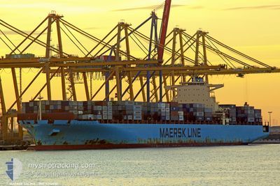
MAERSK SALINA
Container Ship
Current Trip
| Time Travelled | 24 days |
|---|---|
| Remaining Time | 3 h, 21 mins |
| Distance Travelled | 11149.42 nm |
| Remaining Distance | 36.62 nm |
| AVG Speed | 19.1 Knots |
| MAX Speed | 22.7 Knots |
| AVG Wind | 12.8 knots |
| MAX Wind | 31 knots |
| MIN Temp | 7.2°C / 44.96°F |
| MAX Temp | 29.5°C / 85.1°F |
| Draught | 14.7 m |
| Position Received | 1 m ago |
Current Position
| Longitude | -73.42963° |
|---|---|
| Latitude | 40.24597° |
| Status | Under way using engine |
| Speed | 9.9 Knots |
| Course | 306.2° |
| Area | North Atlantic Ocean |
| Station | T-AIS |
| Position Received | 1 m ago |
Info
Information
The current position of MAERSK SALINA is in North Atlantic Ocean with coordinates 40.24597° / -73.42963° as reported on 2024-04-20 03:32 by AIS to our vessel tracker app. The vessel's current speed is 9.9 Knots and is heading at the port of NEW YORK. The estimated time of arrival as calculated by MyShipTracking vessel tracking app is 2024-04-20 06:54 LT
The vessel MAERSK SALINA (IMO: 9352030, MMSI: 477770300) is a Container Ship that was built in 2008 ( 16 years old ). It's sailing under the flag of [HK] Hong Kong.
In this page you can find informations about the vessels current position, last detected port calls, and current voyage information. If the vessels is not in coverage by AIS you will find the latest position.
The current position of MAERSK SALINA is detected by our AIS receivers and we are not responsible for the reliability of the data. The last position was recorded while the vessel was in Coverage by the Ais receivers of our vessel tracking app.
The current draught of MAERSK SALINA as reported by AIS is 14.7 meters
Weather
| Temperature | 8.7°C / 47.66°F |
|---|---|
| Wind Speed | 8 knots |
| Direction | 186° S |
| Pressure | 1017.8 hPa |
| Humidity | 93.5 % |
| Cloud Coverage | 90 % |
Featured Company
Last Port Calls
| Port | Arrival | Departure | Time In Port |
|---|---|---|---|
| 2024-03-25 16:31 | 2024-03-26 06:40 | 14 h | |
| 2024-03-21 12:04 | 2024-03-22 01:53 | 13 h | |
| 2024-03-15 07:53 | 2024-03-16 20:59 | 1 d | |
| 2024-03-09 04:24 | 2024-03-12 12:26 | 3 d | |
| 2024-02-08 09:34 | 2024-02-10 03:14 | 1 d | |
| 2024-02-05 04:26 | 2024-02-06 18:42 | 1 d | |
| 2024-02-01 08:49 |
Most Visited Ports (Last year)
| Port | Arrivals | |
|---|---|---|
| 6 | ||
| 4 | ||
| 4 | ||
| 3 | ||
| 3 | ||
| 3 |
Last Trips
| Origin | Departure | Destination | Arrival | Distance | |
|---|---|---|---|---|---|
| 2024-03-22 07:23 | 2024-03-25 20:31 | 1640.95 nm | |||
| 2024-03-17 04:59 | 2024-03-21 17:34 | 1655.96 nm | |||
| 2024-03-12 19:26 | 2024-03-15 15:53 | 819.80 nm | |||
| 2024-02-09 22:14 | 2024-03-09 11:24 | 13210.23 nm | |||
| 2024-02-06 13:42 | 2024-02-08 04:34 | 531.00 nm | |||
| 2024-02-01 03:49 | 2024-02-04 23:26 | 432.38 nm |
Events
| Time | Event | Details | Position / Dest | Info |
|---|---|---|---|---|
| 2024-04-20 02:26 | Status Changed | Under way using engine Default |
40.13770 / -73.22460
OMSLL > USNWK
|
Speed: 10 kn Course: 303° |
| 2024-04-20 02:19 | Status Changed | Default Under way using engine |
40.12500 / -73.20167
OMSLL > USNWK
|
Speed: 10.5 kn Course: 299.2° |
| 2024-04-20 02:12 | Status Changed | Under way using engine Default |
40.11555 / -73.18010
OMSLL > USNWK
|
Speed: 10 kn Course: 303° |
| 2024-04-20 01:37 | Status Changed | Default Under way using engine |
40.09667 / -73.05500
OMSLL > USNWK
|
Speed: 4.7 kn Course: 261° |
| 2024-04-20 01:30 | Status Changed | Under way using engine Default |
40.10192 / -73.04565
OMSLL > USNWK
|
Speed: Course: -1° |
| 2024-04-20 01:30 | START Moving |
40.10192 / -73.04565
OMSLL > USNWK
|
Speed: 3.6 kn Course: 208° |
|
| 2024-04-20 01:22 | IN Coverage |
40.10137 / -73.04588
North Atlantic Ocean
OMSLL > USNWK
|
Speed: 3.8 kn Course: 202.4° |
|
| 2024-04-20 00:07 | Status Changed | Default Under way using engine |
40.11167 / -73.04667
OMSLL > USNWK
|
Speed: 3 kn Course: 121° |
| 2024-04-19 23:50 | OUT of Coverage |
40.11258 / -73.06783
North Atlantic Ocean
OMSLL > USNWK
|
Speed: 3 kn Course: 157.1° |
|
| 2024-04-19 23:49 | Status Changed | Under way using engine Default |
40.11348 / -73.06822
OMSLL > USNWK
|
Speed: 2 kn Course: -1° |