
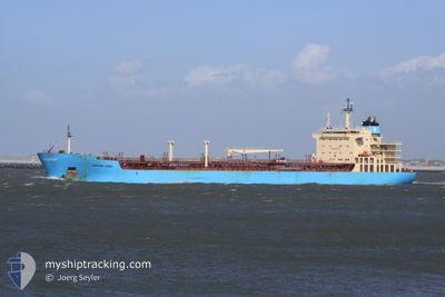
MAERSK KIERA
Oil/Chemical Tanker
Current Trip
| Time Travelled | 8 h, 43 mins |
|---|---|
| Remaining Time | --- |
| Distance Travelled | 65.59 nm |
| Remaining Distance | 782.33 nm |
| AVG Speed | 8.1 Knots |
| MAX Speed | 11.4 Knots |
| AVG Wind | 13.2 knots |
| MAX Wind | 17 knots |
| MIN Temp | 21.9°C / 71.42°F |
| MAX Temp | 23.4°C / 74.12°F |
| Draught | 11.5 m |
| Position Received | 26 d ago |
Current Position
| Longitude | --- |
|---|---|
| Latitude | --- |
| Status | Under way using engine |
| Speed | 8.8 Knots |
| Course | 210.6° |
| Area | South Atlantic Ocean |
| Station | T-AIS |
| Position Received | 26 d ago |
Info
Information
The current position of MAERSK KIERA is in South Atlantic Ocean with coordinates -28.69860° / -48.49302° as reported on 2024-11-16 12:31 by AIS to our vessel tracker app. The vessel's current speed is 8.8 Knots and is heading at the port of RIO GRANDE.
The vessel MAERSK KIERA (IMO: 9431305, MMSI: 566234000) is a Oil/Chemical Tanker that was built in 2011 ( 13 years old ). It's sailing under the flag of [SG] Singapore.
In this page you can find informations about the vessels current position, last detected port calls, and current voyage information. If the vessels is not in coverage by AIS you will find the latest position.
The current position of MAERSK KIERA is detected by our AIS receivers and we are not responsible for the reliability of the data. The last position was recorded while the vessel was in Coverage by the Ais receivers of our vessel tracking app.
The current draught of MAERSK KIERA as reported by AIS is 11.5 meters
Weather
| Temperature | 23°C / 73.4°F |
|---|---|
| Wind Speed | 12 knots |
| Direction | 68° ENE |
| Pressure | 1014.2 hPa |
| Humidity | 81.7 % |
| Cloud Coverage | 85 % |
Featured Company
Last Port Calls
| Port | Arrival | Departure | Time In Port |
|---|---|---|---|
| 2024-12-11 07:12 | 2024-12-12 16:29 | 1 d | |
| 2024-12-07 21:29 | 2024-12-08 23:37 | 1 d | |
| 2024-11-12 20:57 | 2024-11-12 21:48 | 51 m | |
| 2024-10-26 05:14 | 2024-10-27 07:44 | 1 d | |
| 2024-10-02 21:24 | 2024-10-03 23:40 | 1 d |
Most Visited Ports (Last year)
| Port | Arrivals | |
|---|---|---|
| 12 | ||
| 6 | ||
| 6 | ||
| 5 | ||
| 2 | ||
| 2 |
Last Trips
| Origin | Departure | Destination | Arrival | Distance | |
|---|---|---|---|---|---|
| 2024-12-08 23:37 | 2024-12-11 07:12 | 371.98 nm | |||
| 2024-11-12 21:48 | 2024-12-07 21:29 | 1627.50 nm | |||
| 2024-10-27 07:44 | 2024-11-12 20:57 | 1515.19 nm | |||
| 2024-10-03 23:40 | 2024-10-26 05:14 | 614.40 nm | |||
| 2024-09-26 09:32 | 2024-10-02 21:24 | 387.77 nm |
Events
| Time | Event | Details | Position / Dest | Info |
|---|---|---|---|---|
| 2024-12-12 19:29 | PORT DEPARTURE |
|
-22.94175 / -43.86689
BRRIG
|
Speed: 7 kn Course: 205° |
| 2024-12-12 19:25 | START Moving |
-22.93412 / -43.86169
[BR] ITAGUAI
|
Speed: 7 kn Course: 205° |
|
| 2024-12-11 10:12 | STOP Moving |
-22.92812 / -43.85831
[BR] ITAGUAI
|
Speed: Course: 193° |
|
| 2024-12-11 10:12 | PORT ARRIVAL |
|
-22.92812 / -43.85831
[BR] ITAGUAI
|
Speed: 1.5 kn Course: 190° |
| 2024-12-11 07:01 | START Moving | 8.25 nm, South East of VILA DO ABRAAO |
-23.19054 / -44.02640
BRRIG
|
Speed: 4.8 kn Course: 346° |
| 2024-12-10 23:34 | STOP Moving | 8.45 nm, East of VILA DO ABRAAO |
-23.19011 / -44.02233
BRRIG
|
Speed: 0.3 kn Course: 192° |
| 2024-12-09 02:44 | START Moving | 0.57 nm, South of JARDIM CAMBURI |
-20.29539 / -40.25039
BRRIG
|
Speed: 4.9 kn Course: 173° |
| 2024-12-09 02:37 | PORT DEPARTURE |
|
-20.29539 / -40.25039
BRRIG
|
Speed: Course: 156° |
| 2024-12-08 01:03 | STOP Moving |
-20.28732 / -40.24491
[BR] JARDIM CAMBURI
|
Speed: 0.1 kn Course: 155° |
|
| 2024-12-08 00:29 | PORT ARRIVAL |
|
-20.29339 / -40.24908
[BR] JARDIM CAMBURI
|
Speed: 5.2 kn Course: 346° |