
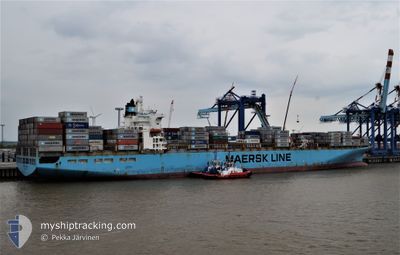
MAERSK KARACHI
Container Ship
Current Trip
| Time Travelled | 15 days |
|---|---|
| Remaining Time | --- |
| Distance Travelled | 7081.32 nm |
| Remaining Distance | --- |
| AVG Speed | 17.9 Knots |
| MAX Speed | 21.2 Knots |
| AVG Wind | 12.3 knots |
| MAX Wind | 29.4 knots |
| MIN Temp | 15.3°C / 59.54°F |
| MAX Temp | 29.5°C / 85.1°F |
| Draught | 13.7 m |
| Position Received | 4 d ago |
Current Position
| Longitude | 18.97077° |
|---|---|
| Latitude | -34.90106° |
| Status | Under way using engine |
| Speed | 18.8 Knots |
| Course | 109.5° |
| Area | South Atlantic Ocean |
| Station | T-AIS |
| Position Received | 4 d ago |
Info
Information
The current position of MAERSK KARACHI is in South Atlantic Ocean with coordinates -34.90106° / 18.97077° as reported on 2024-04-21 05:49 by AIS to our vessel tracker app. The vessel's current speed is 18.8 Knots and is heading at the port of SALALAH. The estimated time of arrival as calculated by MyShipTracking vessel tracking app is 2024-04-30 14:00 LT
The vessel MAERSK KARACHI (IMO: 9162215, MMSI: 477728400) is a Container Ship that was built in 1998 ( 26 years old ). It's sailing under the flag of [HK] Hong Kong.
In this page you can find informations about the vessels current position, last detected port calls, and current voyage information. If the vessels is not in coverage by AIS you will find the latest position.
The current position of MAERSK KARACHI is detected by our AIS receivers and we are not responsible for the reliability of the data. The last position was recorded while the vessel was in Coverage by the Ais receivers of our vessel tracking app.
The current draught of MAERSK KARACHI as reported by AIS is 13.7 meters
Weather
| Temperature | 28.8°C / 83.84°F |
|---|---|
| Wind Speed | 11 knots |
| Direction | 215° SW |
| Pressure | 1009.7 hPa |
| Humidity | 73.6 % |
| Cloud Coverage | 100 % |
Featured Company
Last Port Calls
| Port | Arrival | Departure | Time In Port |
|---|---|---|---|
| 2024-04-08 11:58 | 2024-04-09 16:20 | 1 d | |
| 2024-03-30 09:26 | 2024-03-31 09:46 | 1 d | |
| 2024-03-26 20:03 | 2024-03-27 12:25 | 16 h | |
| 2024-03-19 19:14 | 2024-03-21 22:46 | 2 d | |
| 2024-03-14 08:49 | 2024-03-15 11:28 | 1 d | |
| 2024-03-11 19:42 | 2024-03-12 06:05 | 10 h | |
| 2024-03-05 07:59 | 2024-03-10 02:34 | 4 d | |
| 2024-02-25 00:59 | 2024-02-25 11:59 | 10 h | |
| 2024-02-21 05:45 | 2024-02-22 05:40 | 23 h |
Most Visited Ports (Last year)
| Port | Arrivals | |
|---|---|---|
| 6 | ||
| 4 | ||
| 3 | ||
| 3 | ||
| 3 | ||
| 3 |
Last Trips
| Origin | Departure | Destination | Arrival | Distance | |
|---|---|---|---|---|---|
| 2024-03-31 05:46 | 2024-04-08 13:58 | 3374.66 nm | |||
| 2024-03-27 08:25 | 2024-03-30 05:26 | 314.33 nm | |||
| 2024-03-21 17:46 | 2024-03-26 16:03 | 1781.02 nm | |||
| 2024-03-15 07:28 | 2024-03-19 14:14 | 1356.16 nm | |||
| 2024-03-12 02:05 | 2024-03-14 04:49 | 184.38 nm | |||
| 2024-03-09 21:34 | 2024-03-11 15:42 | 640.24 nm | |||
| 2024-02-25 12:59 | 2024-03-05 02:59 | 3280.04 nm | |||
| 2024-02-22 06:40 | 2024-02-25 01:59 | 123.84 nm | |||
| 2024-01-22 04:52 | 2024-02-21 06:45 | 10141.63 nm |
Events
| Time | Event | Details | Position / Dest | Info |
|---|---|---|---|---|
| 2024-04-21 05:54 | Status Changed | Default Under way using engine |
-34.90842 / 18.99789
OMSLV
|
Speed: 18.8 kn Course: 109.5° |
| 2024-04-21 05:49 | Status Changed | Under way using engine Default |
-34.90106 / 18.97077
OMSLV
|
Speed: 18.6 kn Course: 106° |
| 2024-04-21 05:49 | OUT of Coverage |
-34.90106 / 18.97077
South Atlantic Ocean
OMSLV
|
Speed: 18.8 kn Course: 109.5° |
|
| 2024-04-21 05:09 | Status Changed | Default Under way using engine |
-34.84047 / 18.72760
OMSLV
|
Speed: 19.1 kn Course: 107.3° |
| 2024-04-21 05:04 | Status Changed | Under way using engine Default |
-34.83164 / 18.69672
OMSLV
|
Speed: 19.1 kn Course: 110° |
| 2024-04-21 04:48 | Status Changed | Default Under way using engine |
-34.80327 / 18.59874
OMSLV
|
Speed: 18.8 kn Course: 106.3° |
| 2024-04-20 22:48 | Status Changed | Under way using engine Default |
-33.53905 / 17.09047
OMSLV
|
Speed: 18.3 kn Course: 141° |
| 2024-04-20 22:43 | Status Changed | Default Under way using engine |
-33.51988 / 17.07362
OMSLV
|
Speed: 18.6 kn Course: 141.5° |
| 2024-04-20 22:34 | Status Changed | Under way using engine Default |
-33.48247 / 17.04072
OMSLV
|
Speed: 18.6 kn Course: 142° |
| 2024-04-20 22:19 | IN Coverage |
-33.48247 / 17.04072
South Atlantic Ocean
OMSLV
|
Speed: 18.5 kn Course: 144.4° |