
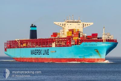
MAERSK HORSBURGH
Cargo A
Current Trip
LKCMBCT>MAPTM02
| Time Travelled | 20 days |
|---|---|
| Remaining Time | --- |
| Distance Travelled | 9588.01 nm |
| Remaining Distance | --- |
| AVG Speed | 19.9 Knots |
| MAX Speed | 24 Knots |
| AVG Wind | 11.2 knots |
| MAX Wind | 30.2 knots |
| MIN Temp | 16.6°C / 61.88°F |
| MAX Temp | 29.9°C / 85.82°F |
| Draught | 16.6 m |
| Position Received | 1 h, 40 m ago |
Current Position
| Longitude | -6.60358° |
|---|---|
| Latitude | 35.56475° |
| Status | Under way using engine |
| Speed | 17.5 Knots |
| Course | 40.4° |
| Area | North Atlantic Ocean |
| Station | T-AIS |
| Position Received | 1 h, 40 m ago |
Info
Information
The current position of MAERSK HORSBURGH is in North Atlantic Ocean with coordinates 35.56475° / -6.60358° as reported on 2024-04-24 19:33 by AIS to our vessel tracker app. The vessel's current speed is 17.5 Knots
The vessel MAERSK HORSBURGH (IMO: 9784269, MMSI: 563026700) is a Cargo A It's sailing under the flag of [SG] Singapore.
In this page you can find informations about the vessels current position, last detected port calls, and current voyage information. If the vessels is not in coverage by AIS you will find the latest position.
The current position of MAERSK HORSBURGH is detected by our AIS receivers and we are not responsible for the reliability of the data. The last position was recorded while the vessel was in Coverage by the Ais receivers of our vessel tracking app.
The current draught of MAERSK HORSBURGH as reported by AIS is 16.6 meters
Weather
| Temperature | 17.6°C / 63.68°F |
|---|---|
| Wind Speed | 14 knots |
| Direction | 64° ENE |
| Pressure | 1014.4 hPa |
| Humidity | 76.1 % |
| Cloud Coverage | 100 % |
Featured Company
Last Port Calls
| Port | Arrival | Departure | Time In Port |
|---|---|---|---|
| 2024-04-03 14:21 | 2024-04-04 18:13 | 1 d | |
| 2024-03-29 02:06 | 2024-03-31 07:37 | 2 d | |
| 2024-03-27 15:37 | 2024-03-28 23:53 | 1 d | |
| 2024-02-24 10:06 | 2024-02-24 22:23 | 12 h | |
| 2024-02-19 15:11 | 2024-02-21 06:22 | 1 d | |
| 2024-02-15 05:54 | 2024-02-17 13:51 | 2 d | |
| 2024-02-07 04:23 | 2024-02-08 17:44 | 1 d | |
| 2024-02-02 17:18 | 2024-02-04 09:49 | 1 d |
Most Visited Ports (Last year)
| Port | Arrivals | |
|---|---|---|
| 8 | ||
| 7 | ||
| 6 | ||
| 4 | ||
| 3 | ||
| 3 |
Last Trips
| Origin | Departure | Destination | Arrival | Distance | |
|---|---|---|---|---|---|
| 2024-03-31 15:37 | 2024-04-03 19:51 | 1610.84 nm | |||
| 2024-03-29 07:53 | 2024-03-29 10:06 | 20.95 nm | |||
| 2024-02-24 23:23 | 2024-03-27 23:37 | 10819.06 nm | |||
| 2024-02-21 07:22 | 2024-02-24 11:06 | 1036.34 nm | |||
| 2024-02-17 14:51 | 2024-02-19 16:11 | 696.86 nm | |||
| 2024-02-08 18:44 | 2024-02-15 06:54 | 286.28 nm | |||
| 2024-01-05 20:58 | 2024-02-07 05:23 | 14101.51 nm | |||
| 2024-01-05 20:58 | 2024-02-02 19:18 | 12759.53 nm |
Events
| Time | Event | Details | Position / Dest | Info |
|---|---|---|---|---|
| 2024-04-24 19:38 | Status Changed | Default Under way using engine |
35.58743 / -6.58020
LKCMBCT>MAPTM02
|
Speed: 17.5 kn Course: 40.4° |
| 2024-04-24 19:33 | OUT of Coverage |
35.56475 / -6.60358
North Atlantic Ocean
LKCMBCT>MAPTM02
|
Speed: 17.5 kn Course: 40.4° |
|
| 2024-04-24 19:27 | Status Changed | Under way using engine Default |
35.54402 / -6.62497
LKCMBCT>MAPTM02
|
Speed: 17.4 kn Course: 39° |
| 2024-04-24 19:26 | Status Changed | Default Under way using engine |
35.54222 / -6.62678
LKCMBCT>MAPTM02
|
Speed: 17.2 kn Course: 39.6° |
| 2024-04-24 19:12 | Status Changed | Under way using engine Default |
35.49073 / -6.67870
LKCMBCT>MAPTM02
|
Speed: 17.2 kn Course: 39° |
| 2024-04-24 19:12 | IN Coverage |
35.49590 / -6.67347
North Atlantic Ocean
LKCMBCT>MAPTM02
|
Speed: 17.2 kn Course: 39.7° |
|
| 2024-04-24 17:37 | Status Changed | Default Under way using engine |
35.15667 / -7.05167
LKCMBCT>MAPTM02
|
Speed: 16.9 kn Course: 41.3° |
| 2024-04-24 17:32 | OUT of Coverage |
35.13858 / -7.07138
North Atlantic Ocean
LKCMBCT>MAPTM02
|
Speed: 16.9 kn Course: 41.3° |
|
| 2024-04-24 17:24 | Status Changed | Under way using engine Default |
35.10860 / -7.10378
LKCMBCT>MAPTM02
|
Speed: 16.6 kn Course: 42° |
| 2024-04-24 16:46 | Status Changed | Default Under way using engine |
34.97833 / -7.24500
LKCMBCT>MAPTM02
|
Speed: 16.8 kn Course: 42.7° |