
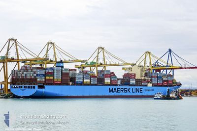
MAERSK HAMBURG
Cargo A
Current Trip
| Time Travelled | 21 days |
|---|---|
| Remaining Time | 8 h, 0 mins |
| Distance Travelled | 9361.69 nm |
| Remaining Distance | 137.73 nm |
| AVG Speed | 18.5 Knots |
| MAX Speed | 22 Knots |
| AVG Wind | 14.2 knots |
| MAX Wind | 36 knots |
| MIN Temp | 16.6°C / 61.88°F |
| MAX Temp | 30°C / 86°F |
| Draught | 16 m |
| Position Received | Now |
Current Position
| Longitude | -7.67550° |
|---|---|
| Latitude | 34.62443° |
| Status | Under way using engine |
| Speed | 16.7 Knots |
| Course | 40.1° |
| Area | North Atlantic Ocean |
| Station | T-AIS |
| Position Received | Now |
Info
Information
The current position of MAERSK HAMBURG is in North Atlantic Ocean with coordinates 34.62443° / -7.67550° as reported on 2024-04-19 10:34 by AIS to our vessel tracker app. The vessel's current speed is 16.7 Knots and is heading at the port of TANGER MED. The estimated time of arrival as calculated by MyShipTracking vessel tracking app is 2024-04-19 18:35 LT
The vessel MAERSK HAMBURG (IMO: 9784312, MMSI: 563053300) is a Cargo A It's sailing under the flag of [SG] Singapore.
In this page you can find informations about the vessels current position, last detected port calls, and current voyage information. If the vessels is not in coverage by AIS you will find the latest position.
The current position of MAERSK HAMBURG is detected by our AIS receivers and we are not responsible for the reliability of the data. The last position was recorded while the vessel was in Coverage by the Ais receivers of our vessel tracking app.
The current draught of MAERSK HAMBURG as reported by AIS is 16 meters
Weather
| Temperature | 17.7°C / 63.86°F |
|---|---|
| Wind Speed | 4 knots |
| Direction | 15° NNE |
| Pressure | 1014.8 hPa |
| Humidity | 76.2 % |
| Cloud Coverage | 100 % |
Featured Company
Last Port Calls
| Port | Arrival | Departure | Time In Port |
|---|---|---|---|
| 2024-03-28 03:25 | 2024-03-29 07:05 | 1 d | |
| 2024-03-21 22:40 | 2024-03-23 23:08 | 2 d | |
| 2024-03-17 18:50 | 2024-03-18 14:26 | 19 h | |
| 2024-03-16 23:29 | |||
| 2024-03-12 12:56 | 2024-03-14 04:25 | 1 d | |
| 2024-03-05 11:05 | 2024-03-07 09:52 | 1 d | |
| 2024-02-01 00:06 | 2024-02-02 03:58 | 1 d |
Most Visited Ports (Last year)
| Port | Arrivals | |
|---|---|---|
| 6 | ||
| 4 | ||
| 4 | ||
| 4 | ||
| 3 | ||
| 2 |
Last Trips
| Origin | Departure | Destination | Arrival | Distance | |
|---|---|---|---|---|---|
| 2024-03-24 07:08 | 2024-03-28 08:55 | 1614.31 nm | |||
| 2024-03-18 22:26 | 2024-03-22 06:40 | 1487.56 nm | |||
| 2024-03-17 07:29 | 2024-03-18 02:50 | 124.18 nm | |||
| 2024-03-07 17:52 | 2024-03-12 20:56 | 2155.63 nm | |||
| 2024-01-29 00:53 | 2024-03-05 19:05 | 12714.03 nm | |||
| 2024-01-29 00:53 | 2024-02-01 02:06 | 1350.96 nm |
Events
| Time | Event | Details | Position / Dest | Info |
|---|---|---|---|---|
| 2024-04-19 03:33 | Status Changed | Under way using engine Default |
33.05965 / -9.27787
LKCMB>MAPTM
|
Speed: 19 kn Course: 44° |
| 2024-04-19 03:17 | IN Coverage |
33.06230 / -9.27505
North Atlantic Ocean
LKCMB>MAPTM
|
Speed: 18.7 kn Course: 41.6° |
|
| 2024-04-19 02:17 | OUT of Coverage |
32.76365 / -9.59560
North Atlantic Ocean
LKCMB>MAPTM
|
Speed: 18.4 kn Course: 44° |
|
| 2024-04-18 23:28 | Status Changed | Under way using engine Default |
32.10762 / -10.26172
LKCMB>MAPTM
|
Speed: 18 kn Course: 40° |
| 2024-04-18 23:01 | Status Changed | Default Under way using engine |
32.00167 / -10.36667
LKCMB>MAPTM
|
Speed: 18.3 kn Course: 40.3° |
| 2024-04-18 22:10 | Status Changed | Under way using engine Default |
31.79048 / -10.55005
LKCMB>MAPTM
|
Speed: 19 kn Course: 35° |
| 2024-04-18 22:04 | Status Changed | Default Under way using engine |
31.76333 / -10.57167
LKCMB>MAPTM
|
Speed: 18.8 kn Course: 34.7° |
| 2024-04-18 21:33 | Status Changed | Under way using engine Default |
31.62908 / -10.67840
LKCMB>MAPTM
|
Speed: 19 kn Course: 36° |
| 2024-04-18 21:25 | IN Coverage |
31.62908 / -10.67840
North Atlantic Ocean
LKCMB>MAPTM
|
Speed: 19.1 kn Course: 35.6° |
|
| 2024-04-18 20:31 | OUT of Coverage |
31.35728 / -10.89513
North Atlantic Ocean
LKCMB>MAPTM
|
Speed: 18.8 kn Course: 34.4° |