
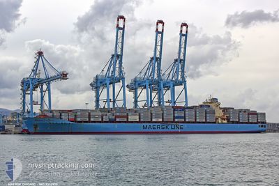
MAERSK CHICAGO
Container Ship
Current Trip
| Time Travelled | 2 days |
|---|---|
| Remaining Time | 4 days |
| Distance Travelled | 1134.89 nm |
| Remaining Distance | 2075.76 nm |
| AVG Speed | 17.6 Knots |
| MAX Speed | 20.2 Knots |
| AVG Wind | 12.3 knots |
| MAX Wind | 24 knots |
| MIN Temp | 14.8°C / 58.64°F |
| MAX Temp | 18.4°C / 65.12°F |
| Draught | 14.7 m |
| Position Received | 1 d ago |
Current Position
| Longitude | -15.97687° |
|---|---|
| Latitude | 38.13993° |
| Status | Under way using engine |
| Speed | 19.8 Knots |
| Course | 286.3° |
| Area | North Atlantic Ocean |
| Station | T-AIS |
| Position Received | 1 d ago |
Info
Information
The current position of MAERSK CHICAGO is in North Atlantic Ocean with coordinates 38.13993° / -15.97687° as reported on 2024-04-17 07:14 by AIS to our vessel tracker app. The vessel's current speed is 19.8 Knots and is heading at the port of NEW YORK. The estimated time of arrival as calculated by MyShipTracking vessel tracking app is 2024-04-22 22:45 LT
The vessel MAERSK CHICAGO (IMO: 9332975, MMSI: 338408000) is a Container Ship that was built in 2007 ( 17 years old ). It's sailing under the flag of [US] USA.
In this page you can find informations about the vessels current position, last detected port calls, and current voyage information. If the vessels is not in coverage by AIS you will find the latest position.
The current position of MAERSK CHICAGO is detected by our AIS receivers and we are not responsible for the reliability of the data. The last position was recorded while the vessel was in Coverage by the Ais receivers of our vessel tracking app.
The current draught of MAERSK CHICAGO as reported by AIS is 14.7 meters
Weather
| Temperature | 16.2°C / 61.16°F |
|---|---|
| Wind Speed | 8 knots |
| Direction | 108° ESE |
| Pressure | 1008.5 hPa |
| Humidity | 88.3 % |
| Cloud Coverage | 25 % |
Featured Company
Last Port Calls
| Port | Arrival | Departure | Time In Port |
|---|---|---|---|
| 2024-04-14 23:12 | 2024-04-16 02:23 | 1 d | |
| 2024-03-20 15:22 | |||
| 2024-03-13 22:36 | 2024-03-15 07:30 | 1 d | |
| 2024-03-10 18:53 | 2024-03-11 14:53 | 20 h | |
| 2024-02-16 00:30 | 2024-02-17 02:02 | 1 d | |
| 2024-02-02 16:32 | 2024-02-04 14:22 | 1 d |
Most Visited Ports (Last year)
| Port | Arrivals | |
|---|---|---|
| 9 | ||
| 8 | ||
| 6 | ||
| 6 | ||
| 6 | ||
| 4 |
Last Trips
| Origin | Departure | Destination | Arrival | Distance | |
|---|---|---|---|---|---|
| 2024-03-15 11:30 | 2024-03-20 19:22 | 1729.26 nm | |||
| 2024-03-11 18:53 | 2024-03-14 02:36 | 1014.24 nm | |||
| 2024-02-17 03:02 | 2024-03-10 22:53 | 9722.92 nm | |||
| 2024-02-04 08:22 | 2024-02-16 01:30 | 5000.52 nm | |||
| 2024-01-27 13:28 | 2024-02-02 10:32 | 1400.62 nm |
Events
| Time | Event | Details | Position / Dest | Info |
|---|---|---|---|---|
| 2024-04-17 07:22 | Status Changed | Default Under way using engine |
38.15333 / -16.02667
USNYC
|
Speed: 19.8 kn Course: 286.3° |
| 2024-04-17 07:14 | Status Changed | Under way using engine Default |
38.13993 / -15.97687
USNYC
|
Speed: 20 kn Course: 288° |
| 2024-04-17 07:14 | OUT of Coverage |
38.13993 / -15.97687
North Atlantic Ocean
USNYC
|
Speed: 19.8 kn Course: 286.3° |
|
| 2024-04-17 07:07 | Status Changed | Default Under way using engine |
38.12667 / -15.92667
USNYC
|
Speed: 19.8 kn Course: 287.9° |
| 2024-04-17 07:03 | Status Changed | Under way using engine Default |
38.12112 / -15.90190
USNYC
|
Speed: 20 kn Course: 289° |
| 2024-04-17 07:01 | Status Changed | Default Under way using engine |
38.11666 / -15.88667
USNYC
|
Speed: 20 kn Course: 288.1° |
| 2024-04-17 06:33 | Status Changed | Under way using engine Default |
38.06915 / -15.69778
USNYC
|
Speed: 19.9 kn Course: 290° |
| 2024-04-17 06:25 | IN Coverage |
38.07204 / -15.70846
North Atlantic Ocean
USNYC
|
Speed: 20.2 kn Course: 287.5° |
|
| 2024-04-17 05:31 | Status Changed | Default Under way using engine |
37.95833 / -15.28833
USNYC
|
Speed: 19.8 kn Course: 286.8° |
| 2024-04-17 05:27 | OUT of Coverage |
37.95383 / -15.26851
North Atlantic Ocean
USNYC
|
Speed: 19.8 kn Course: 286.8° |