
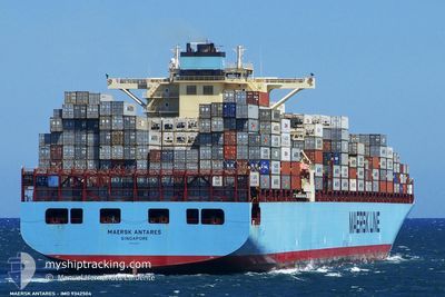
MAERSK ANTARES
Container Ship
Current Trip
USSEA>JPYOKMY
| Time Travelled | 3 days |
|---|---|
| Remaining Time | --- |
| Distance Travelled | 1359.95 nm |
| Remaining Distance | --- |
| AVG Speed | 18.3 Knots |
| MAX Speed | 22.6 Knots |
| AVG Wind | 10.7 knots |
| MAX Wind | 29 knots |
| MIN Temp | 3°C / 37.4°F |
| MAX Temp | 9.2°C / 48.56°F |
| Draught | 12 m |
| Position Received | 2 d ago |
Current Position
| Longitude | -127.16681° |
|---|---|
| Latitude | 48.90389° |
| Status | Under way using engine |
| Speed | 17.7 Knots |
| Course | 287.2° |
| Area | North Pacific Ocean |
| Station | T-AIS |
| Position Received | 2 d ago |
Info
Information
The current position of MAERSK ANTARES is in North Pacific Ocean with coordinates 48.90389° / -127.16681° as reported on 2024-04-22 00:40 by AIS to our vessel tracker app. The vessel's current speed is 17.7 Knots
The vessel MAERSK ANTARES (IMO: 9342504, MMSI: 565661000) is a Container Ship that was built in 2007 ( 17 years old ). It's sailing under the flag of [SG] Singapore.
In this page you can find informations about the vessels current position, last detected port calls, and current voyage information. If the vessels is not in coverage by AIS you will find the latest position.
The current position of MAERSK ANTARES is detected by our AIS receivers and we are not responsible for the reliability of the data. The last position was recorded while the vessel was in Coverage by the Ais receivers of our vessel tracking app.
The current draught of MAERSK ANTARES as reported by AIS is 12 meters
Weather
| Temperature | 4.2°C / 39.56°F |
|---|---|
| Wind Speed | 15 knots |
| Direction | 287° WNW |
| Pressure | 1004.2 hPa |
| Humidity | 82.5 % |
| Cloud Coverage | 100 % |
Featured Company
Last Port Calls
| Port | Arrival | Departure | Time In Port |
|---|---|---|---|
| 2024-04-18 03:10 | 2024-04-21 12:06 | 3 d | |
| 2024-04-08 21:17 | 2024-04-14 20:10 | 5 d | |
| 2024-03-20 07:19 | 2024-03-21 07:00 | 23 h | |
| 2024-03-18 22:17 | 2024-03-19 11:22 | 13 h | |
| 2024-02-29 11:39 | 2024-02-29 20:13 | 8 h | |
| 2024-02-09 14:16 | 2024-02-15 14:21 | 6 d |
Last Trips
| Origin | Departure | Destination | Arrival | Distance | |
|---|---|---|---|---|---|
| 2024-04-14 13:10 | 2024-04-17 20:10 | 1199.76 nm | |||
| 2024-03-21 15:00 | 2024-04-08 14:17 | 6553.97 nm | |||
| 2024-03-19 19:22 | 2024-03-20 15:19 | 96.23 nm | |||
| 2024-03-01 05:13 | 2024-03-19 06:17 | 3521.81 nm | |||
| 2024-02-15 06:21 | 2024-02-29 20:39 | 5212.30 nm | |||
| 2024-01-19 11:16 | 2024-02-09 06:16 | 6815.34 nm |
Events
| Time | Event | Details | Position / Dest | Info |
|---|---|---|---|---|
| 2024-04-22 00:45 | Status Changed | Default Under way using engine |
48.91005 / -127.19840
USSEA>JPYOKMY
|
Speed: 17.7 kn Course: 287.2° |
| 2024-04-22 00:40 | Status Changed | Under way using engine Default |
48.90389 / -127.16681
USSEA>JPYOKMY
|
Speed: 17.7 kn Course: 286° |
| 2024-04-22 00:40 | OUT of Coverage |
48.90389 / -127.16681
North Pacific Ocean
USSEA>JPYOKMY
|
Speed: 17.7 kn Course: 287.2° |
|
| 2024-04-22 00:38 | Status Changed | Default Under way using engine |
48.90036 / -127.14827
USSEA>JPYOKMY
|
Speed: 17.7 kn Course: 287.2° |
| 2024-04-21 19:08 | Change Sea Area | Canadian part of the North Pacific Ocean Canadian part of the The Coastal Waters of Southeast Alaska and British Columbia |
48.51943 / -124.75574
North Pacific Ocean
USSEA>JPYOKMY
|
Speed: 18.3 kn Course: 283° |
| 2024-04-21 19:08 | Status Changed | Under way using engine Default |
48.51943 / -124.75574
USSEA>JPYOKMY
|
Speed: 18.2 kn Course: 290° |
| 2024-04-21 19:02 | Status Changed | Default Under way using engine |
48.50861 / -124.71323
USSEA>JPYOKMY
|
Speed: 18 kn Course: 294.9° |
| 2024-04-21 18:56 | Status Changed | Under way using engine Default |
48.49487 / -124.66945
USSEA>JPYOKMY
|
Speed: 18 kn Course: 296° |
| 2024-04-21 18:42 | Status Changed | Default Under way using engine |
48.46497 / -124.57523
USSEA>JPYOKMY
|
Speed: 18.8 kn Course: 294.4° |
| 2024-04-21 18:27 | Status Changed | Under way using engine Default |
48.43187 / -124.46357
USSEA>JPYOKMY
|
Speed: 17.7 kn Course: 293° |