
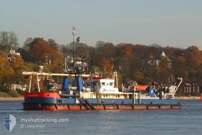
MAASMOND
Suction Dredger
Current Trip
| Time Travelled | 1 day |
|---|---|
| Remaining Time | 1 h, 23 mins |
| Distance Travelled | 56.34 nm |
| Remaining Distance | 15.73 nm |
| AVG Speed | 7.3 Knots |
| MAX Speed | 10.7 Knots |
| AVG Wind | 14.3 knots |
| MAX Wind | 21.4 knots |
| MIN Temp | 4.4°C / 39.92°F |
| MAX Temp | 8.1°C / 46.58°F |
| Draught | 2.2 m |
| Position Received | Now |
Current Position
| Longitude | 8.19403° |
|---|---|
| Latitude | 53.75771° |
| Status | Restricted manoeuverability |
| Speed | 1.3 Knots |
| Course | 304° |
| Area | North Sea |
| Station | T-AIS |
| Position Received | Now |
Info
Information
The current position of MAASMOND is in North Sea with coordinates 53.75771° / 8.19403° as reported on 2024-04-23 18:33 by AIS to our vessel tracker app. The vessel's current speed is 1.3 Knots and is heading at the port of BREMERHAVEN. The estimated time of arrival as calculated by MyShipTracking vessel tracking app is 2024-04-23 19:57 LT
The vessel MAASMOND (IMO: 8862129, MMSI: 245910000) is a Suction Dredger that was built in 1931 ( 93 years old ). It's sailing under the flag of [NL] Netherlands.
In this page you can find informations about the vessels current position, last detected port calls, and current voyage information. If the vessels is not in coverage by AIS you will find the latest position.
The current position of MAASMOND is detected by our AIS receivers and we are not responsible for the reliability of the data. The last position was recorded while the vessel was in Coverage by the Ais receivers of our vessel tracking app.
The current draught of MAASMOND as reported by AIS is 2.2 meters
Weather
| Temperature | 6.2°C / 43.16°F |
|---|---|
| Wind Speed | 15 knots |
| Direction | 310° NW |
| Pressure | 1011.3 hPa |
| Humidity | 87.5 % |
| Cloud Coverage | 100 % |
Featured Company
Last Port Calls
| Port | Arrival | Departure | Time In Port |
|---|---|---|---|
| 2024-04-19 11:52 | 2024-04-22 13:46 | 3 d | |
| 2024-04-10 20:58 | 2024-04-18 23:58 | 8 d | |
| 2024-04-09 19:38 | 2024-04-10 04:10 | 8 h | |
| 2024-04-08 07:01 | 2024-04-08 11:32 | 4 h | |
| 2024-04-08 03:24 | 2024-04-08 05:58 | 2 h | |
| 2024-04-06 19:51 | 2024-04-08 01:40 | 1 d | |
| 2024-04-05 19:42 | 2024-04-06 04:09 | 8 h | |
| 2024-04-04 19:40 | 2024-04-05 04:06 | 8 h | |
| 2024-03-27 11:59 | 2024-04-04 04:10 | 7 d | |
| 2024-03-08 12:11 | 2024-03-27 09:30 | 18 d |
Most Visited Ports (Last year)
| Port | Arrivals | |
|---|---|---|
| 81 | ||
| 43 | ||
| 34 | ||
| 14 | ||
| 9 | ||
| 2 |
Last Trips
| Origin | Departure | Destination | Arrival | Distance | |
|---|---|---|---|---|---|
| 2024-04-19 01:58 | 2024-04-19 13:52 | 51.66 nm | |||
| 2024-04-10 06:10 | 2024-04-10 22:58 | 15.64 nm | |||
| 2024-04-08 13:32 | 2024-04-09 21:38 | 29.51 nm | |||
| 2024-04-08 07:58 | 2024-04-08 09:01 | 4.55 nm | |||
| 2024-04-08 03:40 | 2024-04-08 05:24 | 5.44 nm | |||
| 2024-04-06 06:09 | 2024-04-06 21:51 | 24.74 nm | |||
| 2024-04-05 06:06 | 2024-04-05 21:42 | 23.16 nm | |||
| 2024-04-04 06:10 | 2024-04-04 21:40 | 19.24 nm | |||
| 2024-03-27 10:30 | 2024-03-27 12:59 | 3.48 nm | |||
| 2024-03-08 11:59 | 2024-03-08 13:11 | 1.35 nm |
Events
| Time | Event | Details | Position / Dest | Info |
|---|---|---|---|---|
| 2024-04-23 16:22 | STOP Moving | 7.58 nm, North East of WANGERSIEL |
53.75752 / 8.19429
BREMERHAVEN
|
Speed: 0.3 kn Course: 136° |
| 2024-04-23 15:59 | START Moving | 7.66 nm, North East of WANGERSIEL |
53.77900 / 8.16472
BREMERHAVEN
|
Speed: 3.9 kn Course: 146° |
| 2024-04-23 10:29 | STOP Moving | 7.83 nm, North East of WANGERSIEL |
53.78547 / 8.15926
BREMERHAVEN
|
Speed: 0.3 kn Course: 335° |
| 2024-04-23 10:27 | START Moving | 7.77 nm, North East of WANGERSIEL |
53.78464 / 8.15830
BREMERHAVEN
|
Speed: 3.1 kn Course: 0° |
| 2024-04-23 06:57 | Status Changed | Restricted manoeuverability At anchor |
53.79255 / 8.14575
BREMERHAVEN
|
Speed: 0.8 kn Course: 306° |
| 2024-04-23 04:55 | STOP Moving | 7.94 nm, North East of WANGERSIEL |
53.79234 / 8.14876
BREMERHAVEN
|
Speed: 0.3 kn Course: 150° |
| 2024-04-23 04:17 | START Moving | 7.11 nm, North East of WANGERSIEL |
53.77888 / 8.14032
BREMERHAVEN
|
Speed: 3.4 kn Course: 43° |
| 2024-04-22 19:08 | STOP Moving | 7 nm, North East of WANGERSIEL |
53.77512 / 8.14385
BREMERHAVEN
|
Speed: 0.1 kn Course: 341° |
| 2024-04-22 19:05 | Status Changed | At anchor Under way using engine |
53.77566 / 8.14347
BREMERHAVEN
|
Speed: 1.1 kn Course: 329° |
| 2024-04-22 13:46 | PORT DEPARTURE |
|
53.87279 / 8.71435
BREMERHAVEN
|
Speed: 7.1 kn Course: 30° |