
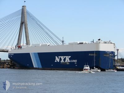
LYRA LEADER
Vehicles Carrier
Current Trip
| Time Travelled | 13 days |
|---|---|
| Remaining Time | --- |
| Distance Travelled | 5422.00 nm |
| Remaining Distance | --- |
| AVG Speed | 16 Knots |
| MAX Speed | 18.1 Knots |
| AVG Wind | 11.4 knots |
| MAX Wind | 22.1 knots |
| MIN Temp | 10°C / 50°F |
| MAX Temp | 29.5°C / 85.1°F |
| Draught | 8.8 m |
| Position Received | 6 d ago |
Current Position
| Longitude | -16.33838° |
|---|---|
| Latitude | 8.93858° |
| Status | Under way using engine |
| Speed | 16.6 Knots |
| Course | 146° |
| Area | North Atlantic Ocean |
| Station | T-AIS |
| Position Received | 6 d ago |
Info
Information
The current position of LYRA LEADER is in North Atlantic Ocean with coordinates 8.93858° / -16.33838° as reported on 2024-04-19 08:56 by AIS to our vessel tracker app. The vessel's current speed is 16.6 Knots and is heading at the port of JEBEL ALI. The estimated time of arrival as calculated by MyShipTracking vessel tracking app is 2024-05-11 03:00 LT
The vessel LYRA LEADER (IMO: 9284752, MMSI: 431190000) is a Vehicles Carrier that was built in 2005 ( 19 years old ). It's sailing under the flag of [JP] Japan.
In this page you can find informations about the vessels current position, last detected port calls, and current voyage information. If the vessels is not in coverage by AIS you will find the latest position.
The current position of LYRA LEADER is detected by our AIS receivers and we are not responsible for the reliability of the data. The last position was recorded while the vessel was in Coverage by the Ais receivers of our vessel tracking app.
The current draught of LYRA LEADER as reported by AIS is 8.8 meters
Weather
| Temperature | 20.4°C / 68.72°F |
|---|---|
| Wind Speed | 22 knots |
| Direction | 137° SE |
| Pressure | 1017.6 hPa |
| Humidity | 75.3 % |
| Cloud Coverage | 67 % |
Featured Company
Last Port Calls
| Port | Arrival | Departure | Time In Port |
|---|---|---|---|
| 2024-04-10 17:32 | 2024-04-11 21:38 | 1 d | |
| 2024-04-07 18:22 | 2024-04-09 16:17 | 1 d | |
| 2024-03-25 04:04 | 2024-03-26 05:44 | 1 d | |
| 2024-03-23 14:23 | 2024-03-23 20:38 | 6 h | |
| 2024-03-22 17:34 | 2024-03-22 23:55 | 6 h | |
| 2024-03-16 10:51 | 2024-03-16 15:42 | 4 h | |
| 2024-03-15 12:10 | 2024-03-15 18:26 | 6 h | |
| 2024-03-14 09:01 | 2024-03-14 15:35 | 6 h | |
| 2024-03-13 10:35 | 2024-03-13 15:15 | 4 h | |
| 2024-03-12 21:55 | 2024-03-13 02:04 | 4 h |
Most Visited Ports (Last year)
| Port | Arrivals | |
|---|---|---|
| 5 | ||
| 2 | ||
| 2 | ||
| 2 | ||
| 2 | ||
| 2 |
Last Trips
| Origin | Departure | Destination | Arrival | Distance | |
|---|---|---|---|---|---|
| 2024-04-09 18:17 | 2024-04-10 19:32 | 329.82 nm | |||
| 2024-03-26 01:44 | 2024-04-07 20:22 | 4330.45 nm | |||
| 2024-03-23 16:38 | 2024-03-25 00:04 | 353.81 nm | |||
| 2024-03-22 19:55 | 2024-03-23 10:23 | 131.62 nm | |||
| 2024-03-16 11:42 | 2024-03-22 13:34 | 1846.78 nm | |||
| 2024-03-15 14:26 | 2024-03-16 06:51 | 88.60 nm | |||
| 2024-03-14 11:35 | 2024-03-15 08:10 | 142.45 nm | |||
| 2024-03-13 11:15 | 2024-03-14 05:01 | 92.74 nm | |||
| 2024-03-12 22:04 | 2024-03-13 06:35 | 64.19 nm | |||
| 2024-03-12 02:53 | 2024-03-12 17:55 | 59.76 nm |
Events
| Time | Event | Details | Position / Dest | Info |
|---|---|---|---|---|
| 2024-04-19 09:05 | Status Changed | Default Under way using engine |
8.90332 / -16.31895
AE JEA
|
Speed: 16.6 kn Course: 146° |
| 2024-04-19 08:56 | OUT of Coverage |
8.93858 / -16.33838
North Atlantic Ocean
AE JEA
|
Speed: 16.6 kn Course: 146° |
|
| 2024-04-19 06:25 | Detected in Sea | Guinean part of the North Atlantic Ocean |
9.52112 / -16.75893
North Atlantic Ocean
AE JEA
|
Speed: 17 kn Course: 142° |
| 2024-04-19 06:24 | Status Changed | Under way using engine Default |
9.52478 / -16.76183
AE JEA
|
Speed: 16.7 kn Course: 140° |
| 2024-04-19 06:24 | IN Coverage |
9.52112 / -16.75893
North Atlantic Ocean
AE JEA
|
Speed: 17 kn Course: 142° |
|
| 2024-04-19 04:54 | Status Changed | Default Under way using engine |
9.84772 / -17.02667
AE JEA
|
Speed: 16.6 kn Course: 140° |
| 2024-04-19 04:47 | OUT of Coverage |
9.87167 / -17.04568
North Atlantic Ocean
AE JEA
|
Speed: 16.6 kn Course: 140° |
|
| 2024-04-18 21:35 | Change Sea Area | Guinea Bissau part of the North Atlantic Ocean Senegalese part of the North Atlantic Ocean |
11.60878 / -17.96292
North Atlantic Ocean
AE JEA
|
Speed: 16.9 kn Course: 179° |
| 2024-04-18 19:18 | Status Changed | Under way using engine Default |
12.25030 / -17.95753
AE JEA
|
Speed: 16.7 kn Course: 181° |
| 2024-04-18 19:15 | Status Changed | Default Under way using engine |
12.26212 / -17.95727
AE JEA
|
Speed: 16.8 kn Course: 182° |