
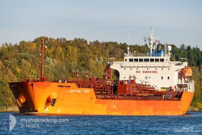
LUMPHINI PARK
Oil/Chemical Tanker
Current Trip
BRSSZ
| Time Travelled | 18 h, 36 mins |
|---|---|
| Remaining Time | --- |
| Distance Travelled | 1.36 nm |
| Remaining Distance | --- |
| AVG Speed | --- |
| MAX Speed | --- |
| AVG Wind | 4.8 knots |
| MAX Wind | 4.9 knots |
| MIN Temp | 24.1°C / 75.38°F |
| MAX Temp | 24.2°C / 75.56°F |
| Draught | 9.4 m |
| Position Received | 18 h, 21 m ago |
Current Position
| Longitude | -46.35834° |
|---|---|
| Latitude | -23.91915° |
| Status | Under way using engine |
| Speed | 2.6 Knots |
| Course | 267° |
| Area | South Atlantic Ocean |
| Station | T-AIS |
| Position Received | 18 h, 21 m ago |
Info
Information
The current position of LUMPHINI PARK is in South Atlantic Ocean with coordinates -23.91915° / -46.35834° as reported on 2024-04-23 20:06 by AIS to our vessel tracker app. The vessel's current speed is 2.6 Knots
The vessel LUMPHINI PARK (IMO: 9640114, MMSI: 636015589) is a Oil/Chemical Tanker that was built in 2013 ( 11 years old ). It's sailing under the flag of [LR] Liberia.
In this page you can find informations about the vessels current position, last detected port calls, and current voyage information. If the vessels is not in coverage by AIS you will find the latest position.
The current position of LUMPHINI PARK is detected by our AIS receivers and we are not responsible for the reliability of the data. The last position was recorded while the vessel was in Coverage by the Ais receivers of our vessel tracking app.
The current draught of LUMPHINI PARK as reported by AIS is 9.4 meters
Weather
| Temperature | 24.5°C / 76.1°F |
|---|---|
| Wind Speed | 5 knots |
| Direction | 330° NNW |
| Pressure | 1013 hPa |
| Humidity | 68.4 % |
| Cloud Coverage | 47 % |
Featured Company
Last Port Calls
| Port | Arrival | Departure | Time In Port |
|---|---|---|---|
| 2024-04-23 19:04 | 2024-04-23 19:51 | 46 m | |
| 2024-03-25 01:45 | 2024-03-26 14:23 | 1 d | |
| 2024-03-21 10:58 | 2024-03-23 15:49 | 2 d | |
| 2024-03-19 05:48 | 2024-03-20 01:05 | 19 h | |
| 2024-03-15 12:32 | 2024-03-16 18:58 | 1 d | |
| 2024-03-04 03:29 | |||
| 2024-02-19 16:37 | 2024-02-20 11:43 | 19 h | |
| 2024-02-14 19:57 | 2024-02-16 02:12 | 1 d | |
| 2024-02-08 00:24 | 2024-02-10 03:35 | 2 d | |
| 2024-02-04 19:21 | 2024-02-05 15:18 | 19 h |
Most Visited Ports (Last year)
| Port | Arrivals | |
|---|---|---|
| 4 | ||
| 4 | ||
| 3 | ||
| 2 | ||
| 2 | ||
| 2 |
Last Trips
| Origin | Departure | Destination | Arrival | Distance | |
|---|---|---|---|---|---|
| 2024-03-26 09:23 | 2024-04-23 16:04 | 5625.08 nm | |||
| 2024-03-23 10:49 | 2024-03-24 20:45 | 415.18 nm | |||
| 2024-03-19 20:05 | 2024-03-21 05:58 | 112.88 nm | |||
| 2024-03-16 13:58 | 2024-03-19 00:48 | 63.94 nm | |||
| 2024-03-03 21:29 | 2024-03-15 07:32 | 662.63 nm | |||
| 2024-02-15 20:12 | 2024-02-19 11:37 | 1029.23 nm | |||
| 2024-02-09 22:35 | 2024-02-14 13:57 | 1125.73 nm | |||
| 2024-02-05 10:18 | 2024-02-07 19:24 | 425.49 nm | |||
| 2024-01-30 13:14 | 2024-02-04 14:21 | 1367.18 nm |
Events
| Time | Event | Details | Position / Dest | Info |
|---|---|---|---|---|
| 2024-04-23 20:22 | Status Changed | Default Under way using engine |
-23.91951 / -46.36066
BRSSZ
|
Speed: 2.6 kn Course: 267° |
| 2024-04-23 20:22 | STOP Moving | 3.51 nm, North West of SANTOS |
-23.91951 / -46.36066
BRSSZ
|
Speed: Course: 280° |
| 2024-04-23 20:06 | OUT of Coverage |
-23.91915 / -46.35834
South Atlantic Ocean
|
Speed: 2.6 kn Course: 265.8° |
|
| 2024-04-23 19:51 | PORT DEPARTURE |
|
-23.92605 / -46.33248
BRSSZ
|
Speed: 8 kn Course: 295° |
| 2024-04-23 19:17 | Status Changed | Under way using engine Default |
-23.98955 / -46.29320
[BR] SANTOS
|
Speed: 9.6 kn Course: 94° |
| 2024-04-23 19:17 | IN Coverage |
-23.98682 / -46.29050
South Atlantic Ocean
[BR] SANTOS
|
Speed: 7.9 kn Course: 32.8° |
|
| 2024-04-23 19:04 | PORT ARRIVAL |
|
-23.99407 / -46.32694
[BR] SANTOS
|
Speed: 10 kn Course: 26° |
| 2024-04-23 18:09 | START Moving | 9.41 nm, South of SANTOS |
-24.12245 / -46.29476
BRSSZ
|
Speed: 4.9 kn Course: 302° |
| 2024-04-22 03:03 | Status Changed | Default At anchor |
-24.12484 / -46.29501
BRSSZ
|
Speed: 0.3 kn Course: 76° |
| 2024-04-22 02:57 | OUT of Coverage |
-24.12480 / -46.29502
South Atlantic Ocean
|
Speed: 0.3 kn Course: 339° |