
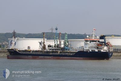
AGARTHA
Oil/Chemical Tanker
Current Trip
| Time Travelled | 9 days |
|---|---|
| Remaining Time | --- |
| Distance Travelled | 1731.21 nm |
| Remaining Distance | --- |
| AVG Speed | 9 Knots |
| MAX Speed | 9 Knots |
| AVG Wind | 10 knots |
| MAX Wind | 33 knots |
| MIN Temp | 12.4°C / 54.32°F |
| MAX Temp | 23.8°C / 74.84°F |
| Draught | 6.5 m |
| Position Received | 1 d ago |
Current Position
| Longitude | 11.33637° |
|---|---|
| Latitude | 37.92240° |
| Status | Under way using engine |
| Speed | 7.4 Knots |
| Course | 309° |
| Area | Mediterranean Sea - Western Basin |
| Station | T-AIS |
| Position Received | 1 d ago |
Info
Information
The current position of AGARTHA is in Mediterranean Sea - Western Basin with coordinates 37.92240° / 11.33637° as reported on 2024-04-22 18:33 by AIS to our vessel tracker app. The vessel's current speed is 7.4 Knots and is heading at the port of HUELVA. The estimated time of arrival as calculated by MyShipTracking vessel tracking app is 2024-04-26 11:00 LT
The vessel AGARTHA (IMO: 9250050, MMSI: 236329000) is a Oil/Chemical Tanker that was built in 2003 ( 21 years old ). It's sailing under the flag of [GI] Gibraltar.
In this page you can find informations about the vessels current position, last detected port calls, and current voyage information. If the vessels is not in coverage by AIS you will find the latest position.
The current position of AGARTHA is detected by our AIS receivers and we are not responsible for the reliability of the data. The last position was recorded while the vessel was in Coverage by the Ais receivers of our vessel tracking app.
The current draught of AGARTHA as reported by AIS is 6.5 meters
Weather
| Temperature | 12.1°C / 53.78°F |
|---|---|
| Wind Speed | 12 knots |
| Direction | 354° N |
| Pressure | 1016.6 hPa |
| Humidity | 70.9 % |
| Cloud Coverage | 100 % |
Featured Company
Events
| Time | Event | Details | Position / Dest | Info |
|---|---|---|---|---|
| 2024-04-22 18:48 | Status Changed | Default Under way using engine |
37.94265 / 11.30610
ES_HUV
|
Speed: 7.4 kn Course: 309° |
| 2024-04-22 18:33 | OUT of Coverage |
37.92240 / 11.33637
Mediterranean Sea - Western Basin
ES_HUV
|
Speed: 7.4 kn Course: 309° |
|
| 2024-04-22 17:56 | Change Sea Area | Italian part of the Mediterranean Sea - Western Basin Italian part of the Mediterranean Sea - Eastern Basin |
37.87560 / 11.41552
Mediterranean Sea - Western Basin
ES_HUV
|
Speed: 7.6 kn Course: 305° |
| 2024-04-22 17:56 | IN Coverage |
37.87560 / 11.41552
Mediterranean Sea - Western Basin
ES_HUV
|
Speed: 7.6 kn Course: 305° |
|
| 2024-04-22 17:55 | Status Changed | Under way using engine Default |
37.87412 / 11.41817
ES_HUV
|
Speed: 7.6 kn Course: 303° |
| 2024-04-22 11:59 | Status Changed | Default Under way using engine |
37.44024 / 12.12912
ES_HUV
|
Speed: 7.3 kn Course: 309° |
| 2024-04-22 11:54 | OUT of Coverage |
37.43365 / 12.13922
Mediterranean Sea - Eastern Basin
ES_HUV
|
Speed: 7.3 kn Course: 309° |
|
| 2024-04-22 11:51 | Status Changed | Under way using engine Default |
37.42973 / 12.14535
ES_HUV
|
Speed: 7.5 kn Course: 307° |
| 2024-04-22 11:07 | Status Changed | Default Under way using engine |
37.37215 / 12.23753
ES_HUV
|
Speed: 7.1 kn Course: 308° |
| 2024-04-22 10:46 | Status Changed | Under way using engine Default |
37.34888 / 12.27522
ES_HUV
|
Speed: 7.1 kn Course: 309° |