
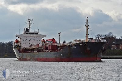
LOYAL
Oil/Chemical Tanker
Current Trip
| Trip Time | 22 h, 36 mins |
|---|---|
| Trip Distance | 249.01 nm |
| AVG Speed | 11.3 Knots |
| MAX Speed | 12.4 Knots |
| Draught | 10.2 m |
| AVG Wind | 9.2 knots |
| MAX Wind | 16 knots |
| MIN Temp | 27.9°C / 82.22°F |
| MAX Temp | 28.9°C / 84.02°F |
| Position Received | 10 d ago |
Current Position
| Longitude | 39.51618° |
|---|---|
| Latitude | 18.48810° |
| Status | Under way using engine |
| Speed | 11.1 Knots |
| Course | 165° |
| Area | Red Sea |
| Station | T-AIS |
| Position Received | 10 d ago |
Info
Information
The current position of LOYAL is in Red Sea with coordinates 18.48810° / 39.51618° as reported on 2024-04-14 12:52 by AIS to our vessel tracker app. The vessel's current speed is 11.1 Knots and is currently inside the port of NHAVA SHEVA.
The vessel LOYAL (IMO: 9345881, MMSI: 574005400) is a Oil/Chemical Tanker that was built in 2006 ( 18 years old ). It's sailing under the flag of [VN] Vietnam.
In this page you can find informations about the vessels current position, last detected port calls, and current voyage information. If the vessels is not in coverage by AIS you will find the latest position.
The current position of LOYAL is detected by our AIS receivers and we are not responsible for the reliability of the data. The last position was recorded while the vessel was in Coverage by the Ais receivers of our vessel tracking app.
The current draught of LOYAL as reported by AIS is 10.2 meters
Weather
| Temperature | 28°C / 82.4°F |
|---|---|
| Wind Speed | 3 knots |
| Direction | 257° WSW |
| Pressure | 1006.7 hPa |
| Humidity | 69.5 % |
| Cloud Coverage | --- |
Featured Company
Last Port Calls
| Port | Arrival | Departure | Time In Port |
|---|---|---|---|
| 2024-04-24 21:04 | |||
| 2024-04-22 20:32 | 2024-04-23 22:28 | 1 d | |
| 2024-04-09 02:26 | 2024-04-09 11:39 | 9 h | |
| 2024-03-22 16:47 | 2024-03-22 17:20 | 33 m | |
| 2024-03-21 07:45 | 2024-03-21 08:51 | 1 h | |
| 2024-03-18 15:21 | 2024-03-20 00:38 | 1 d | |
| 2024-02-29 01:32 | 2024-03-01 19:37 | 1 d | |
| 2024-02-12 07:21 | 2024-02-14 02:31 | 1 d | |
| 2024-02-07 19:03 | 2024-02-09 08:34 | 1 d |
Most Visited Ports (Last year)
| Port | Arrivals | |
|---|---|---|
| 5 | ||
| 3 | ||
| 2 | ||
| 2 | ||
| 1 | ||
| 1 |
Last Trips
| Origin | Departure | Destination | Arrival | Distance | |
|---|---|---|---|---|---|
| 2024-04-24 03:58 | 2024-04-25 02:34 | 249.01 nm | |||
| 2024-03-22 18:20 | 2024-04-23 02:02 | 7578.13 nm | |||
| 2024-03-22 18:20 | 2024-04-09 04:26 | 3935.48 nm | |||
| 2024-03-21 09:51 | 2024-03-22 17:47 | 278.33 nm | |||
| 2024-03-20 01:38 | 2024-03-21 08:45 | 308.59 nm | |||
| 2024-03-01 15:37 | 2024-03-18 16:21 | 4301.84 nm | |||
| 2024-02-13 23:31 | 2024-02-28 21:32 | 3132.97 nm | |||
| 2024-02-09 05:34 | 2024-02-12 04:21 | 4.60 nm | |||
| 2023-12-26 13:33 | 2024-02-07 16:03 | 9491.43 nm |
Events
| Time | Event | Details | Position / Dest | Info |
|---|---|---|---|---|
| 2024-04-24 21:04 | STOP Moving |
18.94502 / 72.93802
[IN] NHAVA SHEVA
|
Speed: 0.1 kn Course: 39° |
|
| 2024-04-24 21:04 | PORT ARRIVAL |
|
18.94502 / 72.93802
[IN] NHAVA SHEVA
|
Speed: 1.5 kn Course: 64° |
| 2024-04-23 22:28 | PORT DEPARTURE |
|
15.42098 / 73.79097
IN MRM
|
Speed: 4.1 kn Course: 326° |
| 2024-04-23 22:20 | START Moving |
15.41658 / 73.80042
[IN] MORMUGAO
|
Speed: 4.1 kn Course: 326° |
|
| 2024-04-22 21:00 | STOP Moving |
15.40528 / 73.80818
[IN] MORMUGAO
|
Speed: 0.1 kn Course: 178° |
|
| 2024-04-22 20:32 | PORT ARRIVAL |
|
15.41510 / 73.80164
[IN] MORMUGAO
|
Speed: 4.5 kn Course: 136° |
| 2024-04-22 19:32 | START Moving | 5.57 nm, West of MORMUGAO |
15.40452 / 73.71436
IN MRM
|
Speed: 5.2 kn Course: 73° |
| 2024-04-22 18:23 | STOP Moving | 5.97 nm, West of MORMUGAO |
15.41105 / 73.70710
IN MRM
|
Speed: 0.1 kn Course: 2° |