
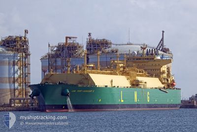
LNG PORT-HARCOURT II
Tanker D
Current Trip
NGBNY
| Time Travelled | 30 days |
|---|---|
| Remaining Time | --- |
| Distance Travelled | 7533.87 nm |
| Remaining Distance | --- |
| AVG Speed | 11.6 Knots |
| MAX Speed | 17.4 Knots |
| AVG Wind | 12.7 knots |
| MAX Wind | 41 knots |
| MIN Temp | 12.5°C / 54.5°F |
| MAX Temp | 26.6°C / 79.88°F |
| Draught | 9.5 m |
| Position Received | 6 d ago |
Current Position
| Longitude | -17.37514° |
|---|---|
| Latitude | 27.34585° |
| Status | Under way using engine |
| Speed | 10.6 Knots |
| Course | 239.1° |
| Area | North Atlantic Ocean |
| Station | T-AIS |
| Position Received | 6 d ago |
Info
Information
The current position of LNG PORT-HARCOURT II is in North Atlantic Ocean with coordinates 27.34585° / -17.37514° as reported on 2024-04-19 01:01 by AIS to our vessel tracker app. The vessel's current speed is 10.6 Knots
The vessel LNG PORT-HARCOURT II (IMO: 9690157, MMSI: 310719000) is a Tanker D It's sailing under the flag of [BM] Bermuda.
In this page you can find informations about the vessels current position, last detected port calls, and current voyage information. If the vessels is not in coverage by AIS you will find the latest position.
The current position of LNG PORT-HARCOURT II is detected by our AIS receivers and we are not responsible for the reliability of the data. The last position was recorded while the vessel was in Coverage by the Ais receivers of our vessel tracking app.
The current draught of LNG PORT-HARCOURT II as reported by AIS is 9.5 meters
Weather
| Temperature | 25.7°C / 78.26°F |
|---|---|
| Wind Speed | 9 knots |
| Direction | 28° NNE |
| Pressure | 1012.9 hPa |
| Humidity | 72.6 % |
| Cloud Coverage | 100 % |
Featured Company
Last Trips
| Origin | Departure | Destination | Arrival | Distance | |
|---|---|---|---|---|---|
| 2024-03-11 03:15 | 2024-03-24 07:38 | 4322.08 nm | |||
| 2024-01-22 14:27 | 2024-03-08 15:03 | 9938.17 nm |
Events
| Time | Event | Details | Position / Dest | Info |
|---|---|---|---|---|
| 2024-04-19 01:15 | Status Changed | Default Under way using engine |
27.32280 / -17.41575
NGBNY
|
Speed: 10.6 kn Course: 239.1° |
| 2024-04-19 01:01 | OUT of Coverage |
27.34585 / -17.37514
North Atlantic Ocean
NGBNY
|
Speed: 10.6 kn Course: 239.1° |
|
| 2024-04-18 18:57 | Status Changed | Under way using engine Default |
27.94314 / -16.40344
NGBNY
|
Speed: 10.9 kn Course: 220° |
| 2024-04-18 18:56 | Status Changed | Default Under way using engine |
27.94586 / -16.40088
NGBNY
|
Speed: 10.8 kn Course: 219.5° |
| 2024-04-18 15:35 | START Moving | 4.25 nm, South East of TENERIFE |
28.42579 / -16.18259
NGBNY
|
Speed: 3.1 kn Course: 140° |
| 2024-04-18 14:51 | Destination Changed | NGBNY ESSCT |
28.42746 / -16.17606
NGBNY
|
Speed: 0.6 kn Course: 135° |
| 2024-04-18 14:51 | ETA Changed | 2024/05/18 09:00 2024/04/18 13:00 |
28.42746 / -16.17606
NGBNY
|
Speed: 0.6 kn Course: 135° |
| 2024-04-18 12:50 | STOP Moving | 4.4 nm, South of SAN ANDRES |
28.43415 / -16.16221
ESSCT
|
Speed: 0.3 kn Course: 139° |
| 2024-04-18 11:26 | Destination Changed | ESSCT NGBNY |
28.34846 / -16.02687
ESSCT
|
Speed: 10.4 kn Course: 311.5° |
| 2024-04-18 11:26 | ETA Changed | 2024/04/18 13:00 2024/05/18 09:00 |
28.34846 / -16.02687
ESSCT
|
Speed: 10.4 kn Course: 311.5° |