
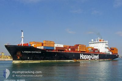
LISBON EXPRESS
Container Ship
Current Trip
| Time Travelled | 6 days |
|---|---|
| Remaining Time | --- |
| Distance Travelled | 2493.75 nm |
| Remaining Distance | --- |
| AVG Speed | 15.2 Knots |
| MAX Speed | 19.7 Knots |
| AVG Wind | 13.3 knots |
| MAX Wind | 27.6 knots |
| MIN Temp | 2.2°C / 35.96°F |
| MAX Temp | 17.5°C / 63.5°F |
| Draught | 8.9 m |
| Position Received | 1 d ago |
Current Position
| Longitude | -28.06999° |
|---|---|
| Latitude | 40.02029° |
| Status | Under way using engine |
| Speed | 15.7 Knots |
| Course | 101.6° |
| Area | North Atlantic Ocean |
| Station | T-AIS |
| Position Received | 1 d ago |
Info
Information
The current position of LISBON EXPRESS is in North Atlantic Ocean with coordinates 40.02029° / -28.06999° as reported on 2024-04-18 05:28 by AIS to our vessel tracker app. The vessel's current speed is 15.7 Knots and is heading at the port of TANGER MED. The estimated time of arrival as calculated by MyShipTracking vessel tracking app is 2024-04-21 01:00 LT
The vessel LISBON EXPRESS (IMO: 9108128, MMSI: 310132000) is a Container Ship that was built in 1995 ( 29 years old ). It's sailing under the flag of [BM] Bermuda.
In this page you can find informations about the vessels current position, last detected port calls, and current voyage information. If the vessels is not in coverage by AIS you will find the latest position.
The current position of LISBON EXPRESS is detected by our AIS receivers and we are not responsible for the reliability of the data. The last position was recorded while the vessel was in Coverage by the Ais receivers of our vessel tracking app.
The current draught of LISBON EXPRESS as reported by AIS is 8.9 meters
Weather
| Temperature | 15.4°C / 59.72°F |
|---|---|
| Wind Speed | 6 knots |
| Direction | 107° ESE |
| Pressure | 1015.4 hPa |
| Humidity | 78.9 % |
| Cloud Coverage | 100 % |
Featured Company
Last Port Calls
| Port | Arrival | Departure | Time In Port |
|---|---|---|---|
| 2024-04-08 21:46 | 2024-04-12 11:05 | 3 d | |
| 2024-03-23 13:17 | 2024-03-24 01:32 | 12 h | |
| 2024-03-17 18:59 | 2024-03-18 01:05 | 6 h | |
| 2024-03-15 21:32 | 2024-03-16 08:44 | 11 h | |
| 2024-03-14 10:25 | 2024-03-14 21:05 | 10 h | |
| 2024-03-11 05:05 | 2024-03-12 00:23 | 19 h | |
| 2024-03-10 05:36 | 2024-03-10 22:22 | 16 h | |
| 2024-02-28 02:28 | 2024-02-28 09:33 | 7 h | |
| 2024-02-13 11:53 | 2024-02-16 14:30 | 3 d |
Last Trips
| Origin | Departure | Destination | Arrival | Distance | |
|---|---|---|---|---|---|
| 2024-03-24 02:32 | 2024-04-08 17:46 | 4115.40 nm | |||
| 2024-03-18 02:05 | 2024-03-23 14:17 | 800.19 nm | |||
| 2024-03-16 09:44 | 2024-03-17 19:59 | 415.31 nm | |||
| 2024-03-14 22:05 | 2024-03-15 22:32 | 345.75 nm | |||
| 2024-03-12 01:23 | 2024-03-14 11:25 | 311.81 nm | |||
| 2024-03-10 23:22 | 2024-03-11 06:05 | 86.51 nm | |||
| 2024-02-28 10:33 | 2024-03-10 06:36 | 1475.67 nm | |||
| 2024-02-16 09:30 | 2024-02-28 03:28 | 3305.86 nm | |||
| 2024-01-30 19:58 | 2024-02-13 06:53 | 3014.10 nm |
Events
| Time | Event | Details | Position / Dest | Info |
|---|---|---|---|---|
| 2024-04-18 06:01 | Status Changed | Default Under way using engine |
39.99278 / -27.88546
MAPTM
|
Speed: 15.7 kn Course: 101.6° |
| 2024-04-18 05:28 | OUT of Coverage |
40.02029 / -28.06999
North Atlantic Ocean
MAPTM
|
Speed: 15.7 kn Course: 101.6° |
|
| 2024-04-18 05:19 | Status Changed | Under way using engine Default |
40.02707 / -28.11978
MAPTM
|
Speed: 15.7 kn Course: 100° |
| 2024-04-18 05:03 | Status Changed | Default Under way using engine |
40.03948 / -28.20966
MAPTM
|
Speed: 15.6 kn Course: 100.8° |
| 2024-04-18 02:43 | ETA Changed | 2024/04/21 01:00 2024/04/20 01:00 |
40.16784 / -28.98434
MAPTM
|
Speed: 15.5 kn Course: 104° |
| 2024-04-18 02:22 | Change Sea Area | Portuguese (Azores) part of the North Atlantic Ocean Canadian part of the Gulf of St-Lawrence |
40.18809 / -29.10054
North Atlantic Ocean
MAPTM
|
Speed: 15.4 kn Course: 101.9° |
| 2024-04-18 02:21 | Status Changed | Under way using engine Default |
40.18828 / -29.10165
MAPTM
|
Speed: 15.3 kn Course: 102° |
| 2024-04-18 02:05 | IN Coverage |
40.18809 / -29.10054
North Atlantic Ocean
MAPTM
|
Speed: 15.4 kn Course: 101.9° |
|
| 2024-04-13 06:46 | Status Changed | Default Under way using engine |
48.64237 / -68.53997
MAPTM
|
Speed: 16 kn Course: 53.2° |
| 2024-04-13 06:40 | OUT of Coverage |
48.62733 / -68.57072
Gulf of St-Lawrence
MAPTM
|
Speed: 16 kn Course: 53.2° |