
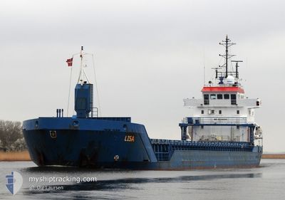
LISA
General Cargo
Current Trip
| Time Travelled | 1 day |
|---|---|
| Remaining Time | 4 h, 44 mins |
| Distance Travelled | 338.96 nm |
| Remaining Distance | 37.43 nm |
| AVG Speed | 7.8 Knots |
| MAX Speed | 13.5 Knots |
| AVG Wind | 12.7 knots |
| MAX Wind | 25.4 knots |
| MIN Temp | 3.4°C / 38.12°F |
| MAX Temp | 10°C / 50°F |
| Draught | 6.1 m |
| Position Received | 1 m ago |
Current Position
| Longitude | 3.19417° |
|---|---|
| Latitude | 51.66766° |
| Status | Under way using engine |
| Speed | 8.2 Knots |
| Course | 204.9° |
| Area | North Sea |
| Station | T-AIS |
| Position Received | 1 m ago |
Info
Information
The current position of LISA is in North Sea with coordinates 51.66766° / 3.19417° as reported on 2024-04-19 07:18 by AIS to our vessel tracker app. The vessel's current speed is 8.2 Knots and is heading at the port of BRUGGE. The estimated time of arrival as calculated by MyShipTracking vessel tracking app is 2024-04-19 12:03 LT
The vessel LISA (IMO: 9235505, MMSI: 209989000) is a General Cargo that was built in 2001 ( 23 years old ). It's sailing under the flag of [CY] Cyprus.
In this page you can find informations about the vessels current position, last detected port calls, and current voyage information. If the vessels is not in coverage by AIS you will find the latest position.
The current position of LISA is detected by our AIS receivers and we are not responsible for the reliability of the data. The last position was recorded while the vessel was in Coverage by the Ais receivers of our vessel tracking app.
The current draught of LISA as reported by AIS is 6.1 meters
Weather
| Temperature | 10°C / 50°F |
|---|---|
| Wind Speed | 25 knots |
| Direction | 297° WNW |
| Pressure | 1011 hPa |
| Humidity | 82.5 % |
| Cloud Coverage | 100 % |
Featured Company
Last Port Calls
| Port | Arrival | Departure | Time In Port |
|---|---|---|---|
| 2024-04-17 11:40 | 2024-04-17 12:30 | 49 m | |
| 2024-04-12 19:30 | 2024-04-15 17:31 | 2 d | |
| 2024-04-09 12:49 | 2024-04-10 20:41 | 1 d | |
| 2024-03-31 17:33 | 2024-04-04 12:53 | 3 d | |
| 2024-03-25 17:05 | 2024-03-26 23:40 | 1 d | |
| 2024-03-24 17:36 | |||
| 2024-03-14 19:04 | |||
| 2024-03-03 18:53 | 2024-03-06 17:54 | 2 d | |
| 2024-03-01 08:29 | 2024-03-01 19:13 | 10 h | |
| 2024-02-24 10:46 | 2024-02-27 14:58 | 3 d |
Last Trips
| Origin | Departure | Destination | Arrival | Distance | |
|---|---|---|---|---|---|
| 2024-04-15 20:31 | 2024-04-17 13:40 | 409.25 nm | |||
| 2024-04-10 22:41 | 2024-04-12 22:30 | 453.71 nm | |||
| 2024-04-04 14:53 | 2024-04-09 14:49 | 918.00 nm | |||
| 2024-03-27 00:40 | 2024-03-31 19:33 | 1058.62 nm | |||
| 2024-03-24 17:36 | 2024-03-25 18:05 | 213.21 nm | |||
| 2024-03-01 20:13 | 2024-03-03 19:53 | 202.80 nm | |||
| 2024-02-27 15:58 | 2024-03-01 09:29 | 547.84 nm | |||
| 2024-02-23 23:26 | 2024-02-24 11:46 | 104.65 nm | |||
| 2024-02-14 00:11 | 2024-02-19 01:10 | 1040.75 nm | |||
| 2024-02-09 22:15 | 2024-02-12 12:16 | 93.69 nm |
Events
| Time | Event | Details | Position / Dest | Info |
|---|---|---|---|---|
| 2024-04-19 04:59 | IN Coverage |
51.97537 / 3.31785
North Sea
BEBGS
|
Speed: 8.5 kn Course: 185.9° |
|
| 2024-04-18 13:11 | OUT of Coverage |
53.55881 / 5.06133
North Sea
BEBGS
|
Speed: 8 kn Course: 246.6° |
|
| 2024-04-18 10:15 | IN Coverage |
53.70076 / 5.77110
North Sea
BEBGS
|
Speed: 9.9 kn Course: 249.8° |
|
| 2024-04-18 08:33 | OUT of Coverage |
53.79009 / 6.22351
North Sea
BEBGS
|
Speed: 9.7 kn Course: 251.5° |
|
| 2024-04-18 08:23 | Detected in Sea | Dutch part of the North Sea |
53.79974 / 6.26930
North Sea
BEBGS
|
Speed: 9.8 kn Course: 250.6° |
| 2024-04-18 03:40 | Status Changed | Under way using engine Default |
53.97672 / 7.41555
BEBGS
|
Speed: 8.7 kn Course: 255° |
| 2024-04-18 03:40 | IN Coverage |
53.97672 / 7.41555
North Sea
BEBGS
|
Speed: 8.5 kn Course: 256.3° |
|
| 2024-04-17 23:33 | Status Changed | Default Under way using engine |
53.97249 / 8.52418
BEBGS
|
Speed: 12.5 kn Course: 280.6° |
| 2024-04-17 23:27 | OUT of Coverage |
53.96898 / 8.55781
North Sea
BEBGS
|
Speed: 12.5 kn Course: 280.6° |
|
| 2024-04-17 23:22 | Status Changed | Under way using engine Default |
53.96535 / 8.58887
BEBGS
|
Speed: 13.5 kn Course: 297° |