
LISA LEHMANN
General Cargo
Current Trip
| Time Travelled | 4 days |
|---|---|
| Remaining Time | 1 day |
| Distance Travelled | 1023.85 nm |
| Remaining Distance | 273.00 nm |
| AVG Speed | 9.5 Knots |
| MAX Speed | 12 Knots |
| AVG Wind | 13.6 knots |
| MAX Wind | 30 knots |
| MIN Temp | 3.7°C / 38.66°F |
| MAX Temp | 8.8°C / 47.84°F |
| Draught | 5.3 m |
| Position Received | 2 m ago |
Current Position
| Longitude | --- |
|---|---|
| Latitude | --- |
| Status | Under way using engine |
| Speed | 9.9 Knots |
| Course | 37.6° |
| Area | Norwegian Sea |
| Station | T-AIS |
| Position Received | 2 m ago |
Info
Information
The current position of LISA LEHMANN is in Norwegian Sea with coordinates 63.45307° / 6.92080° as reported on 2025-12-07 12:33 by AIS to our vessel tracker app. The vessel's current speed is 9.9 Knots and is heading at the port of MOIRANA. The estimated time of arrival as calculated by MyShipTracking vessel tracking app is 2025-12-08 18:03 LT
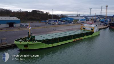
The vessel LISA LEHMANN (IMO: 9325130, MMSI: 305981000) is a General Cargo that was built in 2004 ( 21 years old ). It's sailing under the flag of [AG] Antigua Barbuda.
In this page you can find informations about the vessels current position, last detected port calls, and current voyage information. If the vessels is not in coverage by AIS you will find the latest position.
The current position of LISA LEHMANN is detected by our AIS receivers and we are not responsible for the reliability of the data. The last position was recorded while the vessel was in Coverage by the Ais receivers of our vessel tracking app.
The current draught of LISA LEHMANN as reported by AIS is 5.3 meters
Weather
| Temperature | 6.7°C / 44.06°F |
|---|---|
| Wind Speed | 6 knots |
| Direction | 128° SE |
| Pressure | 1005 hPa |
| Humidity | 65.9 % |
| Cloud Coverage | 12 % |
Featured Company
Last Port Calls
| Port | Arrival | Departure | Time In Port |
|---|---|---|---|
| 2025-12-03 01:35 | 2025-12-03 02:22 | 46 m | |
| 2025-11-29 13:27 | 2025-12-02 20:11 | 3 d | |
| 2025-11-28 20:29 | 2025-11-29 08:16 | 11 h | |
| 2025-11-24 21:38 | 2025-11-26 21:09 | 1 d | |
| 2025-11-17 22:11 | 2025-11-18 23:57 | 1 d | |
| 2025-11-11 13:59 | 2025-11-13 12:45 | 1 d | |
| 2025-11-10 04:18 | 2025-11-10 19:10 | 14 h | |
| 2025-11-03 00:05 | 2025-11-04 15:17 | 1 d | |
| 2025-10-30 18:40 | 2025-11-01 16:25 | 1 d | |
| 2025-10-28 01:35 | 2025-10-29 05:54 | 1 d |
Last Trips
| Origin | Departure | Destination | Arrival | Distance | |
|---|---|---|---|---|---|
| 2025-12-02 20:11 | 2025-12-03 01:35 | 49.03 nm | |||
| 2025-11-29 08:16 | 2025-11-29 13:27 | 48.57 nm | |||
| 2025-11-26 21:09 | 2025-11-28 20:29 | 412.98 nm | |||
| 2025-11-18 23:57 | 2025-11-24 21:38 | 949.65 nm | |||
| 2025-11-13 12:45 | 2025-11-17 22:11 | 897.58 nm | |||
| 2025-11-10 19:10 | 2025-11-11 13:59 | 166.34 nm | |||
| 2025-11-04 15:17 | 2025-11-10 04:18 | 703.53 nm | |||
| 2025-11-01 16:25 | 2025-11-03 00:05 | 329.82 nm | |||
| 2025-10-29 05:54 | 2025-10-30 18:40 | 338.23 nm | |||
| 2025-10-26 14:20 | 2025-10-28 01:35 | 326.45 nm |
Events
| Time | Event | Details | Position / Dest | Info |
|---|---|---|---|---|
| 2025-12-07 11:46 | Status Changed | Under way using engine Default |
63.34889 / 6.73351
MO I RANA
|
Speed: 10.3 kn Course: 38° |
| 2025-12-07 11:45 | Status Changed | Default Under way using engine |
63.34694 / 6.73005
MO I RANA
|
Speed: 10.1 kn Course: 38.3° |
| 2025-12-07 09:42 | Status Changed | Under way using engine Default |
63.07521 / 6.31623
MO I RANA
|
Speed: 8.9 kn Course: 31° |
| 2025-12-07 09:41 | Status Changed | Default Under way using engine |
63.07342 / 6.31383
MO I RANA
|
Speed: 9 kn Course: 32.5° |
| 2025-12-06 19:08 | ETA Changed | 2025/12/08 16:00 2025/12/08 18:00 |
61.04841 / 4.25589
MO I RANA
|
Speed: 9.4 kn Course: 6.4° |
| 2025-12-06 18:51 | Change Sea Area | Norwegian part of the Norwegian Sea Norwegian part of the North Sea |
61.00482 / 4.24674
Norwegian Sea
MO I RANA
|
Speed: 9.1 kn Course: 6.1° |
| 2025-12-05 20:19 | Change Sea Area | Norwegian part of the North Sea Norwegian part of the Skaggerak |
57.93373 / 7.09725
North Sea
MO I RANA
|
Speed: 9.3 kn Course: 287.7° |
| 2025-12-05 15:00 | Status Changed | Under way using engine Default |
57.90818 / 8.71454
MO I RANA
|
Speed: 8.9 kn Course: 277° |
| 2025-12-05 14:57 | Status Changed | Default Under way using engine |
57.90709 / 8.73085
MO I RANA
|
Speed: 8.8 kn Course: 275.2° |
| 2025-12-05 14:29 | Detected in Sea | Norwegian part of the Skaggerak |
57.90012 / 8.85752
Skaggerak
MO I RANA
|
Speed: 9 kn Course: 277.3° |