
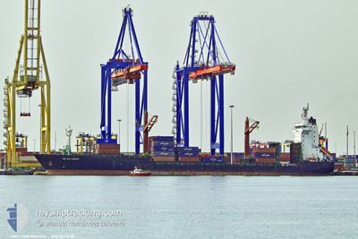
CMA CGM MAPUTO
Cargo A
Current Trip
| Time Travelled | 7 days |
|---|---|
| Remaining Time | --- |
| Distance Travelled | 1225.68 nm |
| Remaining Distance | --- |
| AVG Speed | 12.2 Knots |
| MAX Speed | 18.8 Knots |
| AVG Wind | 11.9 knots |
| MAX Wind | 26.6 knots |
| MIN Temp | 14.5°C / 58.1°F |
| MAX Temp | 21.2°C / 70.16°F |
| Draught | 7.6 m |
| Position Received | 3 d ago |
Current Position
| Longitude | 14.40043° |
|---|---|
| Latitude | 35.75444° |
| Status | Under way using engine |
| Speed | 11.3 Knots |
| Course | 96.2° |
| Area | Mediterranean Sea - Eastern Basin |
| Station | T-AIS |
| Position Received | 3 d ago |
Info
Information
The current position of CMA CGM MAPUTO is in Mediterranean Sea - Eastern Basin with coordinates 35.75444° / 14.40043° as reported on 2024-04-20 17:23 by AIS to our vessel tracker app. The vessel's current speed is 11.3 Knots
The vessel CMA CGM MAPUTO (IMO: 9491628, MMSI: 229786000) is a Cargo A It's sailing under the flag of [MT] Malta.
In this page you can find informations about the vessels current position, last detected port calls, and current voyage information. If the vessels is not in coverage by AIS you will find the latest position.
The current position of CMA CGM MAPUTO is detected by our AIS receivers and we are not responsible for the reliability of the data. The last position was recorded while the vessel was in Coverage by the Ais receivers of our vessel tracking app.
The current draught of CMA CGM MAPUTO as reported by AIS is 7.6 meters
Weather
| Temperature | 15.2°C / 59.36°F |
|---|---|
| Wind Speed | 10 knots |
| Direction | 310° NW |
| Pressure | 1012.9 hPa |
| Humidity | 61.8 % |
| Cloud Coverage | 8 % |
Featured Company
Last Port Calls
| Port | Arrival | Departure | Time In Port |
|---|---|---|---|
| 2024-04-14 04:16 | 2024-04-16 18:36 | 2 d | |
| 2024-04-07 17:25 | 2024-04-09 05:17 | 1 d | |
| 2024-03-18 13:39 | 2024-03-19 15:36 | 1 d | |
| 2024-03-16 12:24 | 2024-03-17 01:52 | 13 h | |
| 2024-03-14 20:44 | |||
| 2024-02-28 01:25 | 2024-02-29 02:22 | 1 d | |
| 2024-02-26 17:03 | 2024-02-27 05:53 | 12 h | |
| 2024-02-25 03:41 | 2024-02-25 11:25 | 7 h | |
| 2024-02-22 04:29 | 2024-02-23 06:37 | 1 d | |
| 2024-02-18 05:17 | 2024-02-18 19:25 | 14 h |
Most Visited Ports (Last year)
| Port | Arrivals | |
|---|---|---|
| 17 | ||
| 12 | ||
| 11 | ||
| 8 | ||
| 8 | ||
| 3 |
Last Trips
| Origin | Departure | Destination | Arrival | Distance | |
|---|---|---|---|---|---|
| 2024-04-09 07:17 | 2024-04-14 05:16 | 608.28 nm | |||
| 2024-03-19 10:36 | 2024-04-07 19:25 | 5277.29 nm | |||
| 2024-03-16 19:52 | 2024-03-18 08:39 | 491.92 nm | |||
| 2024-02-29 03:22 | 2024-03-14 14:44 | 5329.20 nm | |||
| 2024-02-27 06:53 | 2024-02-28 02:25 | 174.75 nm | |||
| 2024-02-25 12:25 | 2024-02-26 18:03 | 388.57 nm | |||
| 2024-02-23 07:37 | 2024-02-25 04:41 | 161.89 nm | |||
| 2024-02-18 20:25 | 2024-02-22 05:29 | 897.43 nm | |||
| 2024-01-29 19:49 | 2024-02-18 06:17 | 5002.62 nm |
Events
| Time | Event | Details | Position / Dest | Info |
|---|---|---|---|---|
| 2024-04-20 20:01 | STOP Moving | 15.37 nm, East of MARSAXLOKK |
35.81333 / 14.86167
MACAS>MTMLA
|
Speed: Course: -1° |
| 2024-04-20 17:27 | Status Changed | Default Under way using engine |
35.75401 / 14.41554
MACAS>MTMLA
|
Speed: 11.3 kn Course: 96.2° |
| 2024-04-20 17:23 | OUT of Coverage |
35.75444 / 14.40043
Mediterranean Sea - Eastern Basin
MACAS>MTMLA
|
Speed: 11.3 kn Course: 96.2° |
|
| 2024-04-20 15:45 | ETA Changed | 2024/04/20 18:00 2024/04/20 20:00 |
35.92905 / 14.06099
MACAS>MTMLA
|
Speed: 12 kn Course: 119.7° |
| 2024-04-20 15:42 | Status Changed | Under way using engine Default |
35.93219 / 14.05442
MACAS>MTMLA
|
Speed: 12 kn Course: 121° |
| 2024-04-20 15:34 | Status Changed | Default Under way using engine |
35.94667 / 14.02333
MACAS>MTMLA
|
Speed: 12 kn Course: 120.6° |
| 2024-04-20 15:19 | Status Changed | Under way using engine Default |
35.97237 / 13.97059
MACAS>MTMLA
|
Speed: 12 kn Course: 119° |
| 2024-04-20 15:10 | Status Changed | Default Under way using engine |
35.98667 / 13.93667
MACAS>MTMLA
|
Speed: 12.1 kn Course: 120.5° |
| 2024-04-20 15:01 | Change Sea Area | Maltese part of the Mediterranean Sea - Eastern Basin Algerian part of the Mediterranean Sea - Western Basin |
36.00333 / 13.90559
Mediterranean Sea - Eastern Basin
MACAS>MTMLA
|
Speed: 12 kn Course: 120.7° |
| 2024-04-20 15:01 | Status Changed | Under way using engine Default |
36.00333 / 13.90559
MACAS>MTMLA
|
Speed: 12 kn Course: 124° |