
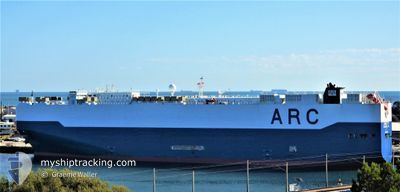
LIBERTY
Not available
Current Trip
| Time Travelled | 9 days |
|---|---|
| Remaining Time | 4 days |
| Distance Travelled | 3799.74 nm |
| Remaining Distance | 2082.40 nm |
| AVG Speed | 16.1 Knots |
| MAX Speed | 20.4 Knots |
| AVG Wind | 17.1 knots |
| MAX Wind | 27 knots |
| MIN Temp | 21.6°C / 70.88°F |
| MAX Temp | 28.7°C / 83.66°F |
| Draught | 9 m |
| Position Received | 5 d ago |
Current Position
| Longitude | -66.54471° |
|---|---|
| Latitude | 19.59879° |
| Status | Under way using engine |
| Speed | 17.1 Knots |
| Course | 92.8° |
| Area | North Atlantic Ocean |
| Station | T-AIS |
| Position Received | 5 d ago |
Info
Information
The current position of LIBERTY is in North Atlantic Ocean with coordinates 19.59879° / -66.54471° as reported on 2024-04-14 02:47 by AIS to our vessel tracker app. The vessel's current speed is 17.1 Knots and is heading at the port of PARANAGUA. The estimated time of arrival as calculated by MyShipTracking vessel tracking app is 2024-04-24 02:35 LT
The vessel LIBERTY (MMSI: 367125000) is a Not available It's sailing under the flag of [US] USA.
In this page you can find informations about the vessels current position, last detected port calls, and current voyage information. If the vessels is not in coverage by AIS you will find the latest position.
The current position of LIBERTY is detected by our AIS receivers and we are not responsible for the reliability of the data. The last position was recorded while the vessel was in Coverage by the Ais receivers of our vessel tracking app.
The current draught of LIBERTY as reported by AIS is 9 meters
Weather
| Temperature | 28.3°C / 82.94°F |
|---|---|
| Wind Speed | 13 knots |
| Direction | 54° NE |
| Pressure | 1010.2 hPa |
| Humidity | 79.8 % |
| Cloud Coverage | 100 % |
Featured Company
Last Port Calls
| Port | Arrival | Departure | Time In Port |
|---|---|---|---|
| 2024-04-08 10:42 | 2024-04-09 12:36 | 1 d | |
| 2024-04-05 02:20 | 2024-04-06 18:56 | 1 d | |
| 2024-03-31 00:50 | 2024-03-31 22:42 | 21 h | |
| 2024-03-21 21:37 | 2024-03-22 11:52 | 14 h | |
| 2024-03-17 07:23 | 2024-03-18 19:23 | 1 d | |
| 2024-03-13 04:49 | 2024-03-15 10:13 | 2 d | |
| 2024-02-13 17:50 | 2024-02-14 20:31 | 1 d | |
| 2024-02-10 23:06 | 2024-02-11 16:18 | 17 h | |
| 2024-02-08 08:12 | 2024-02-08 15:31 | 7 h | |
| 2024-02-06 06:23 | 2024-02-07 04:00 | 21 h |
Most Visited Ports (Last year)
| Port | Arrivals | |
|---|---|---|
| 5 | ||
| 4 | ||
| 3 | ||
| 3 | ||
| 3 | ||
| 3 |
Last Trips
| Origin | Departure | Destination | Arrival | Distance | |
|---|---|---|---|---|---|
| 2024-04-06 12:56 | 2024-04-08 05:42 | 638.77 nm | |||
| 2024-03-31 17:42 | 2024-04-04 20:20 | 1577.03 nm | |||
| 2024-03-22 08:52 | 2024-03-30 19:50 | 3233.36 nm | |||
| 2024-03-18 16:23 | 2024-03-21 18:37 | 1290.88 nm | |||
| 2024-03-15 07:13 | 2024-03-17 04:23 | 577.91 nm | |||
| 2024-02-15 04:31 | 2024-03-13 01:49 | 10981.87 nm | |||
| 2024-02-12 00:18 | 2024-02-14 01:50 | 727.01 nm | |||
| 2024-02-09 00:31 | 2024-02-11 07:06 | 792.67 nm | |||
| 2024-02-07 13:00 | 2024-02-08 17:12 | 470.10 nm | |||
| 2024-02-05 07:26 | 2024-02-06 15:23 | 495.40 nm |
Events
| Time | Event | Details | Position / Dest | Info |
|---|---|---|---|---|
| 2024-04-14 02:50 | Status Changed | Default Under way using engine |
19.59667 / -66.52834
BR PNG
|
Speed: 17.1 kn Course: 92.8° |
| 2024-04-14 02:47 | Status Changed | Under way using engine Default |
19.59879 / -66.54471
BR PNG
|
Speed: 17 kn Course: 92° |
| 2024-04-14 02:47 | OUT of Coverage |
19.59879 / -66.54471
North Atlantic Ocean
|
Speed: 17.1 kn Course: 92.8° |
|
| 2024-04-14 02:38 | IN Coverage |
19.59879 / -66.54471
North Atlantic Ocean
|
Speed: 17.1 kn Course: 92.8° |
|
| 2024-04-14 01:17 | Status Changed | Default Under way using engine |
19.60667 / -66.99167
BR PNG
|
Speed: 16.8 kn Course: 102.5° |
| 2024-04-14 01:12 | OUT of Coverage |
19.61184 / -67.01557
North Atlantic Ocean
|
Speed: 16.8 kn Course: 102.5° |
|
| 2024-04-13 23:33 | Change Sea Area | Puerto Rican part of the North Atlantic Ocean Dominican Republic part of the North Atlantic Ocean |
19.68105 / -67.49393
North Atlantic Ocean
|
Speed: 16.4 kn Course: 94.4° |
| 2024-04-13 23:33 | Status Changed | Under way using engine Default |
19.68105 / -67.49393
BR PNG
|
Speed: 16 kn Course: 99° |
| 2024-04-13 23:21 | IN Coverage |
19.68105 / -67.49393
North Atlantic Ocean
|
Speed: 16.4 kn Course: 94.4° |
|
| 2024-04-13 17:44 | OUT of Coverage |
19.78626 / -69.19899
North Atlantic Ocean
|
Speed: 16.5 kn Course: 94.8° |