
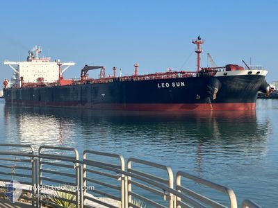
LEO SUN
Crude Oil Tanker
Current Trip
| Time Travelled | 5 days |
|---|---|
| Remaining Time | --- |
| Distance Travelled | 1235.67 nm |
| Remaining Distance | --- |
| AVG Speed | 9.8 Knots |
| MAX Speed | 15.1 Knots |
| AVG Wind | 13 knots |
| MAX Wind | 28.4 knots |
| MIN Temp | 7.6°C / 45.68°F |
| MAX Temp | 24.8°C / 76.64°F |
| Draught | 8.2 m |
| Position Received | 15 h, 19 m ago |
Current Position
| Longitude | -79.57987° |
|---|---|
| Latitude | 25.34456° |
| Status | Under way using engine |
| Speed | 11.1 Knots |
| Course | 168.2° |
| Area | North Atlantic Ocean |
| Station | T-AIS |
| Position Received | 15 h, 19 m ago |
Info
Information
The current position of LEO SUN is in North Atlantic Ocean with coordinates 25.34456° / -79.57987° as reported on 2024-04-18 17:26 by AIS to our vessel tracker app. The vessel's current speed is 11.1 Knots
The vessel LEO SUN (IMO: 9457608, MMSI: 636016127) is a Crude Oil Tanker that was built in 2011 ( 13 years old ). It's sailing under the flag of [LR] Liberia.
In this page you can find informations about the vessels current position, last detected port calls, and current voyage information. If the vessels is not in coverage by AIS you will find the latest position.
The current position of LEO SUN is detected by our AIS receivers and we are not responsible for the reliability of the data. The last position was recorded while the vessel was in Coverage by the Ais receivers of our vessel tracking app.
The current draught of LEO SUN as reported by AIS is 8.2 meters
Weather
| Temperature | 25.5°C / 77.9°F |
|---|---|
| Wind Speed | 16 knots |
| Direction | 99° E |
| Pressure | 1015.6 hPa |
| Humidity | 71.9 % |
| Cloud Coverage | 5 % |
Featured Company
Last Port Calls
| Port | Arrival | Departure | Time In Port |
|---|---|---|---|
| 2024-04-11 17:37 | 2024-04-13 10:37 | 1 d | |
| 2024-04-07 14:15 | 2024-04-07 23:31 | 9 h | |
| 2024-03-18 04:31 | 2024-03-19 18:44 | 1 d | |
| 2024-03-13 00:47 | 2024-03-16 05:00 | 3 d | |
| 2024-03-08 05:28 | 2024-03-09 00:00 | 18 h | |
| 2024-03-07 07:40 | 2024-03-08 05:11 | 21 h | |
| 2024-03-04 20:55 | 2024-03-06 03:38 | 1 d | |
| 2024-02-22 19:05 | 2024-02-23 21:41 | 1 d | |
| 2024-02-07 01:56 | 2024-02-08 12:30 | 1 d |
Most Visited Ports (Last year)
| Port | Arrivals | |
|---|---|---|
| 6 | ||
| 4 | ||
| 2 | ||
| 2 | ||
| 2 | ||
| 2 |
Last Trips
| Origin | Departure | Destination | Arrival | Distance | |
|---|---|---|---|---|---|
| 2024-04-07 19:31 | 2024-04-11 13:37 | 70.31 nm | |||
| 2024-03-19 19:44 | 2024-04-07 10:15 | 4836.77 nm | |||
| 2024-03-16 06:00 | 2024-03-18 05:31 | 531.88 nm | |||
| 2024-03-09 01:00 | 2024-03-13 01:47 | 37.94 nm | |||
| 2024-03-08 06:11 | 2024-03-08 06:28 | 1.79 nm | |||
| 2024-03-06 04:38 | 2024-03-07 08:40 | 270.86 nm | |||
| 2024-02-23 18:11 | 2024-03-04 21:55 | 2618.63 nm | |||
| 2024-02-08 12:30 | 2024-02-22 15:35 | 2104.75 nm | |||
| 2024-01-19 07:46 | 2024-02-07 01:56 | 4620.53 nm |
Events
| Time | Event | Details | Position / Dest | Info |
|---|---|---|---|---|
| 2024-04-18 17:38 | Status Changed | Default Under way using engine |
25.31342 / -79.57736
USNYC->BSFPO
|
Speed: 11.1 kn Course: 168.2° |
| 2024-04-18 17:26 | OUT of Coverage |
25.34456 / -79.57987
North Atlantic Ocean
USNYC->BSFPO
|
Speed: 11.1 kn Course: 168.2° |
|
| 2024-04-18 11:25 | Status Changed | Under way using engine Default |
26.40105 / -79.39617
USNYC->BSFPO
|
Speed: 11.7 kn Course: 181° |
| 2024-04-18 11:25 | IN Coverage |
26.40105 / -79.39617
North Atlantic Ocean
USNYC->BSFPO
|
Speed: 11.8 kn Course: 181.3° |
|
| 2024-04-18 05:18 | Status Changed | Default Under way using engine |
27.54438 / -79.30366
USNYC->BSFPO
|
Speed: 11.3 kn Course: 236.3° |
| 2024-04-18 05:10 | Status Changed | Under way using engine Default |
27.55735 / -79.28095
USNYC->BSFPO
|
Speed: 11.4 kn Course: 237° |
| 2024-04-18 05:10 | OUT of Coverage |
27.55735 / -79.28095
North Atlantic Ocean
USNYC->BSFPO
|
Speed: 11.3 kn Course: 236.3° |
|
| 2024-04-18 04:37 | Status Changed | Default Under way using engine |
27.61029 / -79.17759
USNYC->BSFPO
|
Speed: 11.8 kn Course: 244.1° |
| 2024-04-18 03:53 | Status Changed | Under way using engine Default |
27.66892 / -79.02355
USNYC->BSFPO
|
Speed: 12.3 kn Course: 252° |
| 2024-04-18 03:39 | IN Coverage |
27.66892 / -79.02355
North Atlantic Ocean
USNYC->BSFPO
|
Speed: 12.4 kn Course: 250.3° |