
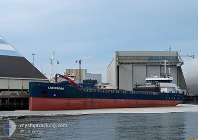
LARIXBORG
General Cargo
Current Trip
| Time Travelled | 1 day |
|---|---|
| Remaining Time | --- |
| Distance Travelled | 395.45 nm |
| Remaining Distance | --- |
| AVG Speed | 8.3 Knots |
| MAX Speed | 11.1 Knots |
| AVG Wind | 7.4 knots |
| MAX Wind | 17.1 knots |
| MIN Temp | 0.5°C / 32.9°F |
| MAX Temp | 8.2°C / 46.76°F |
| Draught | 4.5 m |
| Position Received | 1 m ago |
Current Position
| Longitude | 9.03972° |
|---|---|
| Latitude | 53.86652° |
| Status | Under way using engine |
| Speed | 9.4 Knots |
| Course | 244.3° |
| Area | North Sea |
| Station | T-AIS |
| Position Received | 1 m ago |
Info
Information
The current position of LARIXBORG is in North Sea with coordinates 53.86652° / 9.03972° as reported on 2024-04-25 15:00 by AIS to our vessel tracker app. The vessel's current speed is 9.4 Knots and is heading at the port of GOOLE. The estimated time of arrival as calculated by MyShipTracking vessel tracking app is 2024-04-27 12:00 LT
The vessel LARIXBORG (IMO: 9489546, MMSI: 246639000) is a General Cargo that was built in 2009 ( 15 years old ). It's sailing under the flag of [NL] Netherlands.
In this page you can find informations about the vessels current position, last detected port calls, and current voyage information. If the vessels is not in coverage by AIS you will find the latest position.
The current position of LARIXBORG is detected by our AIS receivers and we are not responsible for the reliability of the data. The last position was recorded while the vessel was in Coverage by the Ais receivers of our vessel tracking app.
The current draught of LARIXBORG as reported by AIS is 4.5 meters
Weather
| Temperature | 8.3°C / 46.94°F |
|---|---|
| Wind Speed | 7 knots |
| Direction | 273° W |
| Pressure | 1002.8 hPa |
| Humidity | 66.4 % |
| Cloud Coverage | 100 % |
Featured Company
Last Port Calls
| Port | Arrival | Departure | Time In Port |
|---|---|---|---|
| 2024-04-20 20:59 | 2024-04-23 18:27 | 2 d | |
| 2024-04-18 22:28 | 2024-04-20 09:26 | 1 d | |
| 2024-04-14 12:20 | 2024-04-15 03:14 | 14 h | |
| 2024-04-11 18:39 | 2024-04-14 12:13 | 2 d | |
| 2024-04-08 13:21 | 2024-04-11 15:29 | 3 d | |
| 2024-04-01 20:04 | 2024-04-04 18:27 | 2 d | |
| 2024-03-26 12:55 | 2024-04-01 15:19 | 6 d | |
| 2024-03-20 13:51 | 2024-03-22 00:45 | 1 d | |
| 2024-03-18 05:08 | 2024-03-18 05:58 | 50 m | |
| 2024-03-12 07:29 | 2024-03-13 15:24 | 1 d |
Most Visited Ports (Last year)
| Port | Arrivals | |
|---|---|---|
| 8 | ||
| 5 | ||
| 3 | ||
| 3 | ||
| 3 | ||
| 3 |
Last Trips
| Origin | Departure | Destination | Arrival | Distance | |
|---|---|---|---|---|---|
| 2024-04-20 12:26 | 2024-04-20 22:59 | 115.29 nm | |||
| 2024-04-15 05:14 | 2024-04-19 01:28 | 768.91 nm | |||
| 2024-04-14 14:13 | 2024-04-14 14:20 | 1.18 nm | |||
| 2024-04-11 17:29 | 2024-04-11 20:39 | 11.77 nm | |||
| 2024-04-04 20:27 | 2024-04-08 15:21 | 853.95 nm | |||
| 2024-04-01 17:19 | 2024-04-01 22:04 | 34.72 nm | |||
| 2024-03-22 01:45 | 2024-03-26 13:55 | 931.47 nm | |||
| 2024-03-18 06:58 | 2024-03-20 14:51 | 1.24 nm | |||
| 2024-03-13 15:24 | 2024-03-18 06:08 | 1024.93 nm | |||
| 2024-03-11 11:33 | 2024-03-12 07:29 | 142.64 nm |
Events
| Time | Event | Details | Position / Dest | Info |
|---|---|---|---|---|
| 2024-04-25 14:34 | START Moving | 0.91 nm, South West of BRUNSBUETTEL |
53.89243 / 9.14146
GOOLE
|
Speed: 4.9 kn Course: 228° |
| 2024-04-25 14:32 | Detected in Sea | German part of the North Sea |
53.89339 / 9.14321
North Sea
GOOLE
|
Speed: 2 kn Course: 226.1° |
| 2024-04-25 13:51 | STOP Moving | 0.8 nm, South West of BRUNSBUETTEL |
53.89375 / 9.14377
GOOLE
|
Speed: 0.2 kn Course: 230° |
| 2024-04-25 11:55 | Status Changed | Under way using engine Default |
54.05810 / 9.30873
GOOLE
|
Speed: 6.5 kn Course: 193° |
| 2024-04-25 11:32 | Status Changed | Default Under way using engine |
54.09775 / 9.32816
GOOLE
|
Speed: 6.5 kn Course: 191° |
| 2024-04-25 11:12 | Status Changed | Under way using engine Default |
54.13334 / 9.33438
GOOLE
|
Speed: 6.4 kn Course: 223° |
| 2024-04-25 11:08 | Status Changed | Default Under way using engine |
54.13938 / 9.34080
GOOLE
|
Speed: 6.7 kn Course: 238.4° |
| 2024-04-25 11:00 | Status Changed | Under way using engine Default |
54.14935 / 9.36213
GOOLE
|
Speed: 6.4 kn Course: 239° |
| 2024-04-25 10:52 | Status Changed | Default Under way using engine |
54.15609 / 9.38172
GOOLE
|
Speed: 6.7 kn Course: 248.1° |
| 2024-04-25 05:52 | START Moving | 1.46 nm, South West of STICKENHΟRN SPORT |
54.36620 / 10.13750
GOOLE
|
Speed: 4.6 kn Course: 283° |