
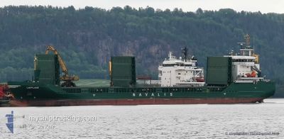
LAPPLAND
Cargo
Current Trip
KRISTIINANKAUXUNKI
| Time Travelled | 1 day |
|---|---|
| Remaining Time | --- |
| Distance Travelled | 330.18 nm |
| Remaining Distance | --- |
| AVG Speed | 10.8 Knots |
| MAX Speed | 12.6 Knots |
| AVG Wind | 13 knots |
| MAX Wind | 19.4 knots |
| MIN Temp | --- |
| MAX Temp | 3.6°C / 38.48°F |
| Draught | 4.7 m |
| Position Received | 6 m ago |
Current Position
| Longitude | 17.40364° |
|---|---|
| Latitude | 60.64744° |
| Status | Moored |
| Speed | |
| Course | 332° |
| Area | Gulf of Bothnia |
| Station | T-AIS |
| Position Received | 6 m ago |
Info
Information
The current position of LAPPLAND is in Gulf of Bothnia with coordinates 60.64744° / 17.40364° as reported on 2024-04-25 03:27 by AIS to our vessel tracker app. The vessel's current speed is 0 Knots
The vessel LAPPLAND (IMO: 9505132, MMSI: 255806291) is a Cargo It's sailing under the flag of [PT] Portugal.
In this page you can find informations about the vessels current position, last detected port calls, and current voyage information. If the vessels is not in coverage by AIS you will find the latest position.
The current position of LAPPLAND is detected by our AIS receivers and we are not responsible for the reliability of the data. The last position was recorded while the vessel was in Coverage by the Ais receivers of our vessel tracking app.
The current draught of LAPPLAND as reported by AIS is 4.7 meters
Weather
| Temperature | 1.4°C / 34.52°F |
|---|---|
| Wind Speed | 4 knots |
| Direction | 160° SSE |
| Pressure | 1008.9 hPa |
| Humidity | 88.3 % |
| Cloud Coverage | 100 % |
Featured Company
Last Port Calls
| Port | Arrival | Departure | Time In Port |
|---|---|---|---|
| 2024-04-21 15:13 | 2024-04-23 16:52 | 2 d | |
| 2024-04-19 04:15 | 2024-04-20 12:47 | 1 d | |
| 2024-04-16 17:20 | 2024-04-17 16:39 | 23 h | |
| 2024-04-14 08:03 | 2024-04-15 18:02 | 1 d | |
| 2024-04-12 05:59 | 2024-04-14 02:16 | 1 d | |
| 2024-04-09 09:41 | 2024-04-11 16:34 | 2 d | |
| 2024-04-07 04:42 | 2024-04-07 23:53 | 19 h | |
| 2024-04-04 17:21 | 2024-04-06 01:01 | 1 d | |
| 2024-04-01 13:17 | 2024-04-03 01:17 | 1 d | |
| 2024-03-27 20:21 | 2024-03-28 20:16 | 23 h |
Last Trips
| Origin | Departure | Destination | Arrival | Distance | |
|---|---|---|---|---|---|
| 2024-04-20 15:47 | 2024-04-21 18:13 | 278.22 nm | |||
| 2024-04-17 19:39 | 2024-04-19 07:15 | 352.18 nm | |||
| 2024-04-15 21:02 | 2024-04-16 20:20 | 257.34 nm | |||
| 2024-04-14 05:16 | 2024-04-14 11:03 | 67.46 nm | |||
| 2024-04-11 19:34 | 2024-04-12 08:59 | 80.55 nm | |||
| 2024-04-08 02:53 | 2024-04-09 12:41 | 372.07 nm | |||
| 2024-04-06 04:01 | 2024-04-07 07:42 | 281.61 nm | |||
| 2024-04-03 04:17 | 2024-04-04 20:21 | 359.71 nm | |||
| 2024-03-28 22:16 | 2024-04-01 16:17 | 661.28 nm | |||
| 2024-03-23 10:56 | 2024-03-27 22:21 | 657.47 nm |
Events
| Time | Event | Details | Position / Dest | Info |
|---|---|---|---|---|
| 2024-04-25 00:12 | Status Changed | Moored Default |
60.64743 / 17.40365
KRISTIINANKAUXUNKI
|
Speed: Course: 332° |
| 2024-04-25 00:06 | Status Changed | Default Moored |
60.64745 / 17.40365
KRISTIINANKAUXUNKI
|
Speed: Course: 332° |
| 2024-04-24 22:21 | Draught Changed | 4.7 6.5 |
60.64746 / 17.40364
KRISTIINANKAUXUNKI
|
Speed: Course: 331° |
| 2024-04-24 22:21 | Destination Changed | KRISTIINANKAUXUNKI KRISTIINANKAUPUNKI |
60.64746 / 17.40364
KRISTIINANKAUXUNKI
|
Speed: Course: 331° |
| 2024-04-24 22:21 | ETA Changed | 2024/04/26 05:00 2024/04/24 20:15 |
60.64746 / 17.40364
KRISTIINANKAUXUNKI
|
Speed: Course: 331° |
| 2024-04-24 21:56 | Destination Changed | KRISTIINANKAUPUNKI SKUTSKAER PEC10-0101 |
60.64745 / 17.40364
KRISTIINANKAUPUNKI
|
Speed: Course: 332° |
| 2024-04-24 21:27 | Status Changed | Moored Under way using engine |
60.64744 / 17.40365
SKUTSKAER PEC10-0101
|
Speed: Course: 333° |
| 2024-04-24 21:17 | STOP Moving | 6.75 nm, East of GAVLE |
60.64741 / 17.40355
SKUTSKAER PEC10-0101
|
Speed: 0.1 kn Course: 330° |
| 2024-04-24 19:11 | Status Changed | Under way using engine Default |
60.70491 / 17.94457
SKUTSKAER PEC10-0101
|
Speed: 11.8 kn Course: 285° |
| 2024-04-24 19:04 | IN Coverage |
60.70630 / 17.93378
Gulf of Bothnia
SKUTSKAER PEC10-0101
|
Speed: 11.8 kn Course: 284.5° |