
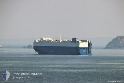
GOLD STAR
Vehicles Carrier
Current Trip
| Time Travelled | 41 days |
|---|---|
| Remaining Time | 27 mins |
| Distance Travelled | 19744.39 nm |
| Remaining Distance | 48.97 nm |
| AVG Speed | 14.8 Knots |
| MAX Speed | 19 Knots |
| AVG Wind | 10.8 knots |
| MAX Wind | 24 knots |
| MIN Temp | 6.3°C / 43.34°F |
| MAX Temp | 29.7°C / 85.46°F |
| Draught | 9 m |
| Position Received | 1 m ago |
Current Position
| Longitude | 35.49081° |
|---|---|
| Latitude | 33.81826° |
| Status | Under way using engine |
| Speed | |
| Course | 41° |
| Area | Mediterranean Sea - Eastern Basin |
| Station | T-AIS |
| Position Received | 1 m ago |
Info
Information
The current position of GOLD STAR is in Mediterranean Sea - Eastern Basin with coordinates 33.81826° / 35.49081° as reported on 2024-04-23 16:00 by AIS to our vessel tracker app. The vessel's current speed is 0 Knots and is heading at the port of HAIFA. The estimated time of arrival as calculated by MyShipTracking vessel tracking app is 2024-04-23 16:29 LT
The vessel GOLD STAR (IMO: 9325178, MMSI: 636015991) is a Vehicles Carrier that was built in 2007 ( 17 years old ). It's sailing under the flag of [LR] Liberia.
In this page you can find informations about the vessels current position, last detected port calls, and current voyage information. If the vessels is not in coverage by AIS you will find the latest position.
The current position of GOLD STAR is detected by our AIS receivers and we are not responsible for the reliability of the data. The last position was recorded while the vessel was in Coverage by the Ais receivers of our vessel tracking app.
The current draught of GOLD STAR as reported by AIS is 9 meters
Weather
| Temperature | 24.8°C / 76.64°F |
|---|---|
| Wind Speed | 6 knots |
| Direction | 11° N |
| Pressure | 1015.5 hPa |
| Humidity | 45.4 % |
| Cloud Coverage | 9 % |
Featured Company
Events
| Time | Event | Details | Position / Dest | Info |
|---|---|---|---|---|
| 2024-04-23 14:26 | IN Coverage |
33.81827 / 35.49080
Mediterranean Sea - Eastern Basin
ILHFA
|
Speed: Course: 98° |
|
| 2024-04-23 12:17 | OUT of Coverage |
33.00317 / 34.07636
Mediterranean Sea - Eastern Basin
ILHFA
|
Speed: 11.5 kn Course: 105.8° |
|
| 2024-04-23 12:07 | Status Changed | Under way using engine Default |
33.00962 / 34.03963
ILHFA
|
Speed: 11.5 kn Course: 96° |
| 2024-04-23 11:32 | Status Changed | Default Under way using engine |
33.02090 / 33.90699
ILHFA
|
Speed: 11.5 kn Course: 92.9° |
| 2024-04-23 11:12 | Status Changed | Under way using engine Default |
33.02734 / 33.83070
ILHFA
|
Speed: 11.7 kn Course: 89° |
| 2024-04-23 10:32 | Status Changed | Default Under way using engine |
33.03812 / 33.67445
ILHFA
|
Speed: 11.3 kn Course: 95.6° |
| 2024-04-23 09:03 | Status Changed | Under way using engine Default |
33.07420 / 33.33075
ILHFA
|
Speed: 11.9 kn Course: 97° |
| 2024-04-23 08:57 | Status Changed | Default Under way using engine |
33.07671 / 33.30528
ILHFA
|
Speed: 11.9 kn Course: 96.9° |
| 2024-04-23 08:55 | Status Changed | Under way using engine Default |
33.07726 / 33.30000
ILHFA
|
Speed: 12 kn Course: 97° |
| 2024-04-23 08:55 | Detected in Sea | Israeli part of the Mediterranean Sea - Eastern Basin |
33.07726 / 33.30000
Mediterranean Sea - Eastern Basin
ILHFA
|
Speed: 11.9 kn Course: 96.9° |