
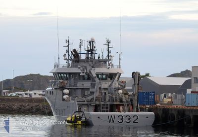
KV HEIMDAL
Patrol Vessel
Current Trip
COASTGUARD
| Time Travelled | 1 day |
|---|---|
| Remaining Time | --- |
| Distance Travelled | 165.98 nm |
| Remaining Distance | --- |
| AVG Speed | 10.8 Knots |
| MAX Speed | 12.9 Knots |
| AVG Wind | 12.8 knots |
| MAX Wind | 23.2 knots |
| MIN Temp | 0.7°C / 33.26°F |
| MAX Temp | 6.5°C / 43.7°F |
| Draught | 5 m |
| Position Received | 2 m ago |
Current Position
| Longitude | --- |
|---|---|
| Latitude | --- |
| Status | Under way using engine |
| Speed | 10.8 Knots |
| Course | 204.9° |
| Area | Norwegian Sea |
| Station | T-AIS |
| Position Received | 2 m ago |
Info
Information
The current position of KV HEIMDAL is in Norwegian Sea with coordinates 66.83580° / 13.27447° as reported on 2025-12-07 13:05 by AIS to our vessel tracker app. The vessel's current speed is 10.8 Knots
The vessel KV HEIMDAL (IMO: 9353345, MMSI: 257079200) is a Patrol Vessel that was built in 2007 ( 18 years old ). It's sailing under the flag of [NO] Norway.
In this page you can find informations about the vessels current position, last detected port calls, and current voyage information. If the vessels is not in coverage by AIS you will find the latest position.
The current position of KV HEIMDAL is detected by our AIS receivers and we are not responsible for the reliability of the data. The last position was recorded while the vessel was in Coverage by the Ais receivers of our vessel tracking app.
The current draught of KV HEIMDAL as reported by AIS is 5 meters
Weather
| Temperature | 4°C / 39.2°F |
|---|---|
| Wind Speed | 12 knots |
| Direction | 119° ESE |
| Pressure | 1010.7 hPa |
| Humidity | 62.1 % |
| Cloud Coverage | 100 % |
Featured Company
Last Port Calls
| Port | Arrival | Departure | Time In Port |
|---|---|---|---|
| 2025-12-05 22:12 | 2025-12-06 08:06 | 9 h | |
| 2025-12-02 18:35 | 2025-12-04 08:34 | 1 d | |
| 2025-12-01 11:03 | 2025-12-01 11:40 | 36 m | |
| 2025-11-29 16:42 | 2025-11-29 16:58 | 16 m | |
| 2025-11-28 13:19 | 2025-11-29 12:33 | 23 h | |
| 2025-11-23 18:08 | 2025-11-28 09:39 | 4 d | |
| 2025-11-21 21:05 | 2025-11-22 08:17 | 11 h | |
| 2025-11-21 20:51 | 2025-11-21 20:55 | 3 m | |
| 2025-11-16 20:45 | 2025-11-18 16:48 | 1 d | |
| 2025-11-15 16:55 | 2025-11-16 06:51 | 13 h |
Last Trips
| Origin | Departure | Destination | Arrival | Distance | |
|---|---|---|---|---|---|
| 2025-12-04 08:34 | 2025-12-05 22:12 | 109.71 nm | |||
| 2025-12-01 11:40 | 2025-12-02 18:35 | 140.38 nm | |||
| 2025-11-29 16:58 | 2025-12-01 11:03 | 191.89 nm | |||
| 2025-11-29 12:33 | 2025-11-29 16:42 | 30.29 nm | |||
| 2025-11-28 09:39 | 2025-11-28 13:19 | 18.09 nm | |||
| 2025-11-22 08:17 | 2025-11-23 18:08 | 175.66 nm | |||
| 2025-11-21 20:55 | 2025-11-21 21:05 | 1.93 nm | |||
| 2025-11-18 16:48 | 2025-11-21 20:51 | 447.32 nm | |||
| 2025-11-16 06:51 | 2025-11-16 20:45 | 123.25 nm | |||
| 2025-10-28 09:51 | 2025-11-15 16:55 | 1020.66 nm |
Events
| Time | Event | Details | Position / Dest | Info |
|---|---|---|---|---|
| 2025-12-07 08:56 | START Moving | 4.81 nm, South of SELSOYA |
66.50064 / 13.00044
COASTGUARD
|
Speed: 11.8 kn Course: 297.6° |
| 2025-12-07 08:33 | Status Changed | Under way using engine Default |
66.49793 / 13.01562
COASTGUARD
|
Speed: 0.7 kn Course: 99° |
| 2025-12-07 08:25 | Status Changed | Default At anchor |
66.49812 / 13.01610
COASTGUARD
|
Speed: 0.3 kn Course: 153° |
| 2025-12-07 08:16 | Status Changed | At anchor Default |
66.49796 / 13.01564
COASTGUARD
|
Speed: Course: -1° |
| 2025-12-07 08:11 | Status Changed | Default At anchor |
66.49834 / 13.01500
COASTGUARD
|
Speed: 0.4 kn Course: 161° |
| 2025-12-07 05:46 | Status Changed | At anchor Default |
66.49774 / 13.01548
COASTGUARD
|
Speed: Course: -1° |
| 2025-12-07 05:44 | Status Changed | Default At anchor |
66.49834 / 13.01500
COASTGUARD
|
Speed: 0.1 kn Course: 94° |
| 2025-12-06 18:21 | Status Changed | At anchor Default |
66.49624 / 13.01614
COASTGUARD
|
Speed: Course: -1° |
| 2025-12-06 18:20 | Status Changed | Default At anchor |
66.49667 / 13.01667
COASTGUARD
|
Speed: Course: 40° |
| 2025-12-06 17:58 | STOP Moving | 5.1 nm, South of SELSOYA |
66.49663 / 13.01555
COASTGUARD
|
Speed: 0.1 kn Course: 22° |