
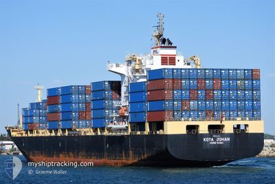
KOTA JOHAN
Cargo
Current Trip
| Time Travelled | 10 h, 27 mins |
|---|---|
| Remaining Time | 2 days |
| Distance Travelled | 147.36 nm |
| Remaining Distance | 809.93 nm |
| AVG Speed | 14.1 Knots |
| MAX Speed | 15 Knots |
| AVG Wind | 8.7 knots |
| MAX Wind | 13.8 knots |
| MIN Temp | 28°C / 82.4°F |
| MAX Temp | 29.1°C / 84.38°F |
| Draught | 9.6 m |
| Position Received | 28 d ago |
Current Position
| Longitude | 103.55720° |
|---|---|
| Latitude | 1.20454° |
| Status | Under way using engine |
| Speed | 15.1 Knots |
| Course | 281.4° |
| Area | Singapore Strait |
| Station | T-AIS |
| Position Received | 28 d ago |
Info
Information
The current position of KOTA JOHAN is in Singapore Strait with coordinates 1.20454° / 103.55720° as reported on 2024-03-22 02:37 by AIS to our vessel tracker app. The vessel's current speed is 15.1 Knots and is heading at the port of TOAMASINA. The estimated time of arrival as calculated by MyShipTracking vessel tracking app is 2024-04-22 03:36 LT
The vessel KOTA JOHAN (IMO: 9641003, MMSI: 477021100) is a Cargo It's sailing under the flag of [HK] Hong Kong.
In this page you can find informations about the vessels current position, last detected port calls, and current voyage information. If the vessels is not in coverage by AIS you will find the latest position.
The current position of KOTA JOHAN is detected by our AIS receivers and we are not responsible for the reliability of the data. The last position was recorded while the vessel was in Coverage by the Ais receivers of our vessel tracking app.
The current draught of KOTA JOHAN as reported by AIS is 9.6 meters
Weather
| Temperature | 28.2°C / 82.76°F |
|---|---|
| Wind Speed | 6 knots |
| Direction | 136° SE |
| Pressure | 1012.6 hPa |
| Humidity | 69.7 % |
| Cloud Coverage | 83 % |
Featured Company
Last Port Calls
| Port | Arrival | Departure | Time In Port |
|---|---|---|---|
| 2024-04-18 12:46 | 2024-04-19 07:45 | 18 h | |
| 2024-04-14 19:12 | 2024-04-16 16:42 | 1 d | |
| 2024-04-12 13:04 | 2024-04-13 04:05 | 15 h | |
| 2024-04-03 11:26 | 2024-04-04 02:43 | 15 h | |
| 2024-03-20 20:43 | 2024-03-22 00:20 | 1 d | |
| 2024-03-04 06:35 | |||
| 2024-02-18 19:22 | 2024-02-19 12:32 | 17 h | |
| 2024-02-11 09:50 | 2024-02-12 09:54 | 1 d | |
| 2024-02-03 01:25 | 2024-02-04 03:56 | 1 d |
Last Trips
| Origin | Departure | Destination | Arrival | Distance | |
|---|---|---|---|---|---|
| 2024-04-16 18:42 | 2024-04-18 14:46 | 532.07 nm | |||
| 2024-04-13 06:05 | 2024-04-14 21:12 | 498.03 nm | |||
| 2024-04-04 05:43 | 2024-04-12 15:04 | 1297.70 nm | |||
| 2024-03-22 08:20 | 2024-04-03 14:26 | 3747.31 nm | |||
| 2024-02-19 20:32 | 2024-03-04 08:35 | 4552.01 nm | |||
| 2024-02-12 17:54 | 2024-02-19 03:22 | 2229.38 nm | |||
| 2024-02-04 11:56 | 2024-02-11 17:50 | 2291.98 nm | |||
| 2024-01-21 12:26 | 2024-02-03 09:25 | 4567.64 nm |
Events
| Time | Event | Details | Position / Dest | Info |
|---|---|---|---|---|
| 2024-04-19 07:45 | PORT DEPARTURE |
|
-14.43333 / 40.67166
MG TMM
|
Speed: Course: 47° |
| 2024-04-18 12:47 | STOP Moving |
-14.54077 / 40.66540
[MZ] NACALA PORTO
|
Speed: Course: 48° |
|
| 2024-04-18 12:46 | PORT ARRIVAL |
|
-14.54077 / 40.66540
[MZ] NACALA PORTO
|
Speed: 0.9 kn Course: 73° |
| 2024-04-16 16:42 | PORT DEPARTURE |
|
-19.82833 / 34.82834
MG TMM
|
Speed: 5 kn Course: 192° |
| 2024-04-16 16:37 | START Moving |
-19.82180 / 34.83178
[MZ] BEIRA
|
Speed: 5 kn Course: 192° |
|
| 2024-04-14 19:12 | STOP Moving |
-19.81667 / 34.83333
[MZ] BEIRA
|
Speed: Course: -1° |
|
| 2024-04-14 19:12 | PORT ARRIVAL |
|
-19.81667 / 34.83333
[MZ] BEIRA
|
Speed: 1 kn Course: -1° |
| 2024-04-14 17:12 | START Moving | 11.16 nm, South East of BEIRA |
-19.90667 / 35.00500
MG TMM
|
Speed: 5 kn Course: 308° |
| 2024-04-14 16:33 | STOP Moving | 11.8 nm, South East of BEIRA |
-19.91167 / 35.01500
MG TMM
|
Speed: Course: -1° |
| 2024-04-13 04:05 | PORT DEPARTURE |
|
-25.98261 / 32.57167
MG TMM
|
Speed: 7.5 kn Course: 132° |