
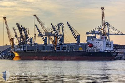
KINGFISHER D
Bulk Carrier
Current Trip
| Time Travelled | 3 days |
|---|---|
| Remaining Time | --- |
| Distance Travelled | 408.23 nm |
| Remaining Distance | --- |
| AVG Speed | 9.3 Knots |
| MAX Speed | 9.3 Knots |
| AVG Wind | 9.8 knots |
| MAX Wind | 16 knots |
| MIN Temp | 11.2°C / 52.16°F |
| MAX Temp | 25.9°C / 78.62°F |
| Draught | 9.9 m |
| Position Received | 1 m ago |
Current Position
| Longitude | 29.13124° |
|---|---|
| Latitude | 41.25589° |
| Status | Under way using engine |
| Speed | 6.6 Knots |
| Course | 186.8° |
| Area | Black Sea |
| Station | T-AIS |
| Position Received | 1 m ago |
Info
Information
The current position of KINGFISHER D is in Black Sea with coordinates 41.25589° / 29.13124° as reported on 2024-04-19 17:25 by AIS to our vessel tracker app. The vessel's current speed is 6.6 Knots and is heading at the port of SFAX. The estimated time of arrival as calculated by MyShipTracking vessel tracking app is 2024-04-22 16:00 LT
The vessel KINGFISHER D (IMO: 9238117, MMSI: 538003253) is a Bulk Carrier that was built in 2002 ( 22 years old ). It's sailing under the flag of [MH] Marshall Is.
In this page you can find informations about the vessels current position, last detected port calls, and current voyage information. If the vessels is not in coverage by AIS you will find the latest position.
The current position of KINGFISHER D is detected by our AIS receivers and we are not responsible for the reliability of the data. The last position was recorded while the vessel was in Coverage by the Ais receivers of our vessel tracking app.
The current draught of KINGFISHER D as reported by AIS is 9.9 meters
Weather
| Temperature | 11.7°C / 53.06°F |
|---|---|
| Wind Speed | 13 knots |
| Direction | 74° ENE |
| Pressure | 1011.1 hPa |
| Humidity | 87.9 % |
| Cloud Coverage | 100 % |
Featured Company
Events
| Time | Event | Details | Position / Dest | Info |
|---|---|---|---|---|
| 2024-04-19 15:51 | START Moving | 10.66 nm, North of RUMELI FENERI |
41.40288 / 29.17534
SFAX
|
Speed: 5.7 kn Course: 207.8° |
| 2024-04-19 15:35 | Status Changed | Under way using engine Not under command |
41.41281 / 29.17573
SFAX
|
Speed: Course: 123° |
| 2024-04-19 12:49 | STOP Moving | 10.81 nm, North of RUMELI FENERI |
41.40461 / 29.17925
SFAX
|
Speed: 0.1 kn Course: 147° |
| 2024-04-19 11:17 | ETA Changed | 2024/04/22 16:00 2024/04/22 01:00 |
41.39431 / 29.19097
SFAX
|
Speed: 0.6 kn Course: 141° |
| 2024-04-18 22:19 | IN Coverage |
41.49262 / 29.24256
Black Sea
SFAX
|
Speed: 0.8 kn Course: 129.6° |
|
| 2024-04-18 15:58 | OUT of Coverage |
41.49493 / 29.10079
Black Sea
SFAX
|
Speed: 2.1 kn Course: 183.7° |
|
| 2024-04-18 15:51 | Status Changed | Under way using engine Not under command |
41.49650 / 29.10329
SFAX
|
Speed: 0.1 kn Course: 230° |
| 2024-04-18 15:44 | STOP Moving | 15.89 nm, North of RUMELI FENERI |
41.49617 / 29.10351
SFAX
|
Speed: 0.2 kn Course: 214° |
| 2024-04-18 13:23 | Status Changed | Not under command Default |
41.49582 / 29.12437
SFAX
|
Speed: 0.7 kn Course: 88° |
| 2024-04-18 13:08 | IN Coverage |
41.49582 / 29.12437
Black Sea
SFAX
|
Speed: 0.6 kn Course: 250.1° |