
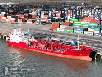
KEY NORTH
Oil/Chemical Tanker
Current Trip
| Time Travelled | 12 h, 45 mins |
|---|---|
| Remaining Time | 20 h, 34 mins |
| Distance Travelled | 160.15 nm |
| Remaining Distance | 258.97 nm |
| AVG Speed | 12.8 Knots |
| MAX Speed | 14.4 Knots |
| AVG Wind | 10.4 knots |
| MAX Wind | 16.3 knots |
| MIN Temp | 6.3°C / 43.34°F |
| MAX Temp | 7°C / 44.6°F |
| Draught | 5.6 m |
| Position Received | Now |
Current Position
| Longitude | 4.25052° |
|---|---|
| Latitude | 61.13262° |
| Status | Under way using engine |
| Speed | 13.2 Knots |
| Course | 2.3° |
| Area | Norwegian Sea |
| Station | T-AIS |
| Position Received | Now |
Info
Information
The current position of KEY NORTH is in Norwegian Sea with coordinates 61.13262° / 4.25052° as reported on 2024-04-16 04:45 by AIS to our vessel tracker app. The vessel's current speed is 13.2 Knots and is heading at the port of TRONDHEIM. The estimated time of arrival as calculated by MyShipTracking vessel tracking app is 2024-04-17 01:20 LT
The vessel KEY NORTH (IMO: 9020417, MMSI: 236669000) is a Oil/Chemical Tanker that was built in 1992 ( 32 years old ). It's sailing under the flag of [GI] Gibraltar.
In this page you can find informations about the vessels current position, last detected port calls, and current voyage information. If the vessels is not in coverage by AIS you will find the latest position.
The current position of KEY NORTH is detected by our AIS receivers and we are not responsible for the reliability of the data. The last position was recorded while the vessel was in Coverage by the Ais receivers of our vessel tracking app.
The current draught of KEY NORTH as reported by AIS is 5.6 meters
Weather
| Temperature | 6.4°C / 43.52°F |
|---|---|
| Wind Speed | 6 knots |
| Direction | 35° NE |
| Pressure | 1002.7 hPa |
| Humidity | 72.9 % |
| Cloud Coverage | 100 % |
Featured Company
Last Port Calls
| Port | Arrival | Departure | Time In Port |
|---|---|---|---|
| 2024-04-15 04:38 | 2024-04-15 16:01 | 11 h | |
| 2024-04-14 23:05 | 2024-04-15 04:09 | 5 h | |
| 2024-04-13 05:10 | 2024-04-13 18:07 | 12 h | |
| 2024-04-10 08:34 | 2024-04-11 05:32 | 20 h | |
| 2024-04-06 03:43 | 2024-04-06 19:54 | 16 h | |
| 2024-04-01 09:37 | 2024-04-02 19:25 | 1 d | |
| 2024-03-28 12:13 | 2024-03-30 03:22 | 1 d | |
| 2024-03-25 08:51 | 2024-03-25 22:19 | 13 h | |
| 2024-03-24 06:47 | 2024-03-24 14:13 | 7 h | |
| 2024-03-21 17:11 | 2024-03-21 22:35 | 5 h |
Last Trips
| Origin | Departure | Destination | Arrival | Distance | |
|---|---|---|---|---|---|
| 2024-04-15 06:09 | 2024-04-15 06:38 | 0.58 nm | |||
| 2024-04-13 20:07 | 2024-04-15 01:05 | 275.41 nm | |||
| 2024-04-11 07:32 | 2024-04-13 07:10 | 466.17 nm | |||
| 2024-04-06 21:54 | 2024-04-10 10:34 | 315.87 nm | |||
| 2024-04-02 21:25 | 2024-04-06 05:43 | 514.20 nm | |||
| 2024-03-30 04:22 | 2024-04-01 11:37 | 540.22 nm | |||
| 2024-03-25 23:19 | 2024-03-28 13:13 | 662.04 nm | |||
| 2024-03-24 15:13 | 2024-03-25 09:51 | 211.54 nm | |||
| 2024-03-21 23:35 | 2024-03-24 07:47 | 529.43 nm | |||
| 2024-03-21 17:02 | 2024-03-21 18:11 | 4.13 nm |
Events
| Time | Event | Details | Position / Dest | Info |
|---|---|---|---|---|
| 2024-04-16 04:08 | Change Sea Area | Norwegian part of the Norwegian Sea Norwegian part of the North Sea |
61.00235 / 4.24577
Norwegian Sea
NO TRD
|
Speed: 12.4 kn Course: 359.7° |
| 2024-04-15 16:01 | PORT DEPARTURE |
|
58.97232 / 5.76379
NO TRD
|
Speed: 5.1 kn Course: 53° |
| 2024-04-15 16:00 | START Moving |
58.97213 / 5.76088
[NO] STAVANGER
|
Speed: 3.3 kn Course: 104° |
|
| 2024-04-15 15:41 | Status Changed | Under way using engine Moored |
58.97203 / 5.75531
[NO] STAVANGER
|
Speed: Course: 194° |
| 2024-04-15 15:41 | Draught Changed | 5.6 5.1 |
58.97203 / 5.75536
[NO] STAVANGER
|
Speed: Course: 194° |
| 2024-04-15 12:49 | ETA Changed | 2024/04/17 06:00 2024/04/17 18:00 |
58.97205 / 5.75531
[NO] STAVANGER
|
Speed: Course: 194° |
| 2024-04-15 12:33 | Destination Changed | NO TRD NO AES |
58.97201 / 5.75536
[NO] STAVANGER
|
Speed: Course: 195° |
| 2024-04-15 12:33 | ETA Changed | 2024/04/17 18:00 2024/04/16 18:00 |
58.97201 / 5.75536
[NO] STAVANGER
|
Speed: Course: 195° |
| 2024-04-15 10:34 | Destination Changed | NO AES NO SVG |
58.97206 / 5.75537
[NO] STAVANGER
|
Speed: Course: 194° |
| 2024-04-15 10:31 | ETA Changed | 2024/04/16 18:00 2024/04/14 23:35 |
58.97206 / 5.75537
[NO] STAVANGER
|
Speed: Course: 194° |