
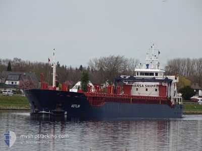
KETLIN
General Cargo
Current Trip
| Time Travelled | 7 days |
|---|---|
| Remaining Time | 1 h, 58 mins |
| Distance Travelled | 1334.31 nm |
| Remaining Distance | 24.18 nm |
| AVG Speed | 10 Knots |
| MAX Speed | 13.3 Knots |
| AVG Wind | 11.9 knots |
| MAX Wind | 20 knots |
| MIN Temp | 1.3°C / 34.34°F |
| MAX Temp | 8.4°C / 47.12°F |
| Draught | 4.6 m |
| Position Received | 1 m ago |
Current Position
| Longitude | 18.96733° |
|---|---|
| Latitude | 60.10883° |
| Status | Under way using engine |
| Speed | 11.2 Knots |
| Course | 301.8° |
| Area | Gulf of Bothnia |
| Station | T-AIS |
| Position Received | 1 m ago |
Info
Information
The current position of KETLIN is in Gulf of Bothnia with coordinates 60.10883° / 18.96733° as reported on 2024-04-25 06:36 by AIS to our vessel tracker app. The vessel's current speed is 11.2 Knots and is heading at the port of HARGSHAMN. The estimated time of arrival as calculated by MyShipTracking vessel tracking app is 2024-04-25 08:35 LT
The vessel KETLIN (IMO: 9342152, MMSI: 248622000) is a General Cargo that was built in 2006 ( 18 years old ). It's sailing under the flag of [MT] Malta.
In this page you can find informations about the vessels current position, last detected port calls, and current voyage information. If the vessels is not in coverage by AIS you will find the latest position.
The current position of KETLIN is detected by our AIS receivers and we are not responsible for the reliability of the data. The last position was recorded while the vessel was in Coverage by the Ais receivers of our vessel tracking app.
The current draught of KETLIN as reported by AIS is 4.6 meters
Weather
| Temperature | 1.3°C / 34.34°F |
|---|---|
| Wind Speed | 10 knots |
| Direction | 40° NE |
| Pressure | 1007.9 hPa |
| Humidity | 99.6 % |
| Cloud Coverage | 100 % |
Featured Company
Last Port Calls
| Port | Arrival | Departure | Time In Port |
|---|---|---|---|
| 2024-04-14 06:35 | 2024-04-17 08:58 | 3 d | |
| 2024-04-02 08:09 | 2024-04-08 16:27 | 6 d | |
| 2024-03-24 00:03 | 2024-04-01 11:31 | 8 d | |
| 2024-03-12 14:51 | 2024-03-14 20:34 | 2 d | |
| 2024-03-05 07:38 | 2024-03-08 16:23 | 3 d | |
| 2024-02-26 12:31 | 2024-03-01 23:21 | 4 d | |
| 2024-02-16 13:49 | 2024-02-18 10:27 | 1 d | |
| 2024-02-14 06:21 | 2024-02-14 23:23 | 17 h | |
| 2024-02-10 23:05 | 2024-02-13 16:00 | 2 d | |
| 2024-02-02 05:03 | 2024-02-10 10:20 | 8 d |
Last Trips
| Origin | Departure | Destination | Arrival | Distance | |
|---|---|---|---|---|---|
| 2024-04-08 17:27 | 2024-04-14 08:35 | 951.23 nm | |||
| 2024-04-01 13:31 | 2024-04-02 09:09 | 126.40 nm | |||
| 2024-03-14 23:34 | 2024-03-24 01:03 | 1972.18 nm | |||
| 2024-03-08 17:23 | 2024-03-12 17:51 | 702.99 nm | |||
| 2024-03-02 02:21 | 2024-03-05 08:38 | 701.85 nm | |||
| 2024-02-18 12:27 | 2024-02-26 15:31 | 490.43 nm | |||
| 2024-02-15 00:23 | 2024-02-16 15:49 | 375.11 nm | |||
| 2024-02-13 17:00 | 2024-02-14 07:21 | 137.68 nm | |||
| 2024-02-10 11:20 | 2024-02-11 00:05 | 131.27 nm | |||
| 2024-02-01 18:40 | 2024-02-02 06:03 | 110.19 nm |
Events
| Time | Event | Details | Position / Dest | Info |
|---|---|---|---|---|
| 2024-04-25 04:41 | Detected in Sea | Swedish part of the Gulf of Bothnia |
59.88674 / 19.51714
Gulf of Bothnia
SEHAN
|
Speed: 10.6 kn Course: 309° |
| 2024-04-25 03:53 | Change Sea Area | Finnish part of the Gulf of Bothnia Finnish part of the Baltic Sea |
59.79323 / 19.73497
Gulf of Bothnia
SEHAN
|
Speed: 10.9 kn Course: 316.9° |
| 2024-04-25 02:35 | Status Changed | Under way using engine Default |
59.62516 / 20.05456
SEHAN
|
Speed: 10.8 kn Course: 318° |
| 2024-04-25 02:33 | Status Changed | Default Under way using engine |
59.61929 / 20.06533
SEHAN
|
Speed: 10.7 kn Course: 317.1° |
| 2024-04-25 02:14 | Status Changed | Under way using engine Default |
59.57989 / 20.13878
SEHAN
|
Speed: 10.5 kn Course: 314° |
| 2024-04-25 02:12 | Status Changed | Default Under way using engine |
59.57566 / 20.14695
SEHAN
|
Speed: 10.4 kn Course: 358.8° |
| 2024-04-25 01:54 | Status Changed | Under way using engine Default |
59.52202 / 20.15550
SEHAN
|
Speed: 10.7 kn Course: 0° |
| 2024-04-25 01:52 | Status Changed | Default Under way using engine |
59.51812 / 20.15549
SEHAN
|
Speed: 10.6 kn Course: 31.4° |
| 2024-04-25 01:45 | Detected in Sea | Finnish part of the Baltic Sea |
59.49733 / 20.14805
Baltic Sea
SEHAN
|
Speed: 10.6 kn Course: 31.4° |
| 2024-04-25 01:45 | Status Changed | Under way using engine Default |
59.49733 / 20.14805
SEHAN
|
Speed: 10.7 kn Course: 31° |