
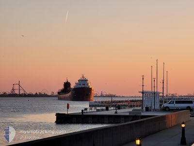
KAYE E BARKER
Self Discharging Bulk Carrier
Current Trip
| Time Travelled | 1 day |
|---|---|
| Remaining Time | 9 h, 30 mins |
| Distance Travelled | 202.32 nm |
| Remaining Distance | 200.88 nm |
| AVG Speed | 9.9 Knots |
| MAX Speed | 13.6 Knots |
| AVG Wind | 12.7 knots |
| MAX Wind | 22 knots |
| MIN Temp | -2.4°C / 27.68°F |
| MAX Temp | 7.9°C / 46.22°F |
| Draught | 6.4 m |
| Position Received | 20 h, 59 m ago |
Current Position
| Longitude | -82.41569° |
|---|---|
| Latitude | 43.05146° |
| Status | Under way using engine |
| Speed | 12.1 Knots |
| Course | 1.4° |
| Area | --- |
| Station | T-AIS |
| Position Received | 20 h, 59 m ago |
Info
Information
The current position of KAYE E BARKER is in --- with coordinates 43.05146° / -82.41569° as reported on 2024-04-24 23:29 by AIS to our vessel tracker app. The vessel's current speed is 12.1 Knots and is heading at the port of DETROIT. The estimated time of arrival as calculated by MyShipTracking vessel tracking app is 2024-04-26 05:58 LT
The vessel KAYE E BARKER (IMO: 5097450, MMSI: 366904910) is a Self Discharging Bulk Carrier that was built in 1952 ( 72 years old ). It's sailing under the flag of [US] USA.
In this page you can find informations about the vessels current position, last detected port calls, and current voyage information. If the vessels is not in coverage by AIS you will find the latest position.
The current position of KAYE E BARKER is detected by our AIS receivers and we are not responsible for the reliability of the data. The last position was recorded while the vessel was in Coverage by the Ais receivers of our vessel tracking app.
The current draught of KAYE E BARKER as reported by AIS is 6.4 meters
Weather
| Temperature | 7.9°C / 46.22°F |
|---|---|
| Wind Speed | 9 knots |
| Direction | 129° SE |
| Pressure | 1028.7 hPa |
| Humidity | 32.7 % |
| Cloud Coverage | --- |
Featured Company
Last Port Calls
| Port | Arrival | Departure | Time In Port |
|---|---|---|---|
| 2024-04-24 01:15 | 2024-04-24 11:50 | 10 h | |
| 2024-04-23 08:35 | 2024-04-23 18:51 | 10 h | |
| 2024-04-23 00:39 | 2024-04-23 02:12 | 1 h | |
| 2024-04-22 13:03 | 2024-04-22 15:02 | 1 h | |
| 2024-04-21 11:30 | 2024-04-21 12:54 | 1 h | |
| 2024-04-20 02:26 | 2024-04-20 20:10 | 17 h | |
| 2024-04-19 20:06 | 2024-04-20 01:40 | 5 h | |
| 2024-04-19 06:44 | 2024-04-19 09:08 | 2 h | |
| 2024-04-16 09:06 | 2024-04-16 17:52 | 8 h | |
| 2024-04-15 14:55 | 2024-04-16 02:42 | 11 h |
Last Trips
| Origin | Departure | Destination | Arrival | Distance | |
|---|---|---|---|---|---|
| 2024-04-23 14:51 | 2024-04-23 21:15 | 74.07 nm | |||
| 2024-04-22 22:12 | 2024-04-23 04:35 | 73.33 nm | |||
| 2024-04-22 11:02 | 2024-04-22 20:39 | 2.89 nm | |||
| 2024-04-21 08:54 | 2024-04-22 09:03 | 283.45 nm | |||
| 2024-04-20 16:10 | 2024-04-21 07:30 | 177.47 nm | |||
| 2024-04-19 21:40 | 2024-04-19 22:26 | 2.24 nm | |||
| 2024-04-19 05:08 | 2024-04-19 16:06 | 128.98 nm | |||
| 2024-04-16 13:52 | 2024-04-19 02:44 | 296.74 nm | |||
| 2024-04-15 22:42 | 2024-04-16 05:06 | 73.63 nm | |||
| 2024-04-15 04:27 | 2024-04-15 10:55 | 73.15 nm |
Events
| Time | Event | Details | Position / Dest | Info |
|---|---|---|---|---|
| 2024-04-25 10:49 | STOP Moving | 3.63 nm, South East of PRESQUE ISLE |
45.30667 / -83.41500
STONEPORT
|
Speed: Course: -1° |
| 2024-04-24 23:34 | Status Changed | Default Under way using engine |
43.06667 / -82.41333
STONEPORT
|
Speed: 12.1 kn Course: 1.4° |
| 2024-04-24 23:29 | OUT of Coverage |
43.05146 / -82.41569
STONEPORT
|
Speed: 12.1 kn Course: 1.4° |
|
| 2024-04-24 22:46 | Destination Changed | STONEPORT MARQUETTE |
42.94429 / -82.43858
STONEPORT
|
Speed: 8.8 kn Course: 41.7° |
| 2024-04-24 22:46 | ETA Changed | 2024/04/25 08:00 2024/04/25 23:45 |
42.94429 / -82.43858
STONEPORT
|
Speed: 8.8 kn Course: 41.7° |
| 2024-04-24 22:39 | Status Changed | Under way using engine Default |
42.93449 / -82.45111
MARQUETTE
|
Speed: 7.7 kn Course: 17° |
| 2024-04-24 22:38 | Status Changed | Default Under way using engine |
42.93170 / -82.45273
MARQUETTE
|
Speed: 10.2 kn Course: 18.8° |
| 2024-04-24 22:23 | Status Changed | Under way using engine Default |
42.89308 / -82.46988
MARQUETTE
|
Speed: 10.1 kn Course: 1° |
| 2024-04-24 22:14 | IN Coverage |
42.89308 / -82.46988
MARQUETTE
|
Speed: 9.9 kn Course: 19° |
|
| 2024-04-24 21:18 | START Moving | 4.12 nm, South of ST CLAIR |
42.74610 / -82.47629
MARQUETTE
|
Speed: 3.4 kn Course: 38° |