
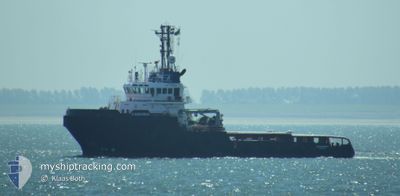
KAMARINA
Tug
Current Trip
| Time Travelled | 30 days |
|---|---|
| Remaining Time | --- |
| Distance Travelled | 3252.59 nm |
| Remaining Distance | --- |
| AVG Speed | 5.4 Knots |
| MAX Speed | 11.2 Knots |
| AVG Wind | 20.8 knots |
| MAX Wind | 39 knots |
| MIN Temp | 6.9°C / 44.42°F |
| MAX Temp | 19.1°C / 66.38°F |
| Draught | 5.8 m |
| Position Received | 14 h, 50 m ago |
Current Position
| Longitude | 9.33290° |
|---|---|
| Latitude | 39.06473° |
| Status | Under way using engine |
| Speed | 2.8 Knots |
| Course | 141° |
| Area | Tyrrhenian Sea |
| Station | T-AIS |
| Position Received | 14 h, 50 m ago |
Info
Information
The current position of KAMARINA is in Tyrrhenian Sea with coordinates 39.06473° / 9.33290° as reported on 2024-04-19 11:15 by AIS to our vessel tracker app. The vessel's current speed is 2.8 Knots and is heading at the port of ARBATAX. The estimated time of arrival as calculated by MyShipTracking vessel tracking app is 2024-04-16 06:00 LT
The vessel KAMARINA (IMO: 9499644, MMSI: 247278400) is a Tug that was built in 2010 ( 14 years old ). It's sailing under the flag of [IT] Italy.
In this page you can find informations about the vessels current position, last detected port calls, and current voyage information. If the vessels is not in coverage by AIS you will find the latest position.
The current position of KAMARINA is detected by our AIS receivers and we are not responsible for the reliability of the data. The last position was recorded while the vessel was in Coverage by the Ais receivers of our vessel tracking app.
The current draught of KAMARINA as reported by AIS is 5.8 meters
Weather
| Temperature | 14.2°C / 57.56°F |
|---|---|
| Wind Speed | 9 knots |
| Direction | 281° W |
| Pressure | 1017.5 hPa |
| Humidity | 57.1 % |
| Cloud Coverage | --- |
Featured Company
Last Port Calls
| Port | Arrival | Departure | Time In Port |
|---|---|---|---|
| 2024-03-17 15:45 | 2024-03-20 10:14 | 2 d | |
| 2024-03-16 13:55 | 2024-03-17 15:36 | 1 d | |
| 2024-02-17 13:23 | 2024-03-06 15:09 | 18 d | |
| 2024-02-17 08:23 |
Most Visited Ports (Last year)
| Port | Arrivals | |
|---|---|---|
| 3 | ||
| 3 | ||
| 2 | ||
| 2 | ||
| 2 | ||
| 1 |
Last Trips
| Origin | Departure | Destination | Arrival | Distance | |
|---|---|---|---|---|---|
| 2024-03-17 16:36 | 2024-03-17 16:45 | 1.00 nm | |||
| 2024-03-06 16:09 | 2024-03-16 14:55 | 2410.98 nm | |||
| 2024-02-17 09:23 | 2024-02-17 14:23 | 41.53 nm |
Events
| Time | Event | Details | Position / Dest | Info |
|---|---|---|---|---|
| 2024-04-19 11:15 | OUT of Coverage |
39.06473 / 9.33290
Tyrrhenian Sea
|
Speed: 2.8 kn Course: 141° |
|
| 2024-04-19 08:46 | Change Sea Area | Italian part of the Tyrrhenian Sea Algerian part of the Mediterranean Sea - Western Basin |
39.06532 / 9.33733
Tyrrhenian Sea
|
Speed: 2 kn Course: 325° |
| 2024-04-19 08:46 | IN Coverage |
39.06532 / 9.33733
Tyrrhenian Sea
|
Speed: 2 kn Course: 325° |
|
| 2024-04-14 02:04 | Status Changed | Default Restricted manoeuverability |
36.80522 / .23485
IT ATX
|
Speed: 7.2 kn Course: 71° |
| 2024-04-14 01:56 | Status Changed | Restricted manoeuverability Default |
36.79675 / .20177
IT ATX
|
Speed: 7.1 kn Course: 71° |
| 2024-04-14 01:56 | OUT of Coverage |
36.79675 / .20177
Mediterranean Sea - Western Basin
IT ATX
|
Speed: 7.2 kn Course: 71° |
|
| 2024-04-14 01:54 | Status Changed | Default Restricted manoeuverability |
36.79900 / .21013
IT ATX
|
Speed: 7.2 kn Course: 71° |
| 2024-04-14 01:25 | Status Changed | Restricted manoeuverability Default |
36.78087 / .14043
IT ATX
|
Speed: 7.4 kn Course: 72° |
| 2024-04-14 01:18 | Status Changed | Default Restricted manoeuverability |
36.77637 / .12227
IT ATX
|
Speed: 7.5 kn Course: 72° |
| 2024-04-14 01:12 | Status Changed | Restricted manoeuverability Default |
36.77240 / .10717
IT ATX
|
Speed: 7.5 kn Course: 68° |