
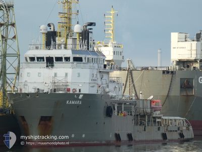
KAMARA
Anchor Handling Vessel
Current Trip
OWF BALTICA 2
| Time Travelled | 6 days |
|---|---|
| Remaining Time | --- |
| Distance Travelled | 152.38 nm |
| Remaining Distance | --- |
| AVG Speed | 10.8 Knots |
| MAX Speed | 12 Knots |
| AVG Wind | 13 knots |
| MAX Wind | 22 knots |
| MIN Temp | 1.4°C / 34.52°F |
| MAX Temp | 5.5°C / 41.9°F |
| Draught | 5.2 m |
| Position Received | 4 d ago |
Current Position
| Longitude | 16.96360° |
|---|---|
| Latitude | 55.11366° |
| Status | Restricted manoeuverability |
| Speed | |
| Course | 225° |
| Area | Baltic Sea |
| Station | T-AIS |
| Position Received | 4 d ago |
Info
Information
The current position of KAMARA is in Baltic Sea with coordinates 55.11366° / 16.96360° as reported on 2024-04-19 00:17 by AIS to our vessel tracker app. The vessel's current speed is 0 Knots
The vessel KAMARA (IMO: 9322607, MMSI: 215088000) is a Anchor Handling Vessel that was built in 2005 ( 19 years old ). It's sailing under the flag of [MT] Malta.
In this page you can find informations about the vessels current position, last detected port calls, and current voyage information. If the vessels is not in coverage by AIS you will find the latest position.
The current position of KAMARA is detected by our AIS receivers and we are not responsible for the reliability of the data. The last position was recorded while the vessel was in Coverage by the Ais receivers of our vessel tracking app.
The current draught of KAMARA as reported by AIS is 5.2 meters
Weather
| Temperature | 4°C / 39.2°F |
|---|---|
| Wind Speed | 11 knots |
| Direction | 245° WSW |
| Pressure | 1014.7 hPa |
| Humidity | 72.5 % |
| Cloud Coverage | 100 % |
Featured Company
Last Port Calls
| Port | Arrival | Departure | Time In Port |
|---|---|---|---|
| 2024-04-15 13:31 | 2024-04-16 17:45 | 1 d | |
| 2024-04-12 22:19 | 2024-04-12 22:24 | 4 m | |
| 2024-04-10 16:35 | 2024-04-11 03:15 | 10 h | |
| 2024-04-10 06:23 | 2024-04-10 16:32 | 10 h | |
| 2024-04-09 18:53 | 2024-04-10 06:18 | 11 h | |
| 2024-04-09 08:09 | 2024-04-09 18:49 | 10 h | |
| 2024-04-08 19:02 | 2024-04-09 08:05 | 13 h | |
| 2024-04-08 06:24 | 2024-04-08 13:17 | 6 h | |
| 2024-04-07 19:36 | 2024-04-08 06:20 | 10 h | |
| 2024-04-06 19:18 | 2024-04-07 06:11 | 10 h |
Most Visited Ports (Last year)
| Port | Arrivals | |
|---|---|---|
| 16 | ||
| 7 | ||
| 4 | ||
| 3 | ||
| 2 | ||
| 2 |
Last Trips
| Origin | Departure | Destination | Arrival | Distance | |
|---|---|---|---|---|---|
| 2024-04-13 00:24 | 2024-04-15 15:31 | 346.54 nm | |||
| 2024-04-11 05:15 | 2024-04-13 00:19 | 317.61 nm | |||
| 2024-04-10 18:32 | 2024-04-10 18:35 | 0.95 nm | |||
| 2024-04-10 08:18 | 2024-04-10 08:23 | 1.44 nm | |||
| 2024-04-09 20:49 | 2024-04-09 20:53 | 0.83 nm | |||
| 2024-04-09 10:05 | 2024-04-09 10:09 | 1.01 nm | |||
| 2024-04-08 15:17 | 2024-04-08 21:02 | 16.88 nm | |||
| 2024-04-08 08:20 | 2024-04-08 08:24 | 1.45 nm | |||
| 2024-04-07 08:11 | 2024-04-07 21:36 | 23.19 nm | |||
| 2024-04-06 08:18 | 2024-04-06 21:18 | 28.23 nm |
Events
| Time | Event | Details | Position / Dest | Info |
|---|---|---|---|---|
| 2024-04-22 13:53 | STOP Moving |
55.11333 / 16.96333
OWF BALTICA 2
|
Speed: Course: -1° |
|
| 2024-04-20 03:14 | STOP Moving |
55.10500 / 16.97167
OWF BALTICA 2
|
Speed: Course: -1° |
|
| 2024-04-19 20:26 | START Moving |
55.12838 / 16.98363
OWF BALTICA 2
|
Speed: 3.2 kn Course: 245° |
|
| 2024-04-19 00:17 | OUT of Coverage |
55.11366 / 16.96360
Baltic Sea
|
Speed: Course: 53.5° |
|
| 2024-04-19 00:17 | IN Coverage |
55.11366 / 16.96360
Baltic Sea
|
Speed: Course: 53.5° |
|
| 2024-04-18 23:12 | OUT of Coverage |
55.11344 / 16.96350
Baltic Sea
|
Speed: Course: 37.4° |
|
| 2024-04-18 22:22 | IN Coverage |
55.11339 / 16.96351
Baltic Sea
|
Speed: 0.1 kn Course: 87.8° |
|
| 2024-04-17 00:34 | STOP Moving |
54.89146 / 17.56300
OWF BALTICA 2
|
Speed: Course: 9° |
|
| 2024-04-16 22:35 | Status Changed | Default Under way using engine |
54.93833 / 18.08667
OWF BALTICA 2
|
Speed: 11.1 kn Course: 277.8° |
| 2024-04-16 22:05 | OUT of Coverage |
54.92571 / 18.24858
Baltic Sea
OWF BALTICA 2
|
Speed: 11.1 kn Course: 277.8° |