
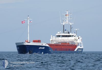
MS JUTLAND
General Cargo
Current Trip
| Time Travelled | 21 h, 37 mins |
|---|---|
| Remaining Time | 5 h, 9 mins |
| Distance Travelled | 201.51 nm |
| Remaining Distance | 41.60 nm |
| AVG Speed | 10.5 Knots |
| MAX Speed | 15.5 Knots |
| AVG Wind | 14 knots |
| MAX Wind | 21.8 knots |
| MIN Temp | 6.4°C / 43.52°F |
| MAX Temp | 7.9°C / 46.22°F |
| Draught | 3.1 m |
| Position Received | 7 h, 4 m ago |
Current Position
| Longitude | 4.74862° |
|---|---|
| Latitude | 53.50451° |
| Status | Under way using engine |
| Speed | 8.8 Knots |
| Course | 247.6° |
| Area | North Sea |
| Station | T-AIS |
| Position Received | 7 h, 4 m ago |
Info
Information
The current position of MS JUTLAND is in North Sea with coordinates 53.50451° / 4.74862° as reported on 2024-04-25 05:50 by AIS to our vessel tracker app. The vessel's current speed is 8.8 Knots and is heading at the port of AMSTERDAM. The estimated time of arrival as calculated by MyShipTracking vessel tracking app is 2024-04-25 18:04 LT
The vessel MS JUTLAND (IMO: 9142497, MMSI: 211718360) is a General Cargo that was built in 1997 ( 27 years old ). It's sailing under the flag of [DE] Germany.
In this page you can find informations about the vessels current position, last detected port calls, and current voyage information. If the vessels is not in coverage by AIS you will find the latest position.
The current position of MS JUTLAND is detected by our AIS receivers and we are not responsible for the reliability of the data. The last position was recorded while the vessel was in Coverage by the Ais receivers of our vessel tracking app.
The current draught of MS JUTLAND as reported by AIS is 3.1 meters
Weather
| Temperature | 7.6°C / 45.68°F |
|---|---|
| Wind Speed | 21 knots |
| Direction | 227° SW |
| Pressure | 1002.6 hPa |
| Humidity | 75.2 % |
| Cloud Coverage | 100 % |
Featured Company
Last Port Calls
| Port | Arrival | Departure | Time In Port |
|---|---|---|---|
| 2024-04-24 00:46 | 2024-04-24 15:18 | 14 h | |
| 2024-04-23 00:32 | 2024-04-23 22:28 | 21 h | |
| 2024-04-22 17:14 | 2024-04-22 23:20 | 6 h | |
| 2024-04-22 17:00 | 2024-04-22 17:06 | 6 m | |
| 2024-04-22 04:42 | 2024-04-22 15:31 | 10 h | |
| 2024-04-17 18:21 | |||
| 2024-04-14 20:25 | 2024-04-15 13:38 | 17 h | |
| 2024-04-12 06:51 | 2024-04-13 11:42 | 1 d | |
| 2024-04-08 08:57 | 2024-04-10 08:29 | 1 d | |
| 2024-04-05 11:26 | 2024-04-06 12:35 | 1 d |
Last Trips
| Origin | Departure | Destination | Arrival | Distance | |
|---|---|---|---|---|---|
| 2024-04-24 00:28 | 2024-04-24 02:46 | 11.64 nm | |||
| 2024-04-23 01:20 | 2024-04-23 02:32 | 8.57 nm | |||
| 2024-04-22 19:06 | 2024-04-22 19:14 | 0.35 nm | |||
| 2024-04-22 17:31 | 2024-04-22 19:00 | 7.79 nm | |||
| 2024-04-22 17:31 | 2024-04-22 06:42 | 7.79 nm | |||
| 2024-04-15 15:38 | 2024-04-17 21:21 | 415.24 nm | |||
| 2024-04-13 13:42 | 2024-04-14 22:25 | 185.78 nm | |||
| 2024-04-10 10:29 | 2024-04-12 08:51 | 364.77 nm | |||
| 2024-04-06 14:35 | 2024-04-08 10:57 | 332.44 nm | |||
| 2024-04-05 04:05 | 2024-04-05 13:26 | 80.11 nm |
Events
| Time | Event | Details | Position / Dest | Info |
|---|---|---|---|---|
| 2024-04-25 05:58 | Status Changed | Default Under way using engine |
53.49806 / 4.71872
NLAMS
|
Speed: 8.8 kn Course: 247.6° |
| 2024-04-25 05:50 | OUT of Coverage |
53.50451 / 4.74862
North Sea
NLAMS
|
Speed: 8.8 kn Course: 247.6° |
|
| 2024-04-25 01:31 | Change Sea Area | Dutch part of the North Sea German part of the North Sea |
53.72990 / 5.90657
North Sea
NLAMS
|
Speed: 10.6 kn Course: 251.2° |
| 2024-04-25 01:31 | IN Coverage |
53.72990 / 5.90657
North Sea
NLAMS
|
Speed: 10.6 kn Course: 251.2° |
|
| 2024-04-25 01:29 | Status Changed | Under way using engine Default |
53.73141 / 5.91397
NLAMS
|
Speed: 10 kn Course: 255° |
| 2024-04-24 21:43 | Status Changed | Default Under way using engine |
53.89208 / 6.89405
NLAMS
|
Speed: 8.7 kn Course: 254.8° |
| 2024-04-24 21:43 | OUT of Coverage |
53.89241 / 6.89627
North Sea
NLAMS
|
Speed: 8.7 kn Course: 254.8° |
|
| 2024-04-24 21:06 | Status Changed | Under way using engine Default |
53.91204 / 7.04167
NLAMS
|
Speed: 9.9 kn Course: 256° |
| 2024-04-24 20:59 | Status Changed | Default Under way using engine |
53.91660 / 7.07080
NLAMS
|
Speed: 10 kn Course: 253.9° |
| 2024-04-24 20:16 | Status Changed | Under way using engine Default |
53.93971 / 7.26458
NLAMS
|
Speed: 9 kn Course: 253° |