
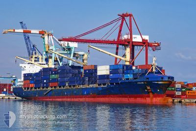
JULIUS S
Container Ship
Current Trip
FREETOWN
| Time Travelled | 1 day |
|---|---|
| Remaining Time | --- |
| Distance Travelled | 754.72 nm |
| Remaining Distance | --- |
| AVG Speed | 16.6 Knots |
| MAX Speed | 17.6 Knots |
| AVG Wind | 9.9 knots |
| MAX Wind | 12.9 knots |
| MIN Temp | 28.4°C / 83.12°F |
| MAX Temp | 29.6°C / 85.28°F |
| Draught | 11.2 m |
| Position Received | 27 d ago |
Current Position
| Longitude | 3.38794° |
|---|---|
| Latitude | 6.43592° |
| Status | Moored |
| Speed | |
| Course | 294° |
| Area | Gulf of Guinea |
| Station | T-AIS |
| Position Received | 27 d ago |
Info
Information
The current position of JULIUS S is in Gulf of Guinea with coordinates 6.43592° / 3.38794° as reported on 2024-03-23 10:44 by AIS to our vessel tracker app. The vessel's current speed is 0 Knots
The vessel JULIUS S (IMO: 9294018, MMSI: 304010000) is a Container Ship that was built in 2004 ( 20 years old ). It's sailing under the flag of [AG] Antigua Barbuda.
In this page you can find informations about the vessels current position, last detected port calls, and current voyage information. If the vessels is not in coverage by AIS you will find the latest position.
The current position of JULIUS S is detected by our AIS receivers and we are not responsible for the reliability of the data. The last position was recorded while the vessel was in Coverage by the Ais receivers of our vessel tracking app.
The current draught of JULIUS S as reported by AIS is 11.2 meters
Weather
| Temperature | 29°C / 84.2°F |
|---|---|
| Wind Speed | 7 knots |
| Direction | 123° ESE |
| Pressure | 1010.3 hPa |
| Humidity | 82.4 % |
| Cloud Coverage | 12 % |
Featured Company
Last Port Calls
| Port | Arrival | Departure | Time In Port |
|---|---|---|---|
| 2024-04-15 20:37 | 2024-04-17 21:39 | 2 d | |
| 2024-04-06 15:51 | 2024-04-07 10:20 | 18 h | |
| 2024-04-02 16:40 | 2024-04-03 17:41 | 1 d | |
| 2024-03-26 13:53 | |||
| 2024-03-22 06:52 | 2024-03-23 23:29 | 1 d | |
| 2024-03-13 18:17 | 2024-03-14 21:49 | 1 d | |
| 2024-02-25 21:35 | 2024-02-27 17:11 | 1 d | |
| 2024-02-14 22:11 | 2024-02-16 08:51 | 1 d | |
| 2024-02-06 07:50 | 2024-02-07 13:18 | 1 d |
Last Trips
| Origin | Departure | Destination | Arrival | Distance | |
|---|---|---|---|---|---|
| 2024-04-07 12:20 | 2024-04-15 20:37 | 2036.38 nm | |||
| 2024-04-03 18:41 | 2024-04-06 17:51 | 966.79 nm | |||
| 2024-03-24 00:29 | 2024-03-26 14:53 | 100.38 nm | |||
| 2024-03-14 22:49 | 2024-03-22 07:52 | 423.05 nm | |||
| 2024-02-27 18:11 | 2024-03-13 19:17 | 772.00 nm | |||
| 2024-02-16 09:51 | 2024-02-25 22:35 | 374.91 nm | |||
| 2024-02-07 14:18 | 2024-02-14 23:11 | 388.20 nm | |||
| 2024-01-25 14:47 | 2024-02-06 08:50 | 398.62 nm |
Events
| Time | Event | Details | Position / Dest | Info |
|---|---|---|---|---|
| 2024-04-17 21:39 | PORT DEPARTURE |
|
5.24439 / -3.99515
FREETOWN
|
Speed: 6.6 kn Course: 127° |
| 2024-04-17 21:15 | START Moving |
5.27558 / -4.02119
[CI] ABIDJAN
|
Speed: 3.3 kn Course: 222° |
|
| 2024-04-15 20:37 | STOP Moving |
5.27978 / -4.01797
[CI] ABIDJAN
|
Speed: 0.2 kn Course: 153° |
|
| 2024-04-15 20:37 | PORT ARRIVAL |
|
5.27978 / -4.01797
[CI] ABIDJAN
|
Speed: 0.9 kn Course: 9° |
| 2024-04-15 19:09 | START Moving | 6.75 nm, South of ABIDJAN |
5.20743 / -4.05609
FREETOWN
|
Speed: 5.2 kn Course: 105° |
| 2024-04-15 17:39 | STOP Moving | 6.75 nm, South of ABIDJAN |
5.20822 / -4.05888
FREETOWN
|
Speed: 0.2 kn Course: 190° |
| 2024-04-15 16:57 | START Moving | 8.86 nm, South of ABIDJAN |
5.16855 / -4.03770
FREETOWN
|
Speed: 5.1 kn Course: 353° |
| 2024-04-15 08:36 | STOP Moving | 10.24 nm, South of ABIDJAN |
5.14515 / -4.03377
FREETOWN
|
Speed: 0.3 kn Course: 105° |
| 2024-04-15 07:20 | START Moving | 7.19 nm, South of ABIDJAN |
5.20213 / -4.06431
FREETOWN
|
Speed: 3.1 kn Course: 156° |
| 2024-04-12 08:55 | STOP Moving | 6.96 nm, South of ABIDJAN |
5.20573 / -4.06290
FREETOWN
|
Speed: 0.3 kn Course: 232° |