
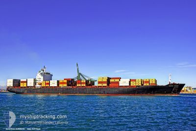
JPO LIBRA
Container Ship
Current Trip
| Time Travelled | 1 day |
|---|---|
| Remaining Time | 7 days |
| Distance Travelled | 357.67 nm |
| Remaining Distance | 2750.99 nm |
| AVG Speed | 12.7 Knots |
| MAX Speed | 15.5 Knots |
| AVG Wind | 15.3 knots |
| MAX Wind | 21 knots |
| MIN Temp | 7.4°C / 45.32°F |
| MAX Temp | 10.5°C / 50.9°F |
| Draught | 10.6 m |
| Position Received | 1 d ago |
Current Position
| Longitude | -4.37770° |
|---|---|
| Latitude | 49.71393° |
| Status | Under way using engine |
| Speed | 15.3 Knots |
| Course | 256.8° |
| Area | English Channel |
| Station | T-AIS |
| Position Received | 1 d ago |
Info
Information
The current position of JPO LIBRA is in English Channel with coordinates 49.71393° / -4.37770° as reported on 2024-04-18 09:01 by AIS to our vessel tracker app. The vessel's current speed is 15.3 Knots and is heading at the port of NEW YORK. The estimated time of arrival as calculated by MyShipTracking vessel tracking app is 2024-04-27 04:48 LT
The vessel JPO LIBRA (IMO: 9297840, MMSI: 636090862) is a Container Ship that was built in 2005 ( 19 years old ). It's sailing under the flag of [LR] Liberia.
In this page you can find informations about the vessels current position, last detected port calls, and current voyage information. If the vessels is not in coverage by AIS you will find the latest position.
The current position of JPO LIBRA is detected by our AIS receivers and we are not responsible for the reliability of the data. The last position was recorded while the vessel was in Coverage by the Ais receivers of our vessel tracking app.
The current draught of JPO LIBRA as reported by AIS is 10.6 meters
Weather
| Temperature | 11.1°C / 51.98°F |
|---|---|
| Wind Speed | 9 knots |
| Direction | 17° NNE |
| Pressure | 1026.6 hPa |
| Humidity | 83.5 % |
| Cloud Coverage | 59 % |
Featured Company
Last Port Calls
| Port | Arrival | Departure | Time In Port |
|---|---|---|---|
| 2024-04-17 01:41 | 2024-04-17 19:59 | 18 h | |
| 2024-04-14 06:18 | 2024-04-16 07:52 | 2 d | |
| 2024-04-11 19:20 | 2024-04-12 21:34 | 1 d | |
| 2024-04-01 06:12 | 2024-04-02 07:02 | 1 d | |
| 2024-03-26 20:06 | 2024-03-28 04:15 | 1 d | |
| 2024-03-24 08:50 | 2024-03-24 23:41 | 14 h | |
| 2024-03-22 05:46 | 2024-03-23 06:48 | 1 d | |
| 2024-03-17 08:23 | 2024-03-18 06:54 | 22 h | |
| 2024-03-06 02:11 | 2024-03-06 19:59 | 17 h | |
| 2024-03-03 11:09 | 2024-03-04 11:59 | 1 d |
Last Trips
| Origin | Departure | Destination | Arrival | Distance | |
|---|---|---|---|---|---|
| 2024-04-16 09:52 | 2024-04-17 03:41 | 268.54 nm | |||
| 2024-04-12 23:34 | 2024-04-14 08:18 | 351.56 nm | |||
| 2024-04-02 03:02 | 2024-04-11 21:20 | 3691.58 nm | |||
| 2024-03-28 00:15 | 2024-04-01 02:12 | 764.44 nm | |||
| 2024-03-24 19:41 | 2024-03-26 16:06 | 497.10 nm | |||
| 2024-03-23 02:48 | 2024-03-24 04:50 | 204.64 nm | |||
| 2024-03-18 02:54 | 2024-03-22 01:46 | 445.37 nm | |||
| 2024-03-06 20:59 | 2024-03-17 04:23 | 3303.60 nm | |||
| 2024-03-04 12:59 | 2024-03-06 03:11 | 266.57 nm | |||
| 2024-03-01 12:05 | 2024-03-03 12:09 | 352.17 nm |
Events
| Time | Event | Details | Position / Dest | Info |
|---|---|---|---|---|
| 2024-04-18 09:07 | Status Changed | Default Under way using engine |
49.70747 / -4.41841
USNWK
|
Speed: 15.3 kn Course: 256.8° |
| 2024-04-18 09:01 | OUT of Coverage |
49.71393 / -4.37770
English Channel
USNWK
|
Speed: 15.3 kn Course: 256.8° |
|
| 2024-04-18 06:59 | Change Sea Area | United Kingdom part of the English Channel French part of the English Channel |
49.86607 / -3.61211
English Channel
USNWK
|
Speed: 15.2 kn Course: 257.9° |
| 2024-04-18 06:57 | Status Changed | Under way using engine Default |
49.86760 / -3.59909
USNWK
|
Speed: 15.1 kn Course: 260° |
| 2024-04-18 06:40 | IN Coverage |
49.86607 / -3.61211
English Channel
USNWK
|
Speed: 15.2 kn Course: 257.9° |
|
| 2024-04-17 22:50 | Status Changed | Default Under way using engine |
49.75167 / -.81833
USNWK
|
Speed: 14.9 kn Course: 300.8° |
| 2024-04-17 22:44 | OUT of Coverage |
49.74099 / -.78887
English Channel
USNWK
|
Speed: 14.9 kn Course: 300.8° |
|
| 2024-04-17 19:59 | PORT DEPARTURE |
|
49.47447 / .09319
USNWK
|
Speed: 12 kn Course: 312° |
| 2024-04-17 19:42 | START Moving |
49.46059 / .13752
[FR] LE HAVRE
|
Speed: 3.1 kn Course: 270° |
|
| 2024-04-17 19:18 | Status Changed | Under way using engine Moored |
49.46098 / .14102
[FR] LE HAVRE
|
Speed: Course: 282° |